- Somerset, Ohio
Infobox Settlement
official_name = Somerset, Ohio
settlement_type = Village
nickname =
motto =
imagesize =
image_caption =
image_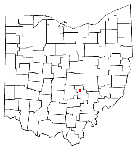
mapsize = 250x200px
map_caption = Location of Somerset, Ohio
mapsize1 =
map_caption1 =subdivision_type = Country
subdivision_name =United States
subdivision_type1 = State
subdivision_name1 =Ohio
subdivision_type2 = County
subdivision_name2 = Perrygovernment_footnotes =
government_type =
leader_title =
leader_name =
leader_title1 =
leader_name1 =
established_title =
established_date =unit_pref = Imperial
area_footnotes =area_magnitude =
area_total_km2 = 3.0
area_land_km2 = 3.0
area_water_km2 = 0.0
area_total_sq_mi = 1.2
area_land_sq_mi = 1.2
area_water_sq_mi = 0.0population_as_of = 2000
population_footnotes =
population_total = 1549
population_density_km2 = 512.8
population_density_sq_mi = 1328.3timezone = Eastern (EST)
utc_offset = -5
timezone_DST = EDT
utc_offset_DST = -4
elevation_footnotes = GR|3
elevation_m = 330
elevation_ft = 1083
latd = 39 |latm = 48 |lats = 25 |latNS = N
longd = 82 |longm = 18 |longs = 4 |longEW = Wpostal_code_type =
ZIP code
postal_code = 43783
area_code = 740
blank_name = FIPS code
blank_info = 39-72977GR|2
blank1_name = GNIS feature ID
blank1_info = 1065343GR|3
website =
footnotes =Somerset is a village in Perry County,
Ohio ,United States . The population was 1,549 at the 2000 census.Civil War General
Phil Sheridan was raised in Somerset. He is memorialized by Ohio's only equestrian Civil War statue, which stands in the center square in a small park in the middle of the traffic circle.St. Joseph Church, the oldest Catholic church in Ohio, is located just outside of Somerset on State Route 383.
Tammie Green , a professional golfer inducted into the Ohio Golf Hall of Fame, was born in Somerset onDecember 17 1959 .Geography
Somerset is located at coor dms|39|48|25|N|82|18|4|W|city (39.806902, -82.301250)GR|1.
According to the
United States Census Bureau , the village has a total area of 1.2square mile s (3.0km² ), all of it land.Demographics
As of the
census GR|2 of 2000, there were 1,549 people, 613 households, and 381 families residing in the village. Thepopulation density was 1,328.3 people per square mile (511.2/km²). There were 659 housing units at an average density of 565.1/sq mi (217.5/km²). The racial makeup of the village was 99.03% White, 0.45% Native American, 0.06% Asian, 0.19% from other races, and 0.26% from two or more races. Hispanic or Latino of any race were 0.26% of the population.There were 613 households out of which 31.5% had children under the age of 18 living with them, 47.3% were married couples living together, 10.8% had a female householder with no husband present, and 37.8% were non-families. 34.6% of all households were made up of individuals and 18.9% had someone living alone who was 65 years of age or older. The average household size was 2.37 and the average family size was 3.05.
In the village the population was spread out with 25.7% under the age of 18, 6.8% from 18 to 24, 26.8% from 25 to 44, 19.6% from 45 to 64, and 21.1% who were 65 years of age or older. The median age was 39 years. For every 100 females there were 82.7 males. For every 100 females age 18 and over, there were 76.8 males.
The median income for a household in the village was $29,844, and the median income for a family was $39,231. Males had a median income of $30,994 versus $21,364 for females. The
per capita income for the village was $14,209. About 6.4% of families and 12.8% of the population were below thepoverty line , including 8.7% of those under age 18 and 20.0% of those age 65 or over.References
External links
* [http://memory.loc.gov/cgi-bin/query/I?fsaall:5:./temp/~ammem_tPZH::displayType=1:m856sd=fsa:m856sf=8a18437:@@@mdb=mcc,gottscho,detr,nfor,wpa,aap,cwar,bbpix,cowellbib,calbkbib,consrvbib,bdsbib,dag,fsaall,gmd,pan,vv,presp,varstg,suffrg,nawbib,horyd,wtc,toddbib,mgw,ncr,ngp,musdibib,hlaw,papr,lhbumbib,rbpebib,lbcoll,alad,hh,aaodyssey,magbell,bbcards,dcm,raelbib,runyon,dukesm,lomaxbib,mtj,gottlieb,aep,qlt,coolbib,fpnas,aasm,scsm,denn,relpet,amss,aaeo,cola,tccc,curt,mharendt,lhbcbbib,eaa,haybib,mesnbib,fine,cwnyhs,svybib,mmorse,afcwwgbib,mymhiwebib,uncall,mfd,afcwip,mtaft,manz,llstbib,fawbib,berl,fmuever,cdn,upboverbib,mussm,cic,afcpearl,awh,awhbib,sgp,wright,lhbtnbib,afcesnbib,hurstonbib,mreynoldsbib,spaldingbib,sgproto,mffbib,afc911bib,mjm,mnwp,rbcmillerbib,molden,ww2map,hawp,omhbib,rbaapcbib,mal,ncpsbib,ncpm,lhbprbib,ftvbib,afcreed,aipn,cwband,flwpabib,wpapos,cmns,psbib,pin,coplandbib Historical Photo of Phil Sheridan Statue]
Wikimedia Foundation. 2010.