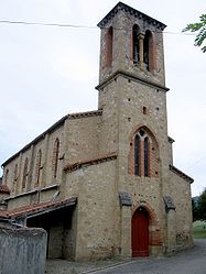
- Montégut-Plantaurel
-
Montégut-Plantaurel

 Montégut-Plantaurel
Administration Country France Region Midi-Pyrénées Department Ariège Arrondissement Pamiers Canton Varilhes Intercommunality Canton of Varilhes Mayor Michel Carriere
(2008–2014)Statistics Elevation 307–630 m (1,007–2,070 ft)
(avg. 325 m/1,066 ft)Land area1 18.95 km2 (7.32 sq mi) Population2 320 (2008) - Density 17 /km2 (44 /sq mi) INSEE/Postal code 09202/ 09120 1 French Land Register data, which excludes lakes, ponds, glaciers > 1 km² (0.386 sq mi or 247 acres) and river estuaries. 2 Population without double counting: residents of multiple communes (e.g., students and military personnel) only counted once. Coordinates: 43°04′12″N 1°29′11″E / 43.07°N 1.48638888889°E
Montégut-Plantaurel is a commune in the Ariège department in southwestern France.
Contents
Geography
The Lèze flows through the northwestern part of the commune.
Population
Historical population of Montégut-Plantaurel 1962 1968 1975 1982 1990 1999 2008 189 210 171 179 253 267 320 See also
References
Categories:- Communes of Ariège
- Ariège geography stubs


Wikimedia Foundation. 2010.