- Mirepoix, Ariège
-
Mirepoix


 Mirepoix
Administration Country France Region Midi-Pyrénées Department Ariège Arrondissement Pamiers Canton Mirepoix Intercommunality Pays de Mirepoix Mayor Nicole Quillien
(2008–2014)Statistics Elevation 276–462 m (906–1,516 ft)
(avg. 308 m/1,010 ft)Land area1 47.28 km2 (18.25 sq mi) Population2 3,123 (2008) - Density 66 /km2 (170 /sq mi) INSEE/Postal code 09194/ 09500 1 French Land Register data, which excludes lakes, ponds, glaciers > 1 km² (0.386 sq mi or 247 acres) and river estuaries. 2 Population without double counting: residents of multiple communes (e.g., students and military personnel) only counted once. Coordinates: 43°05′23″N 1°52′28″E / 43.0897222222°N 1.87444444444°E
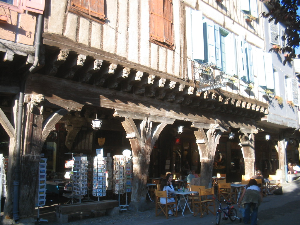
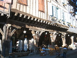 Wooden arcades of the Maison des Consuls.
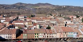
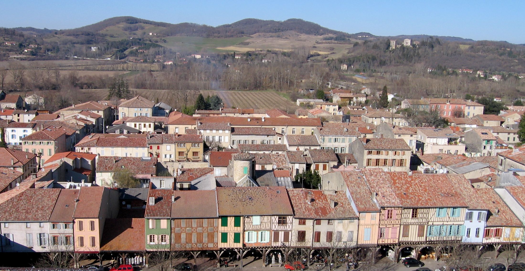
Mirepoix (Occitan: Mirapeis, supposedly from mire peis, meaning see the fish) is a communes in the Ariège department in southwestern France.
Contents
Geography
It lies in the Hers valley between Carcassonne and Pamiers.
History
The original town was virtually destroyed by flooding of the Hers-Vif river on 16 June 1289. It was subsequently rebuilt by Jean de Levis in 1290.
Population
The inhabitants are called Mirapiciens.
Historical population of Mirepoix, Ariège 1962 1968 1975 1982 1990 1999 2008 3078 3255 3273 3139 2993 3061 3123 Sights
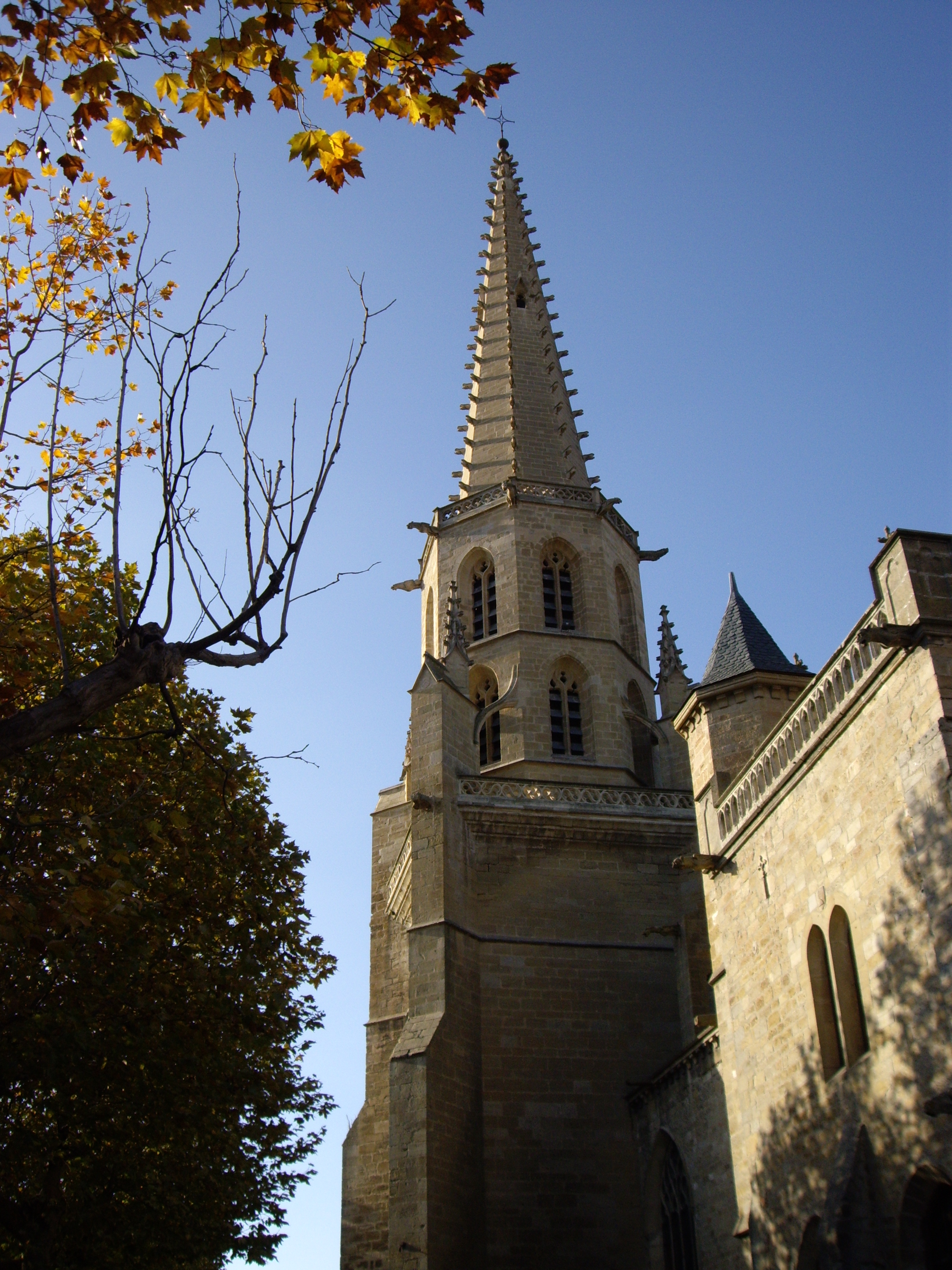
 Cathédrale Saint-Maurice de Mirepoix
The centre of Mirepoix is built around the place de Couverts which in turn has the 14th century Maison des Consuls as its main attraction. The overhanging arcades have exposed beams and from these there are approximately 150 individually carved wooden heads.
The cathedral of St-Maurice, built in the Gothic style, has a particularly wide nave.
See also
References
Categories:- Communes of Ariège
- Ariège geography stubs


Wikimedia Foundation. 2010.