- Segura
-
Segura 
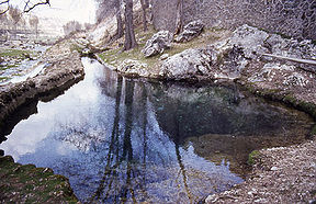
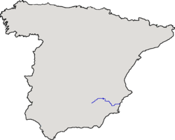
Source of the Segura RiverOrigin Fuente Segura, Jaén Mouth Guardamar del Segura, Alicante Basin countries Spain Length 325 km Source elevation 1,413 m Mouth elevation 0 m Avg. discharge Cieza: 26.3 m³/s Basin area 19,525 km² Segura (Spanish: [seˈɣuɾa], Valencian: [seˈɣuɾa]; Latin: Thader, Arabic: War-Alabiat) is a medium-sized river in southeastern Spain.
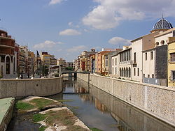
It starts at Santiago Pontones (province of Jaén), passes Calasparra, Cieza, Murcia, Beniaján, Orihuela, Rojales and ends in the Mediterranean Sea near Guardamar del Segura in the province of Alicante. Some of its tributaries are the Mundo (which starts near Riópar), the Alhárabe (which starts in Moratalla), the Mula and the Guadalentín.
The Segura is usually in a state of semi-permanent drought, however, now and then, it does occasionally flood as the consequence of the torrential rains which typically take place once every 6–9 years approximately, always in Autumn.
Avg. discharge Place Discharge Cenajo 17,1 m³/s Cieza 26,3 m³/s Orihuela 5 m³/s Guardamar del Segura 1 m³/s In the twentieth century significant flooding occurred in 1946, 1948, 1973, 1982, 1987 and 1989. Since 1990 the lower reaches of the river have been canalized, removing meanders and hence improving the evacuation of flood waters. The new canal was put to the test in September 1997 and October 2000 when heavy rainfall resulted in significant runoff.
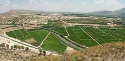
Segura floods in Murcia and Orihuela Date Murcia Orihuela October, 1651 1.700 m³/s October, 1834 1.000 m³/s October, 1879 1.890 m³/s April, 1946 1.187 m³/s 1.138 m³/s October, 1948 934 m³/s 1.172 m³/s November, 1987 1.000 m³/s The alluvial plain is called the Vega del Segura and is a very productive agricultural region growing a wide variety of fruit, vegetables and flowers. The Vegas are divided into three areas: Alta, Media and Baja (upper, medium, and lower).
The Segura is one of the most polluted rivers in Europe. However, in recent years extensive water management techniques and the implementation of waste water treatment plants have greatly improved the situation. What must be considered is that the mean discharge is around 2 to 3 m³/s in Murcia city making it very difficult to dilute illegal pollutants.
See also
- List of rivers of Spain
- Irrigation district
- Transvasement
External links
Coordinates: 38°5′47.17″N 0°40′32.37″W / 38.0964361°N 0.6756583°W
Categories:- Murcia
- Rivers of Spain
Wikimedia Foundation. 2010.


