- Belmont, Ohio
Infobox Settlement
official_name = Belmont, Ohio
settlement_type = Village
nickname =
motto =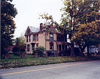
imagesize =
image_caption = Village of Belmont Ohio
image_
mapsize = 250px
map_caption = Location of Belmont, Ohio
mapsize1 =
map_caption1 =subdivision_type = Country
subdivision_name =United States
subdivision_type1 = State
subdivision_name1 =Ohio
subdivision_type2 = County
subdivision_name2 = Belmontgovernment_footnotes =
government_type =
leader_title =
leader_name =
leader_title1 =
leader_name1 =
established_title =
established_date =unit_pref = Imperial
area_footnotes =area_magnitude =
area_total_km2 = 0.7
area_land_km2 = 0.7
area_water_km2 = 0.0
area_total_sq_mi = 0.3
area_land_sq_mi = 0.3
area_water_sq_mi = 0.0population_as_of = 2000
population_footnotes =
population_total = 532
population_density_km2 = 728.4
population_density_sq_mi = 1886.6timezone = Eastern (EST)
utc_offset = -5
timezone_DST = EDT
utc_offset_DST = -4
elevation_footnotes = GR|3
elevation_m = 363
elevation_ft = 1191
latd = 40 |latm = 1 |lats = 39 |latNS = N
longd = 81 |longm = 2 |longs = 27 |longEW = Wpostal_code_type =
ZIP code
postal_code = 43718
area_code = 740
blank_name = FIPS code
blank_info = 39-05312GR|2
blank1_name = GNIS feature ID
blank1_info = 1064410GR|3
website =
footnotes =Belmont is a village in Belmont County,
Ohio ,United States . It is part of theWheeling, West Virginia Metropolitan Statistical Area. The population was 532 at the 2000 census.Geography
Belmont is located at coor dms|40|1|39|N|81|2|27|W|city (40.027560, -81.040807)GR|1.
According to the
United States Census Bureau , the village has a total area of 0.3square mile s (0.7km² ), all of it land.Belmont is also located approximately 1 mile south of Barkcamp State Park. [http://www.dnr.state.oh.us/parks/barkcamp/tabid/713/Default.aspx]
The Village is also part of the historic Drover's Trail that winds through the hills and valleys of Belmont County. [http://www.byways.org/explore/byways/52840/]
Demographics
As of the
census GR|2 of 2000, there were 532 people, 208 households, and 148 families residing in the village. Thepopulation density was 1,886.6 people per square mile (733.6/km²). There were 224 housing units at an average density of 794.4/sq mi (308.9/km²). The racial makeup of the village was 96.43% White, 1.13% African American, 0.38% Native American, 0.94% Pacific Islander, and 1.13% from two or more races. Hispanic or Latino of any race were 0.94% of the population.There were 208 households out of which 29.3% had children under the age of 18 living with them, 55.3% were married couples living together, 11.5% had a female householder with no husband present, and 28.8% were non-families. 24.5% of all households were made up of individuals and 10.1% had someone living alone who was 65 years of age or older. The average household size was 2.56 and the average family size was 3.05.
In the village the population was spread out with 25.6% under the age of 18, 7.7% from 18 to 24, 27.8% from 25 to 44, 25.2% from 45 to 64, and 13.7% who were 65 years of age or older. The median age was 38 years. For every 100 females there were 99.3 males. For every 100 females age 18 and over, there were 96.0 males.
The median income for a household in the village was $28,875, and the median income for a family was $35,000. Males had a median income of $25,000 versus $19,688 for females. The
per capita income for the village was $13,015. About 9.9% of families and 12.0% of the population were below thepoverty line , including 12.1% of those under age 18 and 13.2% of those age 65 or over.History
Belmont was called Wrightstown in the early 1800's before the Civil War. The name was switched to Belmont in anticipation of being the county seat of Belmont County. St. Clairsville, however, was given the honor of having Belmont County's center of government. The
Baltimore and Ohio Railroad cut through the town until its dismantling in the 1980's.Belmont has recently undergone a public sewer project that will enable the village to have sustainable growth and more business development.
Notable natives and residents
*David Clarke, Hollywood actor and Nora Dunfee's husband.
Education and Schools
Union Local School District. [http://www.union-local.k12.oh.us]
Faith Community Christian High School. This used to be Belmont Elementary School, now it is home to a private school. [http://fcchs.com/homeff.html]
References
External links
Wikimedia Foundation. 2010.