- Rockcliffe, Dumfries and Galloway
-
Coordinates: 54°52′21″N 3°48′44″W / 54.87262°N 3.81236°W
Rockcliffe 
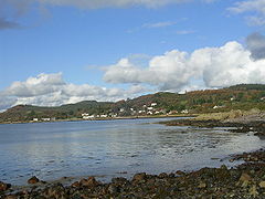
Looking across the Rough Firth to Rockcliffe
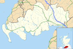
 Rockcliffe shown within Dumfries and Galloway
Population 137 (2001 Census) OS grid reference NX837546 Council area Dumfries and Galloway Lieutenancy area Kirkcudbrightshire Country Scotland Sovereign state United Kingdom Post town Dalbeattie Postcode district DG5 Dialling code 01556 630 Police Dumfries and Galloway Fire Dumfries and Galloway Ambulance Scottish EU Parliament Scotland UK Parliament Dumfries and Galloway Dumfriesshire, Clydesdale and Tweeddale Scottish Parliament Galloway and Upper Nithsdale List of places: UK • Scotland • Rockcliffe is a small coastal tourist village in Dumfries and Galloway in Scotland, with a view of Rough Island, Hestan Island, the Solway Firth and sometimes the Lake District[1].
Rockcliffe lies on shore of the Rough Firth and gives access to Rough Island by way of a tidal causeway. Road access is from Dalbeattie and Dumfries; although Kippford is nearby there is no direct road route. Rockcliffe is linked to Sandyhills, Barcloy Hill, Castle Point and Kippford by footpath.
There is little business in Rockcliffe other than the rental of holiday cottages, one tea room and one hotel. The village has a car park and a public toilet, but no other facilities to speak of.
The site of the 5th century dark age hill fort the Mote of Mark adjoins Rockcliffe[1].
Parts of Rockcliffe, in particular much of the land immediately to the north, are owned by the National Trust for Scotland[2].
References
- ^ a b Rockcliffe at Undiscovered Scotland
- ^ http://walking.visitscotland.com/walks/southscotland/213066
External links
Categories:- Villages in Dumfries and Galloway
- Dumfries and Galloway geography stubs
Wikimedia Foundation. 2010.

