- McFarlan, North Carolina
-
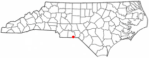
McFarlan, North Carolina — Town — Location of McFarlan, North Carolina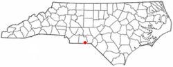
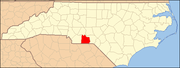
Coordinates: 34°48′48″N 79°58′33″W / 34.81333°N 79.97583°WCoordinates: 34°48′48″N 79°58′33″W / 34.81333°N 79.97583°W Country United States State North Carolina County Anson Area – Total 0.9 sq mi (2.4 km2) – Land 0.9 sq mi (2.4 km2) – Water 0.0 sq mi (0.0 km2) Elevation 305 ft (93 m) Population (2000) – Total 89 – Density 96.0/sq mi (37.1/km2) Time zone Eastern (EST) (UTC-5) – Summer (DST) EDT (UTC-4) ZIP code 28102 Area code(s) 704 FIPS code 37-40240[1] GNIS feature ID 1021390[2] McFarlan is a town in Anson County, North Carolina, United States. The population was 89 at the 2000 census. The town was named after Alan McFarland, a railroad official.
Geography
McFarlan is located at 34°48′48″N 79°58′33″W / 34.81333°N 79.97583°W (34.813448, -79.975955).[3]
According to the United States Census Bureau, the town has a total area of 0.9 square miles (2.3 km2), all of it land.
McFarlan is located on US Route 52 by the South Carolina border.
The main road is named after the Braswell family.
Demographics
As of the census[1] of 2000, there were 89 people, 38 households, and 24 families residing in the town. The population density was 96.0 people per square mile (36.9/km²). There were 44 housing units at an average density of 47.5 per square mile (18.3/km²). The racial makeup of the town was 94.38% White and 5.62% African American.
There were 38 households out of which 23.7% had children under the age of 18 living with them, 50.0% were married couples living together, 10.5% had a female householder with no husband present, and 36.8% were non-families. 34.2% of all households were made up of individuals and 15.8% had someone living alone who was 65 years of age or older. The average household size was 2.34 and the average family size was 3.04.
In the town the population was spread out with 23.6% under the age of 18, 2.2% from 18 to 24, 25.8% from 25 to 44, 24.7% from 45 to 64, and 23.6% who were 65 years of age or older. The median age was 43 years. For every 100 females there were 74.5 males. For every 100 females age 18 and over, there were 83.8 males.
The median income for a household in the town was $26,875, and the median income for a family was $52,917. Males had a median income of $32,188 versus $15,833 for females. The per capita income for the town was $17,295. There were 16.7% of families and 14.5% of the population living below the poverty line, including no under eighteens and 45.5% of those over 64.
References
- ^ a b "American FactFinder". United States Census Bureau. http://factfinder.census.gov. Retrieved 2008-01-31.
- ^ "US Board on Geographic Names". United States Geological Survey. 2007-10-25. http://geonames.usgs.gov. Retrieved 2008-01-31.
- ^ "US Gazetteer files: 2010, 2000, and 1990". United States Census Bureau. 2011-02-12. http://www.census.gov/geo/www/gazetteer/gazette.html. Retrieved 2011-04-23.
Municipalities and communities of Anson County, North Carolina Towns Ansonville | Lilesville | McFarlan | Morven | Peachland | Polkton | Wadesboro
 Categories:
- Populated places in Anson County, North Carolina
- Towns in North Carolina

Wikimedia Foundation. 2010.