- Sheringham Shoal Offshore Wind Farm
Geobox|Energy Plants
name = Sheringham Shoal Offshore Wind Farm
|300px
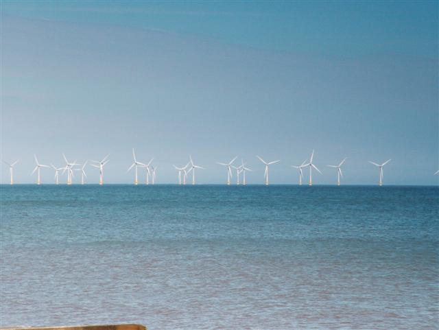
image_caption =Wind Turbines
official_name = Sheringham Shoal Offshore Wind Farm
motto =
symbol =
country =England
state = Norfolk
region = East of England
district =North Norfolk
municipality =Sheringham
location =
elevation =
prominence =
lat_d =
lat_m =
lat_s =
lat_NS =
public =
visitation = | visitation_date =
access =
ascent = | ascent_date =
discovery = | discovery_date =
free =
free_type =
map_caption =
map_background =
map_locator =
commons =
statistics =
website = http://www.scira.co.uk/index.html
footnotes =Sheringham Shoal Offshore Wind Farm is a proposed project to build offshore wind turbines. The nearest turbine will be a minimum distance of approximately convert|9|nmi|km to the shore. The turbines will be supported by foundations secured to the
sea bed . It is proposed that the Wind Farm will consist of approximately 45 to 108 wind turbines. The turbines rated power will be between approximately 3.0 and 7.0 MW, with an estimated maximum power capacity of 315 MW. The wind farm will have a total area of approximately 14 sq. miles (35 sq. km). [ [ http://www.scira.co.uk/windfarm/details.html]Sheringham Shoal Offshore Wind Farm Website] TheSheringham Shoal Offshore Wind Farm will provide enough power for approximately 238,000 homes, over twice the equivalent electricity required to supply the whole of theNorth Norfolk coast.Project overview
The
United Kingdom has the potential to be largest offshore wind resource in the world and it has been estimated that the UK could provide over 33% of the totalEurope an potential for offshore wind energy. This is enough to power the country nearly three times over. Britain’s relatively shallow waters and strong winds extend far into theNorth Sea . The development of the Sheringham Shoal Offshore Wind Farm is another step towards tapping this unlimited and natural resource.The Schedule
Planning applications have now been made by Scira Offshore Energy Limited. Scira is a joint venture company which was formed to develop the Sheringham Shoal Offshore Wind Farm. The joint venture has been formed between two companies, StatoilHydro of
Norway and Ecoventures BV of theNetherlands , both of which have a 50% stake in the venture and expect to provide a strong alliance for successfully developing and achieving planning consent for the wind farm. Applications for a number of regulatory consents were made in May 2006 to the DBERR (Department for Business, Enterprise and Regulatory Reform, Formally the DTI) which leads the consent process in association with DEFRA (Department for Environment, Food and Rural Affairs). On12 March 2007 [ [http://www.ofgem.gov.uk/Licensing/Work/Notices/Licences/Documents1/Scira%20Offshore%20licence%20granted%20notice.pdf] Pdf of the License] Scira Offshore Energy Limited was granted an electricity generation license by the Office of Gas and Electricity Markets (Ofgem). It is hoped that once the planning consent that procurement and contracting can be finalized by 2008. Onshore construction will then proceed between 2009 and 2010 with the offshore construction activity taking place between 2010 and 2011.Export cable
In April 2008, cable company
Nexans was awarded the cable supply contract by StatoilHydro ASA. The contract scope includes engineering, procurement and construction of two 22km, 145 kilovolt (kV) XLPE submarine export cables, and a spare cable with associated equipment. An optical fibre cable will also be included. [ [http://www.nexans.com/eservice/Corporate-en/navigatepub_142482_-15936_297_2579/Nexans_wins_a_24_million_Euro_submarine_power_cabl.html 24 million Euro submarine power cable contract for the Sheringham Shoal Offshore Wind Farm - Nexans ] ]ee also
*
Wind power in the United Kingdom
*Scroby Sands wind farm References
External links
* [http://www.scira.co.uk/index.html Scira website]
Wikimedia Foundation. 2010.