- Ozone Falls State Natural Area
-
Coordinates: 35°52′50″N 84°48′36″W / 35.88043°N 84.80999°W
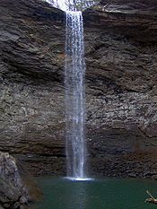
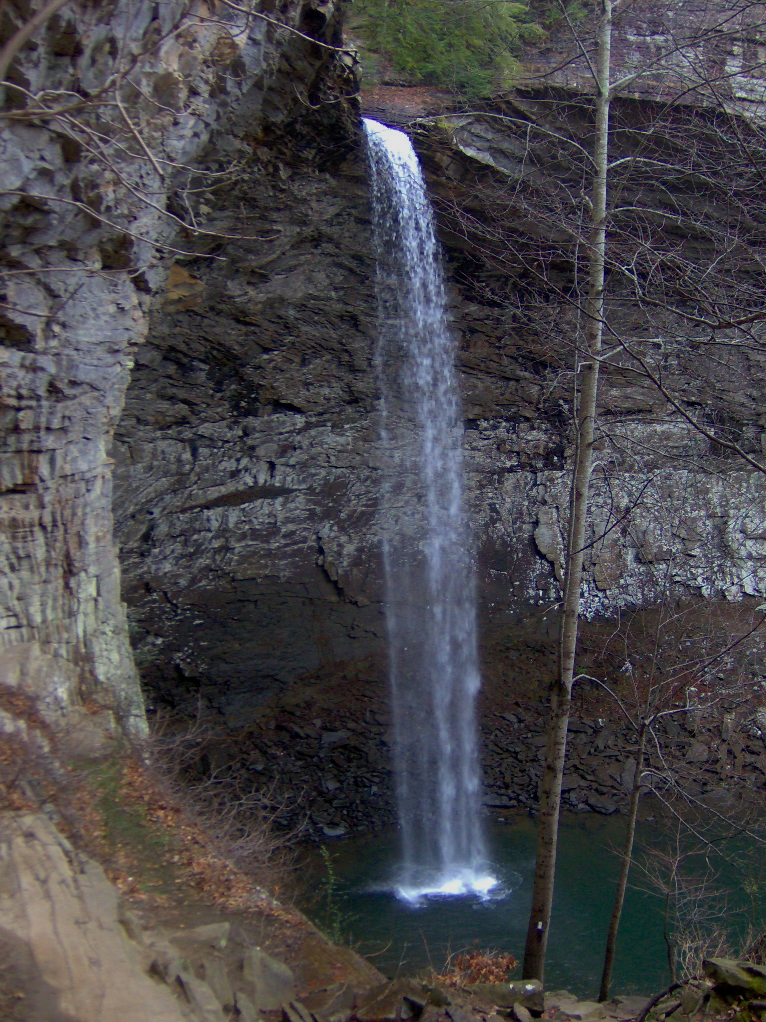
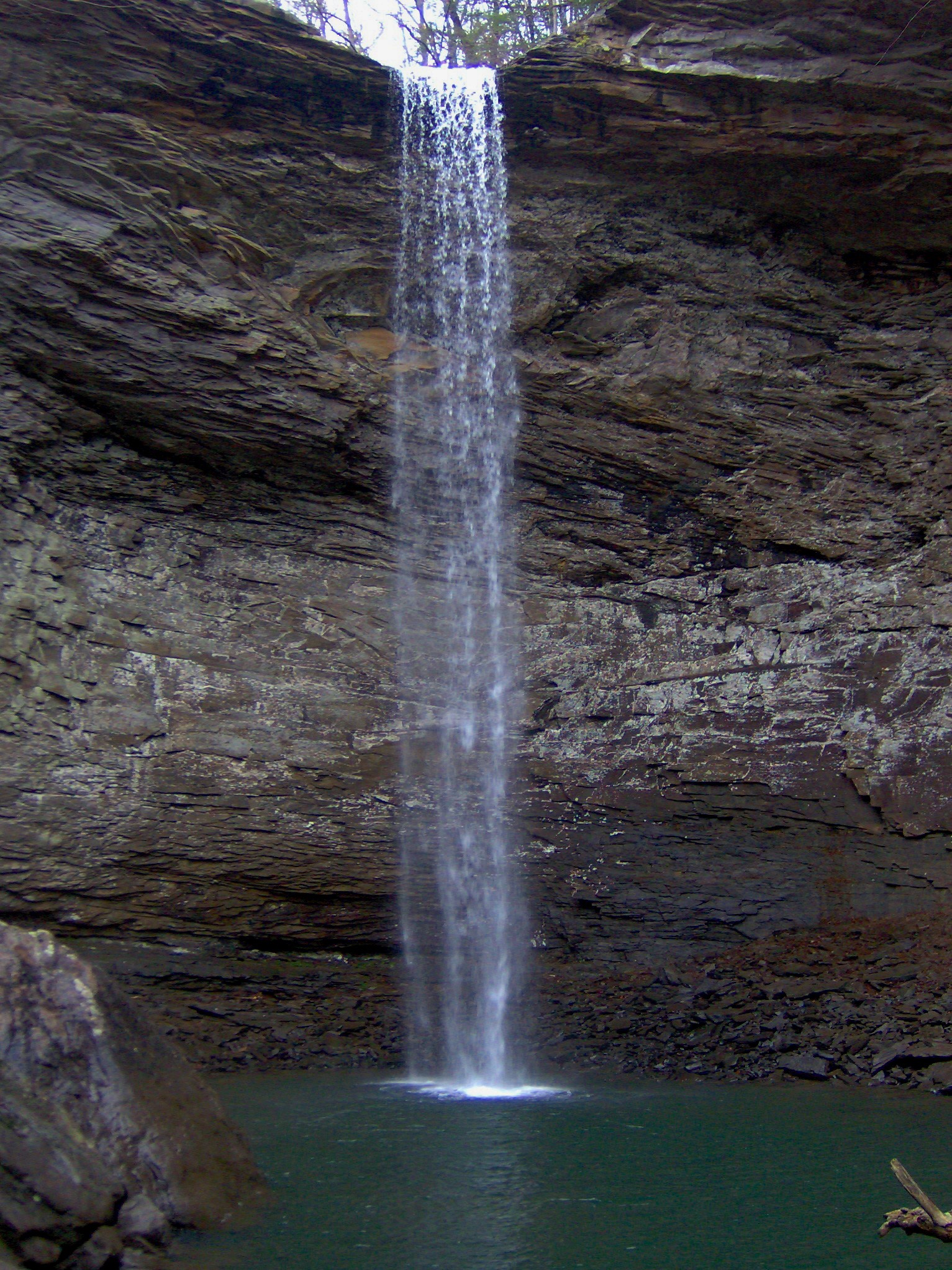
Ozone Falls State Natural Area is a state natural area in Cumberland County, Tennessee, located in the Southeastern United States. It consists of 43 acres (0.17 km2) centered around Ozone Falls, a 110-foot (34 m) plunge waterfall, and its immediate gorge along Fall Creek.
The area is managed by the Tennessee Department of Environment and Conservation and maintained by Cumberland Mountain State Park.
Contents
Geographical setting
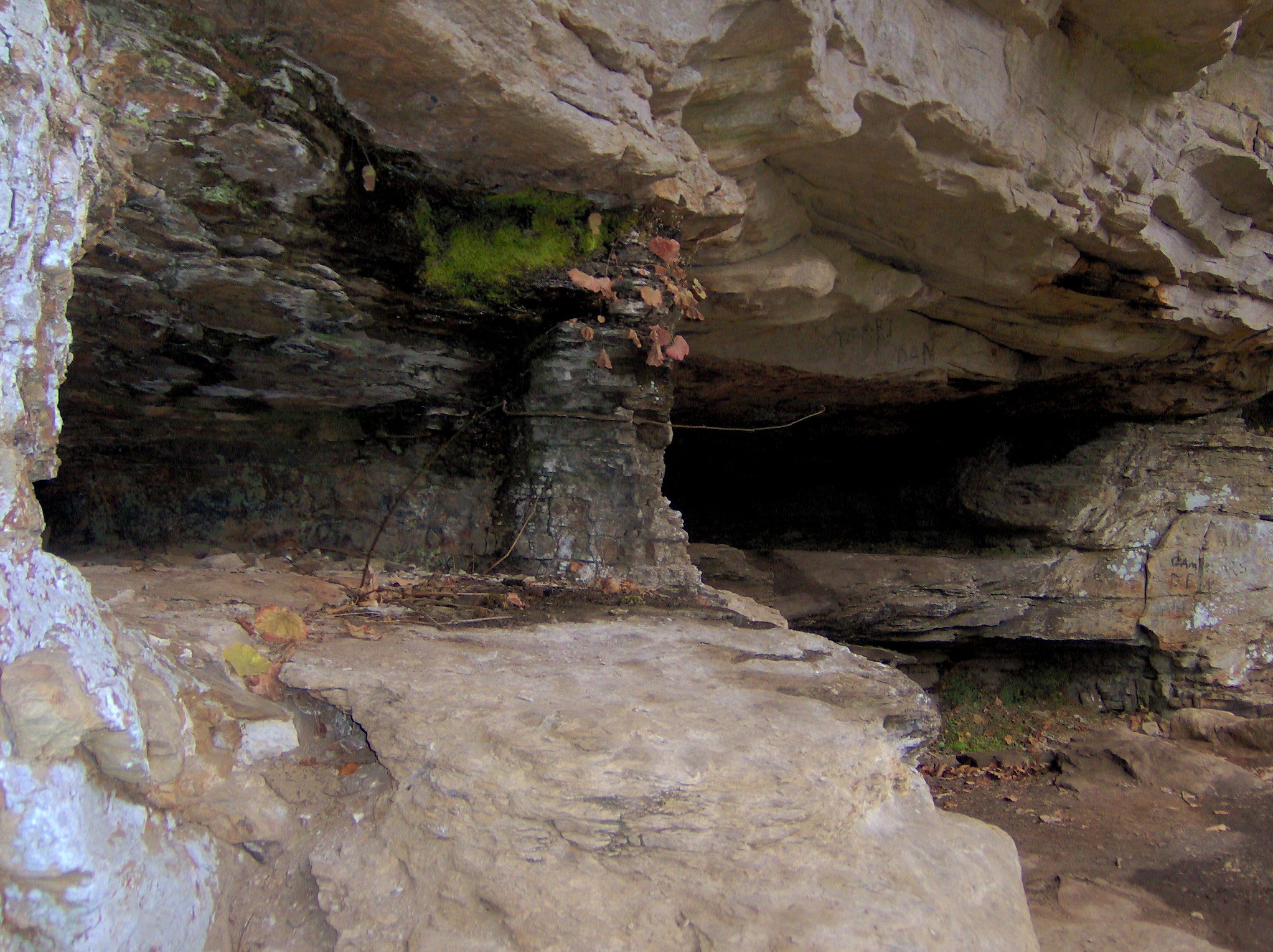
 Gambler's Den, just above the gorge
Ozone Falls is situated along Fall Creek, which drains a short section of the Cumberland Plateau between the Crab Orchard Mountains to the west and Walden Ridge to the east. The creek flows down from its source high in the Crab Orchard Mountains for a mile or so before steadying briefly as it enters the community of Ozone. Fall Creek enters the state natural area just after it passes under U.S. Route 70, which runs perpendicular to it. The creek spills over Ozone Falls a few hundred meters south of US-70.
Beyond Ozone Falls, Fall Creek slices through a small gorge and proceeds southward for several more miles before emptying into Piney Creek. The confluence of Piney and Fall Creek occurs at a point where Roane County, Cumberland County, and Rhea County all meet. Fall Creek is part of the Tennessee River watershed.
The Fall Creek that spills over Ozone Falls is not the same stream as the Fall Creek that spills over Fall Creek Falls in Van Buren County. The latter stream is part of the Cumberland River watershed.
Features
The Ozone Falls State Natural Area consists of Ozone Falls and the gorge immediately downstream. The gorge area around the waterfall's plungepool slopes inward from the top edge, creating a half-dome shape along the gorge's walls. Short hiking trails allow access to the waterfall's overhang and plungepool, as well as the cliffs above the gorge. The trailhead is located along US-70.
History
Migrants crossing the Cumberland Plateau en route to the Nashville area in the early 19th century wrote of Ozone Falls in journals and letters sent to relatives back home. The waterfall was located adjacent to the Walton Road, which was part of the stage route connecting East and Middle Tennessee (the road closely paralleled what is now US-70). One traveler along this road, Elijah Haley, died while passing through the area in 1806. His widow established a tavern at what is now the community of Ozone shortly thereafter, and later helped operate the Crab Orchard Inn at Crab Orchard, a few miles to the west.[1]
The waterfall was known as McNair Falls throughout the 19th century, named after a local miller who operated a grist mill at the waterfall in the 1860s. In 1896, the community of Mammy, which had grown up around the Haley tavern, changed its name to "Ozone", and the name was subsequently applied to the waterfall.[2] The name reflected the high quality of air in the community, which may have been enhanced by the waterfall's mists.[3]
The Ozone Falls State Natural Area was established in 1973, and originally consisted of 14 acres (57,000 m2). In 1996, it was expanded to 43 acres (170,000 m2).[4]
References
- ^ Helen Bullard and Joseph Krechniak, Cumberland County's First Hundred Years (Crossville, Tenn.: Centennial Committee, 1956), 133-135.
- ^ Bullard and Krechniak, Cumberland County's First Hundred Years, 136.
- ^ The Tennessee Department of Environment and Conservation, "Ozone Falls." Retrieved: 8 January 2008.
- ^ Carroll Van West, "Ozone Falls State Natural Area." The Tennessee Encyclopedia of History and Culture, 2002. Retrieved: 11 January 2008.
External links
- Ozone Falls State Natural Area — official site
Categories:- Protected areas of Cumberland County, Tennessee
- Waterfalls of Tennessee
- Nature reserves in Tennessee
Wikimedia Foundation. 2010.