- Ossian, New York
-
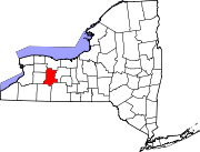
Ossian, New York — Town — Location within the state of New York
 Ossian, New York
Coordinates: 42°31′31″N 77°46′55″W / 42.52528°N 77.78194°W Country United States State New York County Livingston Government - Type Town Council - Town Supervisor Domenick Martello (R) - Town Council Members' ListArea - Total 39.7 sq mi (102.7 km2) - Land 39.6 sq mi (102.7 km2) - Water 0.0 sq mi (0.1 km2) Elevation 1,365 ft (416 m) Population (2000) - Total 751 - Density 18.9/sq mi (7.3/km2) Time zone Eastern (EST) (UTC-5) - Summer (DST) EDT (UTC-4) FIPS code 36-55508 GNIS feature ID 0979322 Ossian is a town in Livingston County, New York, United States. The population was 751 at the 2000 census. Ossian is a figure in Celtic mythology.
The Town of Ossian is the southernmost town in Livingston County and is in the southeast part of the county.
Contents
History
The area was first settled around 1804 near Ossian Center. The Town of Ossian was formed from the Town of Angelica, while part of Allegany County. Ossian became part of Livingston County in 1856.
Geography
According to the United States Census Bureau, the town has a total area of 39.7 square miles (103 km2), of which, 39.6 square miles (103 km2) of it is land and 0.04 square miles (0.10 km2) of it (0.10%) is water.
Part of the west town line and the south town line are the border of Allegany County, New York. Part of the east town line is the border of Steuben County, New York.
New York State Route 436 is a highway across the north part of the town.
Demographics
As of the census[1] of 2000, there were 751 people, 272 households, and 212 families residing in the town. The population density was 18.9 people per square mile (7.3/km²). There were 310 housing units at an average density of 7.8 per square mile (3.0/km²). The racial makeup of the town was 98.93% White, 0.13% African American, 0.13% Native American, and 0.80% from two or more races. Hispanic or Latino of any race were 0.13% of the population.
There were 272 households out of which 36.0% had children under the age of 18 living with them, 70.2% were married couples living together, 4.8% had a female householder with no husband present, and 21.7% were non-families. 18.0% of all households were made up of individuals and 9.2% had someone living alone who was 65 years of age or older. The average household size was 2.75 and the average family size was 3.09.
In the town the population was spread out with 26.2% under the age of 18, 6.8% from 18 to 24, 30.0% from 25 to 44, 26.1% from 45 to 64, and 10.9% who were 65 years of age or older. The median age was 38 years. For every 100 females there were 114.0 males. For every 100 females age 18 and over, there were 102.9 males.
The median income for a household in the town was $46,563, and the median income for a family was $50,938. Males had a median income of $32,313 versus $23,977 for females. The per capita income for the town was $20,252. About 3.2% of families and 6.5% of the population were below the poverty line, including 2.7% of those under age 18 and 9.4% of those age 65 or over.
Communities and locations in Ossian
- Ossian Center – A hamlet near the town center.
- Westview – A hamlet in the northwest corner of the town on Route 436.
- Rattlesnake Hill Wildlife Management Area – A state conservation area in the western part of the town.
References
- ^ "American FactFinder". United States Census Bureau. http://factfinder.census.gov. Retrieved 2008-01-31.
External links
Municipalities and communities of Livingston County, New York County seat: Geneseo Towns Avon | Caledonia | Conesus | Geneseo | Groveland | Leicester | Lima | Livonia | Mount Morris | North Dansville | Nunda | Ossian | Portage | Sparta | Springwater | West Sparta | York
Villages Hamlets Coordinates: 42°31′16″N 77°46′46″W / 42.52111°N 77.77944°W
Categories:- Towns in New York
- Rochester, New York metropolitan area
- Populated places in Livingston County, New York


Wikimedia Foundation. 2010.