Gmina Miastków Kościelny

Gmina Miastków Kościelny
Miastków Kościelny Commune
—  Gmina  —
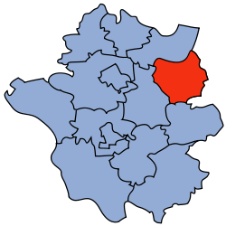
Coordinates (Miastków Kościelny): 51°54′N 21°50′E / 51.9°N 21.833°E / 51.9; 21.833
Country  Poland
Voivodeship Masovian
County Garwolin
Seat Miastków Kościelny
Area
 – Total 85.24 km2 (32.9 sq mi)
Population (2006)
 – Total 5,019
 – Density 58.9/km2 (152.5/sq mi)
Website http://www.miastkowkoscielny.pl/

Gmina Miastków Kościelny is a rural gmina (administrative district) in Garwolin County, Masovian Voivodeship, in east-central Poland. Its seat is the village of Miastków Kościelny, which lies approximately 14 kilometres (9 mi) east of Garwolin and 68 km (42 mi) south-east of Warsaw.

The gmina covers an area of 85.24 square kilometres (32.9 sq mi), and as of 2006 its total population is 5,019.

Villages

Gmina Miastków Kościelny contains the villages and settlements of Brzegi, Glinki, Kruszówka, Kujawy, Miastków Kościelny, Oziemkówka, Przykory, Ryczyska, Stary Miastków, Wola Miastkowska, Zabruzdy, Zabruzdy-Kolonia, Zasiadały, Zgórze, Zwola and Zwola Poduchowna.

Neighbouring gminas

Gmina Miastków Kościelny is bordered by the gminas of Borowie, Górzno, Stoczek Łukowski, Wola Mysłowska and Żelechów.

References


Coordinates: 51°52′53″N 21°49′18″E / 51.88139°N 21.82167°E / 51.88139; 21.82167


Wikimedia Foundation. 2010.

Игры ⚽ Нужно сделать НИР?

Look at other dictionaries:

  • Miastków Kościelny —   Village   …   Wikipedia

  • Miastków Kościelny — Miastków Kościelny …   Wikipedia Español

  • Gmina Stoczek Łukowski — Infobox Settlement name = Gmina Stoczek Łukowski other name = Stoczek Łukowski Commune settlement type = Gmina total type = Total image shield = subdivision type = Country subdivision name = POL subdivision type1 = Voivodeship subdivision name1 …   Wikipedia

  • Gmina Wola Mysłowska — Infobox Settlement name = Gmina Wola Mysłowska other name = Wola Mysłowska Commune settlement type = Gmina total type = Total image shield = subdivision type = Country subdivision name = POL subdivision type1 = Voivodeship subdivision name1 =… …   Wikipedia

  • Gmina Borowie — Infobox Settlement name = Gmina Borowie other name = Borowie Commune settlement type = Gmina total type = Total image shield = POL gmina Borowie COA.svg subdivision type = Country subdivision name = POL subdivision type1 = Voivodeship subdivision …   Wikipedia

  • Gmina Żelechów — Infobox Settlement name = Gmina Żelechów other name = Żelechów Commune settlement type = Gmina total type = Total image shield = subdivision type = Country subdivision name = POL subdivision type1 = Voivodeship subdivision name1 = Masovian… …   Wikipedia

  • Gmina Borowie — Le Gmina Borowie est un gmina rural du powiat de Zduńska Wola dans la Voïvodie de Mazovie, Pologne. Son chef lieu est le village de Borowie. Villages Le gmina inclut les villages de Borowie, Brzuskowola, Chromin, Dudka, Filipówka, Głosków,… …   Wikipédia en Français

  • Gmina Górzno, Masovian Voivodeship — Infobox Settlement name = Gmina Górzno other name = Górzno Commune settlement type = Gmina total type = Total image shield = image shield = subdivision type = Country subdivision name = POL subdivision type1 = Voivodeship subdivision name1 =… …   Wikipedia

  • List of Polish gminas/M — *Gmina Maciejowice (rural, Garwolin County, Masovian Voivodeship, 172.67 km², 7,287) *Gmina Magnuszew (rural, Kozienice County, Masovian Voivodeship, 140.92 km², 6,595) *Gmina Majdan Królewski (rural, Kolbuszowa County, Subcarpathian Voivodeship …   Wikipedia

  • Гмины Мазовецкого воеводства — …   Википедия

Share the article and excerpts

Direct link
Do a right-click on the link above
and select “Copy Link”