- Marrowbone, Kentucky
-
Marrowbone — Unincorporated community — Location within the state of Kentucky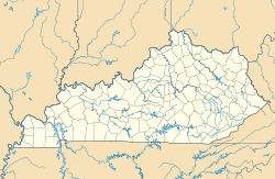
 Marrowbone
Coordinates: 36°45′44″N 85°0′37″W / 36.76222°N 85.01028°WCoordinates: 36°45′44″N 85°0′37″W / 36.76222°N 85.01028°W Country United States State Kentucky County Cumberland Elevation 643 ft (196 m) Time zone Central (CST) (UTC-6) - Summer (DST) CDT (UTC-5) ZIP codes 42759 FIPS code GNIS feature ID 497558 Marrowbone is an unincorporated community in Cumberland County, Kentucky, United States. It lies along Route 90 west of the city of Burkesville, the county seat of Cumberland County.[1] Its elevation is 643 feet (196 m), and it is located at about (36.8288889, -85.5030556).[2] Although it is unincorporated, it has a post office, with the ZIP code of 42759.[3]
In March 2010, nine congregants (and two other victims) of the Marrowbone Christian Brotherhood Mennonite Church were killed on Interstate 65 near Bowling Green and Mammoth Cave National Park in Kentucky's deadliest vehicle wreck in 20 years.
References
- ^ Rand McNally. The Road Atlas '06. Chicago: Rand McNally, 2006, p. 42.
- ^ U.S. Geological Survey Geographic Names Information System: Marrowbone, Kentucky, Geographic Names Information System, 1979-09-20. Accessed 2007-12-31.
- ^ Zip Code Lookup
Municipalities and communities of Cumberland County, Kentucky County seat: Burkesville City 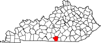
Communities Amandaville | Bakerton | Bow | Dubre | Grider | Judio | Kettle | Marrowbone | Peytonsburg | Waterview
Categories:- Populated places in Cumberland County, Kentucky
- Unincorporated communities in Kentucky
- Kentucky geography stubs


Wikimedia Foundation. 2010.