- Liberty Township, New Jersey
Infobox Settlement
official_name = Liberty Township, New Jersey
settlement_type = Township
nickname =
motto =
imagesize = 250px
image_caption = Free Union Church from Marble Hill Road
image_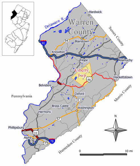
mapsize = 250px
map_caption = Map of Liberty Township in Warren County. Inset: Location of Warren County highlighted in the State of New Jersey.
mapsize1 = 250x200px
map_caption1 = Census Bureau map of Liberty Township, New Jerseysubdivision_type = Country
subdivision_name =United States
subdivision_type1 = State
subdivision_name1 =New Jersey
subdivision_type2 = County
subdivision_name2 = Warren
government_footnotes =
government_type = Township Committee
leader_title = Mayor
leader_name = John E. Inscho (R, 2009)
leader_title1 = Deputy Mayor
leader_name1 = Ray Bolzan (R)
established_title = Incorporated
established_date =April 30 ,1926 unit_pref = Imperial
area_footnotes =
area_magnitude =
area_total_km2 = 31.1
area_land_km2 = 30.6
area_water_km2 = 0.5
area_total_sq_mi = 12.0
area_land_sq_mi = 11.8
area_water_sq_mi = 0.2population_as_of = 2006
population_footnotes =
population_total = 2954
population_density_km2 = 90.5
population_density_sq_mi = 234.3timezone = Eastern (EST)
utc_offset = -5
timezone_DST = EDT
utc_offset_DST = -4
elevation_footnotes = [Gnis|882245|Township of Liberty,Geographic Names Information System . AccessedJanuary 4 ,2008 .]
elevation_m = 272
elevation_ft = 892
latd = 40 |latm = 52 |lats = 11 |latNS = N
longd = 74 |longm = 57 |longs = 17 |longEW = Wpostal_code_type =
ZIP Code s
postal_code = 07823, 07838, 07863
area_code = 908
blank_name = FIPS code
blank_info = 34-40110GR|2 [ [http://mcdc2.missouri.edu/webrepts/commoncodes/ccc_nj.html A Cure for the Common Codes: New Jersey] , Missouri Census Data Center. AccessedJuly 14 ,2008 .]
blank1_name = GNIS feature ID
blank1_info = 0882245GR|3
website = http://www.libertytownship.org
footnotes =Liberty Township is a Township in Warren County,
New Jersey ,United States . As of theUnited States 2000 Census , the township population was 2,765. It is part of the eastern region of theLehigh Valley .Liberty Township was incorporated as a township by an Act of the
New Jersey Legislature onMarch 26 ,1926 , from portions of Hope Township, based on the results of a referendum held onApril 30 ,1926 ."The Story of New Jersey's Civil Boundaries: 1606-1968", John P. Snyder, Bureau of Geology and Topography; Trenton, New Jersey; 1969. p. 247.]Geography
According to the
United States Census Bureau , the township has a total area of 12.0 square miles (31.1 km²), of which, 11.8 square miles (30.6 km²) of it is land and 0.2 square miles (0.5 km²) of it (1.75%) is water (most of which is Mountain Lake).Great Meadows is an area within Liberty Township. The Great Meadows-Vienna
census-designated place straddles both Libert Township and Independence Township.Mountain Lake is over 12,000 years old and is Warren County's largest, natural, glacial lake. Mountain Lake also has an area of convert|122|acre|km2, maximum depth of convert|38|ft|m and an average depth of convert|17|ft|m. The Mountain Lake Community Association (MLCA) oversees the Mountain Lake Watershed and helps to maintain Mt. Lake's natural habitat. South of Mt. Lake is High Rock where many visitors enjoy to go for hiking and a view of the lake and surrounding areas, including the
Delaware Water Gap .Demographics
USCensusPop
1930=419
1940=441
1950=529
1960=760
1970=1229
1980=1730
1990=2493
2000=2765
estimate= 2954
estyear=2006
estref= [http://factfinder.census.gov/servlet/SAFFPopulation?_event=Search&geo_id=06000US3404133930&_geoContext=01000US%7C04000US34%7C05000US34041%7C06000US3404133930&_street=&_county=liberty&_cityTown=liberty&_state=04000US34&_zip=&_lang=en&_sse=on&ActiveGeoDiv=geoSelect&_useEV=&pctxt=fph&pgsl=060&_submenuId=population_0&ds_name=null&_ci_nbr=null&qr_name=null®=null%3Anull&_keyword=&_industry= Census data for Liberty township] ,United States Census Bureau . AccessedAugust 12 ,2007 .]
footnote=Population 1930 - 1990. [ [http://www.wnjpin.net/OneStopCareerCenter/LaborMarketInformation/lmi01/poptrd6.htm New Jersey Resident Population by Municipality: 1930 - 1990] , Workforce New Jersey Public Information Network. AccessedMarch 1 ,2007 .] As of thecensus GR|2 of 2000, there were 2,765 people, 980 households, and 750 families residing in the township. Thepopulation density was 234.3 people per square mile (90.5/km²). There were 1,088 housing units at an average density of 92.2/sq mi (35.6/km²). The racial makeup of the township was 97.40% White, 0.36% African American, 0.11% Native American, 0.58% Asian, 0.54% from other races, and 1.01% from two or more races. Hispanic or Latino of any race were 2.68% of the population.There were 980 households out of which 40.6% had children under the age of 18 living with them, 68.2% were married couples living together, 5.7% had a female householder with no husband present, and 23.4% were non-families. 17.6% of all households were made up of individuals and 6.6% had someone living alone who was 65 years of age or older. The average household size was 2.79 and the average family size was 3.23.
In the township the population was spread out with 28.4% under the age of 18, 5.0% from 18 to 24, 33.1% from 25 to 44, 25.2% from 45 to 64, and 8.5% who were 65 years of age or older. The median age was 38 years. For every 100 females there were 98.6 males. For every 100 females age 18 and over, there were 96.7 males.
The median income for a household in the township was $62,535, and the median income for a family was $68,529. Males had a median income of $48,446 versus $33,529 for females. The
per capita income for the township was $24,743. About 2.0% of families and 3.5% of the population were below thepoverty line , including 3.4% of those under age 18 and 6.7% of those age 65 or over.Government
Local government
Liberty Township is governed under the Township form of government with a five-member Township Committee. The Township Committee is elected directly by the voters in partisan elections to serve three-year terms of office on a staggered basis, with one or two seats coming up for election each year. ["2005 New Jersey Legislative District Data Book",
Rutgers University Edward J. Bloustein School of Planning and Public Policy , April 2005, p. 103.] At an annual reorganization meeting, the Township Committee selects one of its members to serve as Mayor.The Liberty Township Committee consists of
Mayor John E. Inscho (R, term endsDecember 31 ,2009 ), John Fisher (R, 2010), Dan Grover (R, 2010), Ron Petersen (R, 2008) and Mark Tibak (R, 2008). [ [http://www.co.warren.nj.us/mun/liberty.html Liberty Township] , Warren County,New Jersey . AccessedJune 6 ,2008 .] [ [http://www.libertytownship.org/municipal/officials/index.html Officials & Contact Info] , Liberty Township. AccessedJune 6 ,2008 . Still shows 2007 term end dates as of date accessed.]Federal, state and county representation
Liberty Township is in the Fifth Congressional District and is part of New Jersey's 23rd Legislative District. [ [http://www.lwvnj.org/pubs/CG06.pdf 2006 New Jersey Citizen's Guide to Government] , New Jersey
League of Women Voters , p. 59. AccessedAugust 30 ,2006 .]Education
Public school students in grades K through 8 attend the
Great Meadows Regional School District . Schools in the district (with 2005-06 school year enrollment from theNational Center for Education Statistics [ [http://nces.ed.gov/ccd/schoolsearch/school_list.asp?Search=1&DistrictID=3400008 Data for the Great Meadows Regional School District] ,National Center for Education Statistics . AccessedJune 5 ,2008 .] ) are [http://www.gmrsd.com/central.htm Independence Central School] (381 students in K-5), [http://www.gmrsd.com/liberty.htm Liberty School] (254 students in K-5) and [http://www.gmrsd.com/middle.htm Great Meadows Middle School] (354 students in 6-8).Students in public school for grades 9-12 attend
Hackettstown High School which serves students from Hackettstown, as well as students from the townships of Allamuchy, Independence and Liberty, as part ofsending/receiving relationship s with theHackettstown School District . [ [http://education.state.nj.us/rc/rc06/narrative/41/1870/41-1870-050.html Hackettstown High School 2005-06 Report Card Narrative] ,New Jersey Department of Education . AccessedJune 15 ,2007 . "Hackettstown High School is a four year comprehensive High School with an enrollment of 951 students in grades 9-12 who come from the communities of Allamuchy, Hackettstown, Independence, and Liberty Township."]References
External links
* [http://www.libertytownship.org Liberty Township website]
* [http://www.co.warren.nj.us/mun/liberty.html Warren County page for Liberty Township]
* [http://www.gmrsd.com/ Great Meadows Regional School District]
*NJReportCard|41|1785|0|Great Meadows Regional School District
* [http://nces.ed.gov/ccd/schoolsearch/school_list.asp?Search=1&DistrictID=3400008 Data for the Great Meadows Regional School District] ,National Center for Education Statistics
* [http://www.hackettstown.org/hhs/ Hackettstown High School]
Wikimedia Foundation. 2010.