- Nandewar Range
-
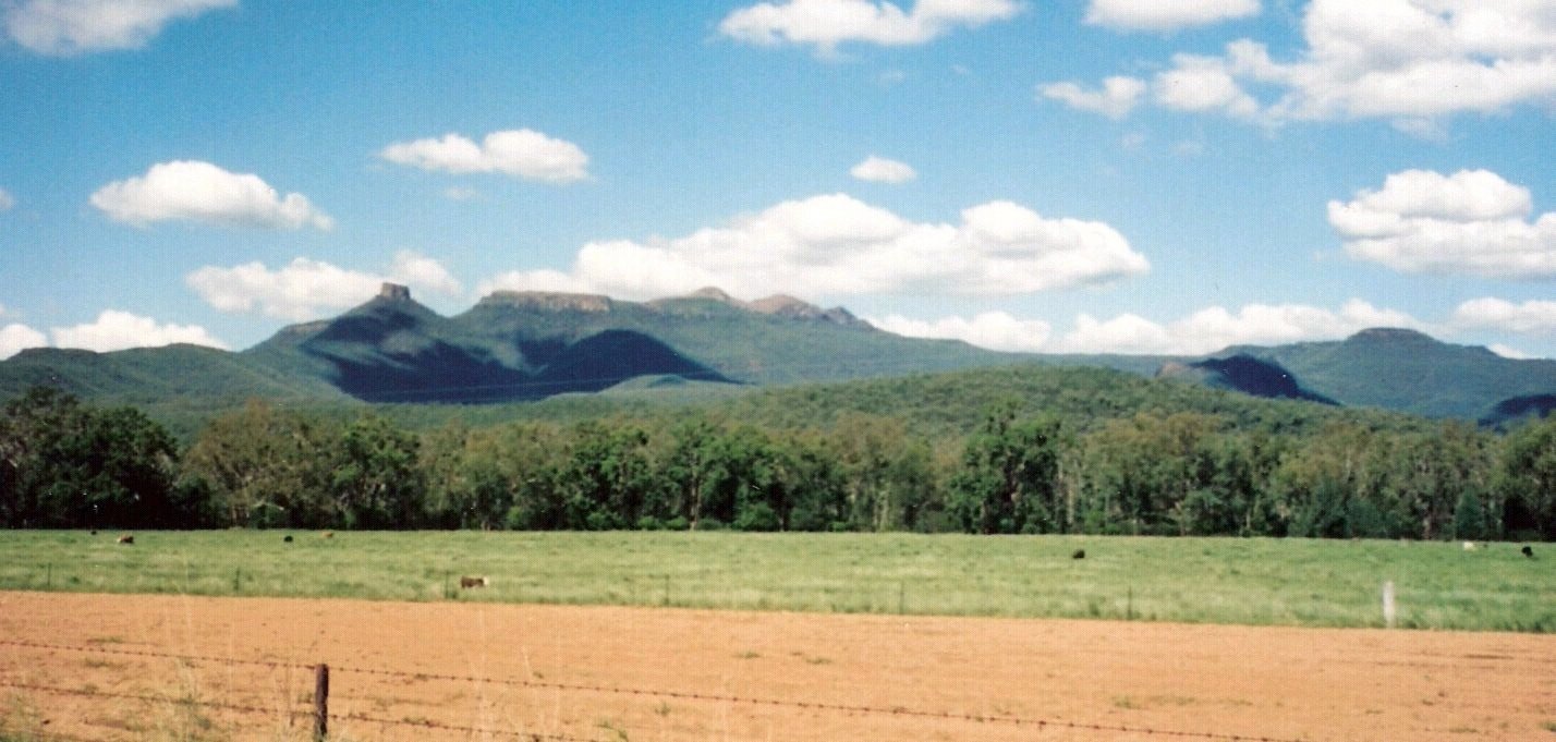
Nandewar Range Range  Mount Kaputar is the third peak from the left in this image and it is the highest. The first is a volcanic plug called 'Ninghdoo' (pronounced locally as Ningy-doo) or 'Nungadhun'. The names Nandewar, Kaputar and Ninghdoo are the traditional Kamilaroi names for these features.
Country Australia State New South Wales Highest point Mount Kaputar - elevation 1,508 m (4,948 ft) Geology Shield volcano Period Cenozoic The Nandewar Range is a mountain range 30 km (19 mi) east of Narrabri in New South Wales, Australia. John Oxley was the first European to see the range in 1818 as he explored the New South Wales Northern Tablelands.[citation needed]
The range is located on the western, inland, side of the New England region, and generally forms the watershed divide between the Namoi River and Gwydir River catchment basins to the south and north respectively. The Macdonald River starting south of Walcha drains west to Warrabah National Park where it changes its name to the Namoi then is added to by the Manilla River, Peel River and Mooki River. The Horton River runs north to the Gwydir. Both rivers together drain large segments of the Nandewar Range.
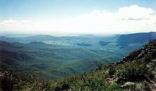
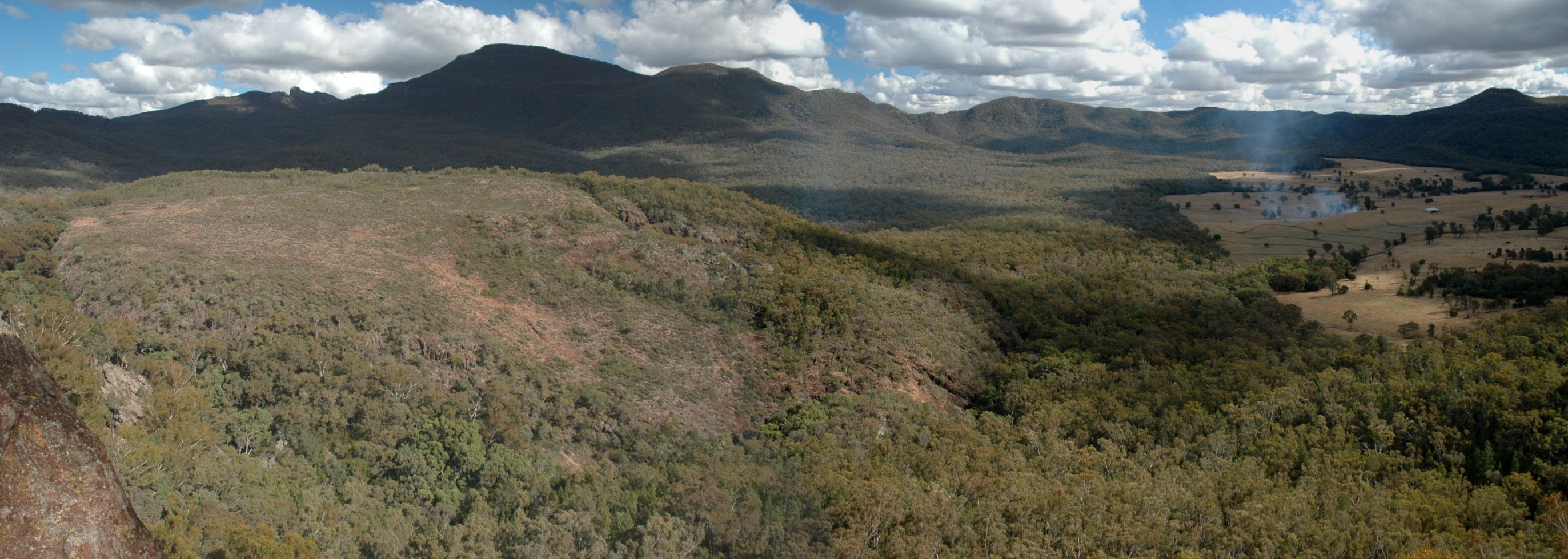
The eastern part of the Nandewar Range starts at the Great Dividing Range south of Uralla. As this is already in the Northern Tablelands of New South Wales it is low, hilly and not particularly distinctive. The main road between Barraba and Bingara crosses the range. At its western end, however, the Nandewar Range culminates at Mount Kaputar, a complex of volcanic origin, from which spectacular views of the flat inland plains of New South Wales can be seen.
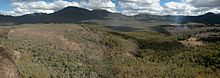
 Forests on the north west slopes of Mount Kaputar.
Small patches of rainforest mark the western limit of some tree species.[citation needed] The foothill areas of the Nandewar Range are used for grazing and cropping. There are forests in some of the higher areas. The Mount Kaputar area is included in Mount Kaputar National Park.
The range is occasionally dusted with light snow in winter.[1]
Contents
Geology
The range is the remnants of an eroded basaltic shield volcano that formed about 18 million years ago. Some of the exposed rocks in the area are 230 million years old.[2]
Peaks
Mountains within the Nandewar Range include;
- Bushy Mountain
- Castletop Mountain
- Gins Mountain
- Grattai Mountain
- Mount Dowe
- Mount Kaputar
- Mount Lawler
- Mount Lindesay
- Mount Ningadhun
- Mount Waa
- Mount Yulludunida
- Round Mountain
See also
References
Categories:- Mountain ranges of New South Wales
- Shield volcanoes
- Miocene volcanoes
- Extinct volcanoes

Wikimedia Foundation. 2010.