- Fullerton, Nebraska
Infobox Settlement
official_name = Fullerton, Nebraska
settlement_type =City
nickname =
motto =
imagesize =
image_caption =
image_
imagesize =
image_caption =
image_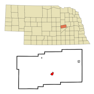
mapsize = 250px
map_caption = Location of Fullerton, Nebraska
mapsize1 =
map_caption1 =subdivision_type = Country
subdivision_name =United States
subdivision_type1 = State
subdivision_name1 =Nebraska
subdivision_type2 = County
subdivision_name2 = Nance
government_footnotes =
government_type =
leader_title =
leader_name =
leader_title1 =
leader_name1 =
established_title =
established_date =unit_pref = Imperial
area_footnotes =area_magnitude =
area_total_km2 = 3.2
area_land_km2 = 3.2
area_water_km2 = 0.0
area_total_sq_mi = 1.2
area_land_sq_mi = 1.2
area_water_sq_mi = 0.0population_as_of = 2000
population_footnotes =
population_total = 1378
population_density_km2 = 428.6
population_density_sq_mi = 1110.0timezone = Central (CST)
utc_offset = -6
timezone_DST = CDT
utc_offset_DST = -5
elevation_footnotes =
elevation_m = 502
elevation_ft = 1647
latd = 41 |latm = 21 |lats = 47 |latNS = N
longd = 97 |longm = 58 |longs = 15 |longEW = Wpostal_code_type =
ZIP code
postal_code = 68638
area_code = 308
blank_name = FIPS code
blank_info = 31-17810GR|2
blank1_name = GNIS feature ID
blank1_info = 0829430GR|3
website =
footnotes =Fullerton is a city in Nance County,
Nebraska ,United States . The population was 1,378 at the 2000 census. The community name is derived from cattleman Randolph Fuller.Fullerton is the
county seat of Nance CountyGR|6.History
A location by Fullerton called "Buffalo Leap" was thought to be used by aboriginals for driving Buffalo to their deaths as a hunting method.
In 1856, the Fullerton area became part of a
Pawnee reservation and was excluded from settlement under theHomestead Act . Randolph Fuller bought large tracts of land when the reservation was auctioned in 1871 and donated some for public use.Geography
Fullerton is located at coor dms|41|21|47|N|97|58|15|W|city (41.363009, -97.970858)GR|1.
According to the
United States Census Bureau , the city has a total area of 1.2square mile s (3.2km² ), all of it land.The community is located at the junction of Routes 14 and 22.
Demographics
As of the
census GR|2 of 2000, there were 1,378 people, 551 households, and 375 families residing in the city. Thepopulation density was 1,110.0 people per square mile (429.1/km²). There were 636 housing units at an average density of 512.3/sq mi (198.0/km²). The racial makeup of the city was 96.95% White, 0.80% Native American, 0.07% Asian, 1.09% from other races, and 1.09% from two or more races. Hispanic or Latino of any race were 2.47% of the population.There were 551 households out of which 29.6% had children under the age of 18 living with them, 55.4% were married couples living together, 9.1% had a female householder with no husband present, and 31.9% were non-families. 30.3% of all households were made up of individuals and 16.9% had someone living alone who was 65 years of age or older. The average household size was 2.37 and the average family size was 2.94.
In the city the population was spread out with 25.9% under the age of 18, 6.7% from 18 to 24, 20.6% from 25 to 44, 22.2% from 45 to 64, and 24.5% who were 65 years of age or older. The median age was 42 years. For every 100 females there were 96.0 males. For every 100 females age 18 and over, there were 88.7 males.
The median income for a household in the city was $31,055, and the median income for a family was $39,087. Males had a median income of $26,528 versus $19,063 for females. The
per capita income for the city was $17,593. About 8.5% of families and 12.0% of the population were below thepoverty line , including 17.2% of those under age 18 and 10.3% of those age 65 or over.References
External links
* [http://www.fullerton-ne.com/ Fullerton web page]
Wikimedia Foundation. 2010.