Dongan Hills (Staten Island Railway station)

Dongan Hills (Staten Island Railway station)
Dongan Hills
Staten Island Railway rapid transit station
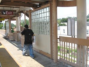
Dongan Hills SIR jeh.JPG
Southbound platform
Station statistics
Address Seaview Avenue & North Railroad Avenue
Staten Island, NY 10304
Borough Staten Island
Locale Dongan Hills
Coordinates 40°35′20″N 74°05′45″W / 40.5890°N 74.0959°W / 40.5890; -74.0959 (Dongan Hills Station)Coordinates: 40°35′20″N 74°05′45″W / 40.5890°N 74.0959°W / 40.5890; -74.0959 (Dongan Hills Station)
Services SIR Main Line
Structure Embankment
Platforms 2 side platforms
Tracks 2
Other information
Opened April 23, 1860[1]
Accessible Handicapped/disabled access
Station succession
Preceding station   Staten Island Railway   Following station
toward St. George
Main Line
toward St. George
Main Line
Handicapped/disabled access

Dongan Hills is a Staten Island Railway station in the neighborhood of Dongan Hills, Staten Island, New York. It is located on an embankment at Seaview Avenue and Railroad Avenue on the main line. It has two side platforms and beige canopies. This station is handicapped accessible in compliance of Americans with Disabilities Act with ramps at the south end that lead to Seaview Avenue. The marble wall at street level on the south end shows when the line was converted from grade level to the current embankment level today. The grade separation took place in 1933. The staircases at the north end lead to Garretson Avenue. Free parking is available on a small lot adjacent to the northbound platform, which is owned by the MTA, the agency that controls the rail line. The brick stationhouse is unusually positioned on the northbound side at platform level, unlike other SIR stationhouses which are usually located on street level. The Dongan Hills stationhouse had a ticket booth and benches until 1987, and then a vending machine for tokens until July 1997.

South of this station, there is an additional third track that once served a coal distributor. Grates between the rails led to chutes which now open into the backyards of homes that run alongside the embankment.

References

  1. ^ Irvin Leigh and Paul Matus (December 23, 2001). "SIRT The Essential History". p. 4. http://www.thethirdrail.net/0201/sirt4.html. Retrieved 2009-03-03. 

External links


Wikimedia Foundation. 2010.

Игры ⚽ Поможем написать реферат

Look at other dictionaries:

  • Dongan Hills, Staten Island — Dongan Hills is a neighborhood located within New York City, USA s borough of Staten Island. It is on the Island s East Shore. The neighborhood was originally known by two separate names, the western half being called Hillside Park and the… …   Wikipedia

  • Old Town (Staten Island Railway station) — Old Town Staten Island Railway rapid transit station …   Wikipedia

  • Jefferson Avenue (Staten Island Railway station) — Infobox NYCS name = Jefferson Avenue SIR = yes font color = white bg color = black image caption = Northbound platform platforms = 2 side platforms tracks = 2 borough = Staten Island open date = Unknown north custom station = Dongan Hills south… …   Wikipedia

  • Dongan Hills — may refer to: Dongan Hills, Staten Island, neighborhood located within New York City, USA s borough of Staten Island Dongan Hills (Staten Island Railway station), railway station at Dongan Hills This disambiguation page lists articles associated… …   Wikipedia

  • Staten Island Railway — Streckenlänge: 22,5 km Spurweite: 1435 mm (Normalspur) Stromsystem: 660 V  …   Deutsch Wikipedia

  • Staten Island Railway — Trajet du SIR Le Staten Island Railway (ou SIR) est un réseau de transport métropolitain dans le borough de Staten Island, à New York. Bien qu étant considéré comme un réseau classique de chemin de fer, le SIR utilise des rames de type R44[1] …   Wikipédia en Français

  • Staten Island — Infobox Settlement name = Staten Island official name = Richmond County other name = native name = nickname = settlement type =Borough of New York City total type = motto = imagesize = image caption = Staten Island streets with views of the… …   Wikipedia

  • Staten Island Ferry — Infobox Water transit name = Staten Island Ferry logo = logo size = image size = 250x210 locale = Staten Island and Manhattan, New York City waterway = Upper New York Bay transit type = Passenger ferry began operation = 1817 ended operation =… …   Wikipedia

  • Clifton, Staten Island — View from the Staten Island Railway platform in Clifton, looking towards the Narrows …   Wikipedia

  • Pleasant Plains, Staten Island — Pleasant Plains is a neighborhood located on Staten Island, one of the five boroughs of New York City, New York, the most populous city in the United States. Welcome To Pleasant Plains sign (Amboy Rd. Facing south,corner of Pleasant Plains Ave.;… …   Wikipedia

Share the article and excerpts

Direct link
Do a right-click on the link above
and select “Copy Link”