Oakwood Heights (Staten Island Railway station)

Oakwood Heights (Staten Island Railway station)
Oakwood Heights
Staten Island Railway rapid transit station
DSCN0381 oakwoodtrainstation e 300.jpg
Exterior of Oakwood Heights SIR Station
Station statistics
Address Guyon Avenue & South Railroad Avenue
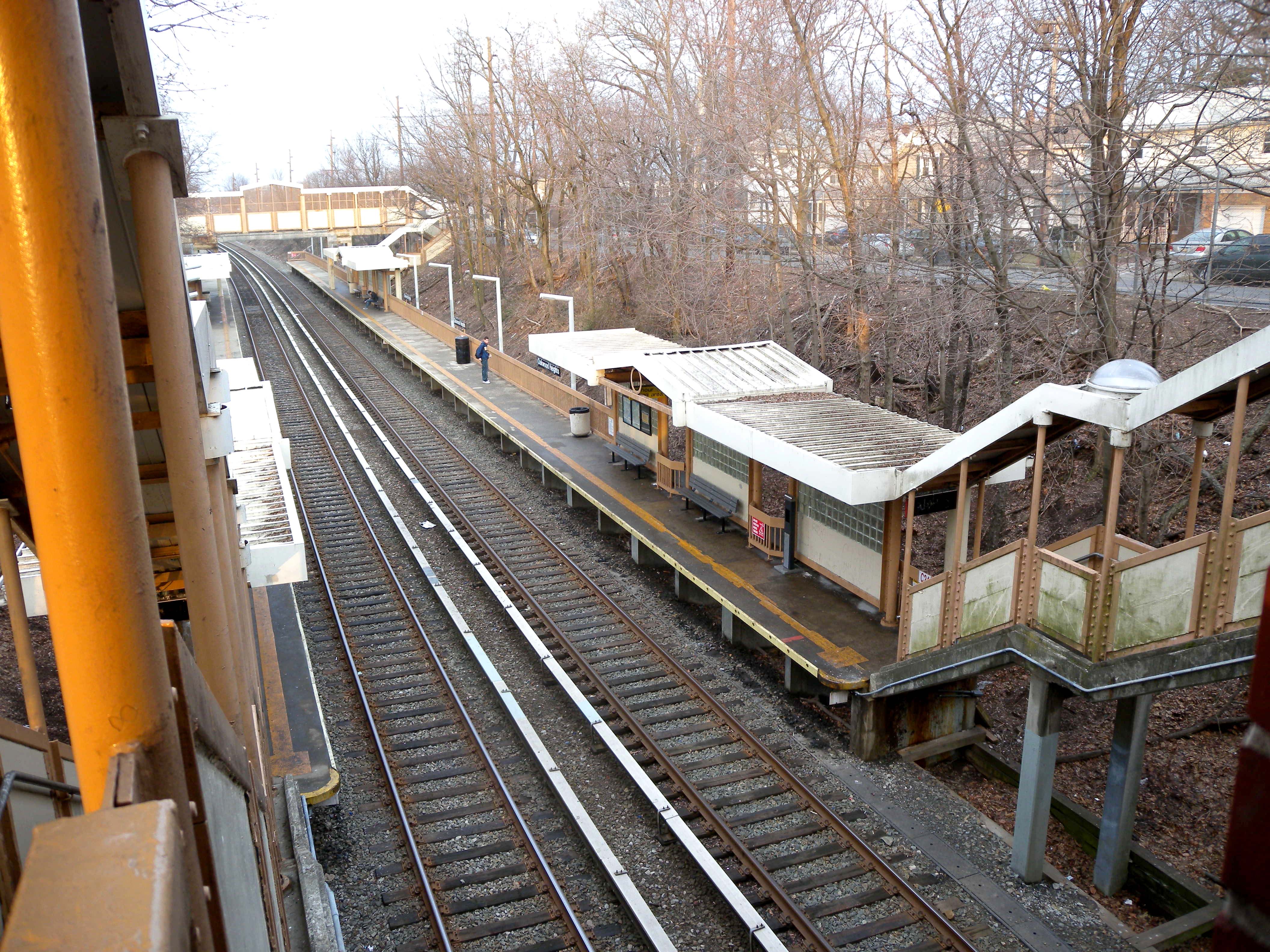
Staten Island, NY 10306
Borough Staten Island
Locale Oakwood
Coordinates 40°33′54″N 74°07′35″W / 40.56495°N 74.12645°W / 40.56495; -74.12645 (Oakwood Heights Station)Coordinates: 40°33′54″N 74°07′35″W / 40.56495°N 74.12645°W / 40.56495; -74.12645 (Oakwood Heights Station)
Services SIR Main Line
Structure Open-cut
Platforms 2 side platforms
Tracks 2
Other information
Opened April 23, 1860[1]
Station succession
Preceding station   Staten Island Railway   Following station
toward St. George
Main Line

Oakwood Heights is a Staten Island Railway station in the neighborhood of Oakwood, Staten Island, New York. It is located on an open cut at Guyon Avenue and Railroad Avenue on the main line. It has two side platforms and beige painted walls. The north end has an overpass bridge with two exits, one to Oak Ave on northbound platform side, and the other to Cedarview Avenue the southbound platform side. This station is used frequently by students of the nearby Monsignor Farrell High School.

Northbound platform and tracks

Bus Connection

References

  1. ^ Irvin Leigh and Paul Matus (December 23, 2001). "SIRT The Essential History". p. 4. http://www.thethirdrail.net/0201/sirt4.html. Retrieved 2009-03-03. 

External links


Wikimedia Foundation. 2010.

Игры ⚽ Нужно решить контрольную?

Look at other dictionaries:

  • New Dorp (Staten Island Railway station) — New Dorp Staten Island Railway rapid transit station …   Wikipedia

  • Bay Terrace (Staten Island Railway station) — Infobox NYCS name = Bay Terrace SIR = yes font color = white bg color = black image caption = Northern part of platform platforms = 1 island platform tracks = 2 borough = Staten Island open date = Unknown north custom station = Oakwood Heights… …   Wikipedia

  • Staten Island Railway — Streckenlänge: 22,5 km Spurweite: 1435 mm (Normalspur) Stromsystem: 660 V  …   Deutsch Wikipedia

  • Staten Island Railway — Trajet du SIR Le Staten Island Railway (ou SIR) est un réseau de transport métropolitain dans le borough de Staten Island, à New York. Bien qu étant considéré comme un réseau classique de chemin de fer, le SIR utilise des rames de type R44[1] …   Wikipédia en Français

  • Oakwood, Staten Island — Coordinates: 40°33′37″N 74°07′12″W / 40.56028°N 74.12°W / 40.56028; 74.12 Oakwood is the name of a neighborhood located in east centr …   Wikipedia

  • Pleasant Plains, Staten Island — Pleasant Plains is a neighborhood located on Staten Island, one of the five boroughs of New York City, New York, the most populous city in the United States. Welcome To Pleasant Plains sign (Amboy Rd. Facing south,corner of Pleasant Plains Ave.;… …   Wikipedia

  • Clifton, Staten Island — View from the Staten Island Railway platform in Clifton, looking towards the Narrows …   Wikipedia

  • Ferrocarril de Staten Island — Staten Island Railway Un tren local SIR en la estación Great Kills SIR station. Lugar Ubicación …   Wikipedia Español

  • Ferrocarril Staten Island — Saltar a navegación, búsqueda Staten Island Railway Un tren local SIR en la estación Great Kills SIR station. Datos generales Tipo …   Wikipedia Español

  • Great Kills, Staten Island — Nelson Avenue and Amboy Road in Great Kills, August 2006 G …   Wikipedia

Share the article and excerpts

Direct link
Do a right-click on the link above
and select “Copy Link”