- Exeter, Nebraska
Infobox Settlement
official_name = Exeter, Nebraska
settlement_type = Village
nickname =
motto =
imagesize =
image_caption =
image_
imagesize =
image_caption =
image_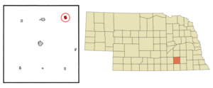
mapsize = 250px
map_caption = Location of Exeter, Nebraska
mapsize1 =
map_caption1 =subdivision_type = Country
subdivision_name =United States
subdivision_type1 = State
subdivision_name1 =Nebraska
subdivision_type2 = County
subdivision_name2 = Fillmore
government_footnotes =
government_type =
leader_title =
leader_name =
leader_title1 =
leader_name1 =
established_title =
established_date =unit_pref = Imperial
area_footnotes =area_magnitude =
area_total_km2 = 1.6
area_land_km2 = 1.6
area_water_km2 = 0.0
area_total_sq_mi = 0.6
area_land_sq_mi = 0.6
area_water_sq_mi = 0.0population_as_of = 2000
population_footnotes =
population_total = 712
population_density_km2 = 432.0
population_density_sq_mi = 1119.0timezone = Central (CST)
utc_offset = -6
timezone_DST = CDT
utc_offset_DST = -5
elevation_footnotes =
elevation_m = 491
elevation_ft = 1611
latd = 40 |latm = 38 |lats = 41 |latNS = N
longd = 97 |longm = 26 |longs = 57 |longEW = Wpostal_code_type =
ZIP code
postal_code = 68351
area_code = 402
blank_name = FIPS code
blank_info = 31-16340GR|2
blank1_name = GNIS feature ID
blank1_info = 0829188GR|3
website =
footnotes =Exeter is a village in Fillmore County,
Nebraska ,United States . The population was 712 at the 2000 census.History
The name Exeter derives from the town of
Exeter inDevon ,England .fact|date=June 2007 Numerous other places have also been given the name Exeter.Geography
Exeter is located at coor dms|40|38|41|N|97|26|57|W|city (40.644684, -97.449229)GR|1.
According to the
United States Census Bureau , the village has a total area of 0.6square mile s (1.7km² ), all of it land.Demographics
As of the
census GR|2 of 2000, there were 712 people, 276 households, and 171 families residing in the village. Thepopulation density was 1,119.0 people per square mile (429.5/km²). There were 297 housing units at an average density of 466.8/sq mi (179.2/km²). The racial makeup of the village was 98.17% White, 0.28% Native American, 0.14% Asian, and 1.40% from two or more races. Hispanic or Latino of any race were 0.56% of the population.There were 276 households out of which 28.6% had children under the age of 18 living with them, 54.3% were married couples living together, 4.7% had a female householder with no husband present, and 37.7% were non-families. 34.1% of all households were made up of individuals and 18.5% had someone living alone who was 65 years of age or older. The average household size was 2.42 and the average family size was 3.15.
In the village the population was spread out with 27.0% under the age of 18, 3.8% from 18 to 24, 26.3% from 25 to 44, 20.4% from 45 to 64, and 22.6% who were 65 years of age or older. The median age was 40 years. For every 100 females there were 96.1 males. For every 100 females age 18 and over, there were 87.1 males.
The median income for a household in the village was $34,286, and the median income for a family was $45,234. Males had a median income of $30,547 versus $17,019 for females. The
per capita income for the village was $16,438. About 4.3% of families and 9.1% of the population were below thepoverty line , including 13.7% of those under age 18 and 15.1% of those age 65 or over.References
External links
Wikimedia Foundation. 2010.