- Winterville, Georgia
Infobox Settlement
official_name = Winterville, Georgia
other_name =
native_name =
nickname =
settlement_type =City
motto =
imagesize =
image_caption =
flag_size =
image_
seal_size =
image_shield =
shield_size =
image_blank_emblem =
blank_emblem_type =
blank_emblem_size =
imagesize =
image_caption =
flag_size =
image_
seal_size =
image_shield =
shield_size =
image_blank_emblem =
blank_emblem_type =
blank_emblem_size =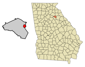
mapsize = 250px
map_caption = Location in Clarke County and the state of Georgia
mapsize1 =
map_caption1 =
image_dot_
dot_mapsize =
dot_map_caption =
dot_x =
dot_y =
pushpin_
pushpin_label_position =
pushpin_map_caption =
pushpin_mapsize =
subdivision_type = Country
subdivision_name =United States
subdivision_type1 = State
subdivision_name1 = Georgia
subdivision_type2 = County
subdivision_name2 = Clarke
subdivision_type3 =
subdivision_name3 =
subdivision_type4 =
subdivision_name4 =
government_footnotes =
government_type =
leader_title =
leader_name =
leader_title1 =
leader_name1 =
leader_title2 =
leader_name2 =
leader_title3 =
leader_name3 =
leader_title4 =
leader_name4 =
established_title =
established_date =
established_title2 =
established_date2 =
established_title3 =
established_date3 =
area_magnitude =
unit_pref = Imperial
area_footnotes =
area_total_km2 = 6.9
area_land_km2 = 6.9
area_water_km2 = 0
area_total_sq_mi = 2.6
area_land_sq_mi = 2.6
area_water_sq_mi = 0
area_water_percent =
area_urban_km2 =
area_urban_sq_mi =
area_metro_km2 =
area_metro_sq_mi =
area_blank1_title =
area_blank1_km2 =
area_blank1_sq_mi =
population_as_of = 2000
population_footnotes =
population_note =
population_total = 1068
population_density_km2 = 154.8
population_density_sq_mi = 410.8
population_metro =
population_density_metro_km2 =
population_density_metro_sq_mi =
population_urban =
population_density_urban_km2 =
population_density_urban_sq_mi =
population_blank1_title =
population_blank1 =
population_density_blank1_km2 =
population_density_blank1_sq_mi =
timezone = Eastern (EST)
utc_offset = -5
timezone_DST = EDT
utc_offset_DST = -4
latd = 33 |latm = 58 |lats = 0 |latNS = N
longd = 83 |longm = 16 |longs = 54 |longEW = W
elevation_footnotes =
elevation_m = 244
elevation_ft = 801
postal_code_type =ZIP code
postal_code = 30683
area_code = 706
blank_name = FIPS code
blank_info = 13-83728GR|2
blank1_name = GNIS feature ID
blank1_info = 0356645GR|3
website =
footnotes =Winterville is a city in Clarke County, Georgia,
United States . Since 1991, when the city of Athens abandoned its city charter to form the unified government of Athens-Clarke County, Winterville has been the only municipality located wholly within Athens-Clarke County. The population was 1,068 at the 2000 census.Geography
Winterville is located at coor dms|33|58|0|N|83|16|54|W|city (33.966720, -83.281669)GR|1.
According to the
United States Census Bureau , the city has a total area of 2.7square mile s (6.9km² ), all of it land.Demographics
As of the
census GR|2 of 2000, there were 1,068 people, 409 households, and 299 families residing in the city. Thepopulation density was 403.2 people per square mile (155.6/km²). There were 432 housing units at an average density of 163.1/sq mi (62.9/km²). The racial makeup of the city was 78.93% White, 18.26% African American, 0.37% Native American, 1.03% Asian, 0.66% from other races, and 0.75% from two or more races. Hispanic or Latino of any race were 1.78% of the population.There were 409 households out of which 35.2% had children under the age of 18 living with them, 55.0% were married couples living together, 14.7% had a female householder with no husband present, and 26.7% were non-families. 20.0% of all households were made up of individuals and 7.3% had someone living alone who was 65 years of age or older. The average household size was 2.52 and the average family size was 2.91.
In the city the population was spread out with 24.5% under the age of 18, 6.3% from 18 to 24, 33.0% from 25 to 44, 23.7% from 45 to 64, and 12.5% who were 65 years of age or older. The median age was 37 years. For every 100 females there were 88.0 males. For every 100 females age 18 and over, there were 81.5 males.
The median income for a household in the city was $47,727, and the median income for a family was $51,667. Males had a median income of $37,100 versus $25,000 for females. The
per capita income for the city was $18,693. About 3.5% of families and 5.3% of the population were below thepoverty line , including 5.4% of those under age 18 and 9.3% of those age 65 or over.History
Winterville was a train stop to
Union Point when an entrepreneur named Sam Winter started an inn on the other side of the road. The inn still stands today.Famous Residents
* Psychedelic alternative rock band
Butthole Surfers lived here in the late 1980s.References
External links
Wikimedia Foundation. 2010.