- Makee Township, Allamakee County, Iowa
-
Makee Township, Allamakee County — Township — 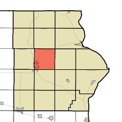
Coordinates: 43°17′31″N 091°25′27″W / 43.29194°N 91.42417°WCoordinates: 43°17′31″N 091°25′27″W / 43.29194°N 91.42417°W Country  United States
State  Iowa
IowaCounty Allamakee Area - Total 35.69 sq mi (92.44 km2) - Land 35.69 sq mi (92.44 km2) - Water 0 sq mi (0 km2) Elevation[1] 1,125 ft (343 m) Population (2000) - Total 4,380 - Density 122.7/sq mi (47.4/km2) FIPS code 19-92799[2] GNIS feature ID 0468333 Makee Township is one of eighteen townships in Allamakee County, Iowa, USA. As of the 2000 census, its population was 4380.
Geography
Makee Township covers an area of 35.69 square miles (92.4 km2) and contains one incorporated settlement, Waukon (the county seat). According to the USGS, it contains five cemeteries: County Care Facility, Lycurgus, Makee Township, Oakland and Round Prairie.
References
- ^ "US Board on Geographic Names". United States Geological Survey. 2007-10-25. http://geonames.usgs.gov. Retrieved 2008-01-31.
- ^ "American FactFinder". United States Census Bureau. http://factfinder.census.gov. Retrieved 2008-01-31.
External links
Municipalities and communities of Allamakee County, Iowa Cities Harpers Ferry | Lansing | New Albin | Postville‡ | Waterville | Waukon

Townships Center | Fairview | Franklin | French Creek | Hanover | Iowa | Jefferson | Lafayette | Lansing | Linton | Ludlow | Makee | Paint Creek | Post | Taylor | Union City | Union Prairie | Waterloo
Unincorporated
communityFootnotes ‡This populated place also has portions in an adjacent county or counties
Categories:- Townships in Allamakee County, Iowa
- Iowa geography stubs

Wikimedia Foundation. 2010.