- Superior, Montana
Infobox Settlement
official_name = Superior, Montana
settlement_type =Town
nickname =
imagesize =
image_caption =
image_
imagesize =
image_caption =
image_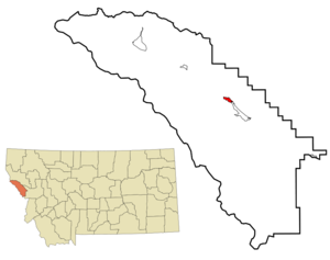
mapsize = 250px
map_caption = Location of Superior, Montana
mapsize1 =
map_caption1 =
subdivision_type = Country
subdivision_name =United States
subdivision_type1 = State
subdivision_name1 =Montana
subdivision_type2 = County
subdivision_name2 = Mineral
government_type =
leader_title =
leader_name =
established_date = 1871
area_magnitude = 1 E9
area_total_sq_mi = 1.2
area_land_sq_mi = 1.1
area_water_sq_mi = 0.1
area_water_percent =
area_urban_km2 =
area_urban_sq_mi =
area_total_km2 = 3.1
area_land_km2 = 2.8
area_water_km2 = 0.3
area_rank =
elevation_m = 842
elevation_ft = 2762
latd = 47 |latm = 11 |lats = 36 |latNS = N
longd = 114 |longm = 53 |longs = 25 |longEW = W
population_as_of = 2000
population_note =
population_total = 893
population_density_km2 = 319.2
population_density_sq_mi = 823.3
timezone = Mountain (MST)
utc_offset = -7
timezone_DST = MDT
utc_offset_DST = -6
latitude = 47°11′36″ N
longitude = 114°53′25″ W
website = http://co.mineral.mt.us/
postal_code_type =ZIP code
postal_code = 59872
area_code = 406
blank_name = FIPS code
blank_info = 30-72625
blank1_name = GNIS feature ID
blank1_info = 0791730
footnotes =Superior is a town in and the
county seat of Mineral County,Montana ,United States .GR|6 The population was 893 at the 2000 census. Superior was named after its founders' hometown ofSuperior, Wisconsin in1869 . Thepost office was established in 1871 after Mineral County became the site of one of the largest gold strikes that helped settle the West.
In the 1860s and 70s, several thousand miners converged on Cedar Creek to earn their fortunes. Long after that strike played out, mining remained a mainstay of the economy. Mining, along with the development oflogging andUnited States Forest Service activities contribute to the area's interesting history.This small town offers a break from interstate travel and an introduction to area history in the Mineral County Museum. Display subjects explore local history and industry, including John Mullan and theMullan Road .Geography
Superior is located at coor dms|47|11|36|N|114|53|25|W|city (47.193305, -114.890379)GR|1, along
Interstate 90 57 miles northwest of Missoula.According to the
United States Census Bureau , the town has a total area of 1.2square mile s (3.1km² ), of which, 1.1 square miles (2.8 km²) of it is land and 0.1 square miles (0.3 km²) of it (8.47%) is water.Superior's elevation is 2,744 feet (836 meters) above sea level. Superior is surrounded by mountains, right in the middle of the
Bitterroot Range . The Clark Fork flows through downtown, heading north towardsSt. Regis, Montana and ultimately emptying intoLake Pend Oreille near Cabinet, Idaho. The mountains to the west of Superior along the Montana/Idaho border receive a large amount of precipitation annually, mostly due to the amount of snow in the winter months. NearbyLookout Pass Ski and Recreation Area receives 400 inches on average each winter. The snow pack melts throughout the spring and summer months, feeding the many mountain streams and creeks with water. All of the water eventually reaches the Clark Fork in the valley below, where Superior is located.Demographics
As of the
census GR|2 of 2000, there were 893 people, 358 households, and 218 families residing in the town. Thepopulation density was 823.3 people per square mile (319.2/km²). There were 410 housing units at an average density of 378.0/sq mi (146.6/km²). The racial makeup of the town was 92.83% White, 0.11% African American, 2.91% Native American, 0.78% Asian, 0.11% from other races, and 3.25% from two or more races. Hispanic or Latino of any race were 1.90% of the population.There were 358 households out of which 29.1% had children under the age of 18 living with them, 47.8% were married couples living together, 9.2% had a female householder with no husband present, and 39.1% were non-families. 33.8% of all households were made up of individuals and 12.8% had someone living alone who was 65 years of age or older. The average household size was 2.32 and the average family size was 2.93.
In the town the population was spread out with 25.3% under the age of 18, 6.9% from 18 to 24, 26.2% from 25 to 44, 24.0% from 45 to 64, and 17.6% who were 65 years of age or older. The median age was 40 years. For every 100 females there were 99.8 males. For every 100 females age 18 and over, there were 99.1 males.
The median income for a household in the town was $25,333, and the median income for a family was $31,650. Males had a median income of $24,688 versus $18,750 for females. The
per capita income for the town was $14,154. About 10.4% of families and 17.0% of the population were below thepoverty line , including 23.0% of those under age 18 and 7.4% of those age 65 or over.Notable residents
*
Pokey Allen , former professional and college football player and coach, was born here.References
External links
* [http://co.mineral.mt.us County website]
* [http://www.montanarockies.org Mineral County Chamber]
Wikimedia Foundation. 2010.