- Troy, Montana
Infobox Settlement
official_name = Troy, Montana
settlement_type =City
nickname =
motto =
imagesize =
image_caption =
image_
imagesize =
image_caption =
image_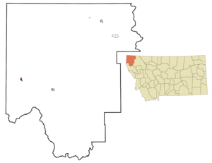
mapsize = 250px
map_caption = Location of Troy, Montana
mapsize1 =
map_caption1 =subdivision_type = Country
subdivision_name =United States
subdivision_type1 = State
subdivision_name1 =Montana
subdivision_type2 = County
subdivision_name2 = Lincoln
government_footnotes =
government_type =
leader_title =
leader_name =
leader_title1 =
leader_name1 =
established_title =
established_date =unit_pref = Imperial
area_footnotes =area_magnitude =
area_total_km2 = 2.0
area_land_km2 = 2.0
area_water_km2 = 0.0
area_total_sq_mi = 0.8
area_land_sq_mi = 0.8
area_water_sq_mi = 0.0population_as_of = 2000
population_footnotes =
population_total = 957
population_density_km2 = 487.3
population_density_sq_mi = 1262.2timezone = Mountain (MST)
utc_offset = -7
timezone_DST = MDT
utc_offset_DST = -6
elevation_footnotes =
elevation_m = 579
elevation_ft = 1900
latd = 48 |latm = 27 |lats = 36 |latNS = N
longd = 115 |longm = 53 |longs = 28 |longEW = Wpostal_code_type =
ZIP code
postal_code = 59935
area_code = 406
blank_name = FIPS code
blank_info = 30-75025
blank1_name = GNIS feature ID
blank1_info = 0792409
website =
footnotes =Troy is a city in Lincoln County,
Montana ,United States . The population was 957 at the 2000 census.Geography
Troy is located at coor dms|48|27|36|N|115|53|28|W|city (48.459944, -115.890974)GR|1.
According to the
United States Census Bureau , the city has a total area of 0.8square mile s (2.0km² ), of which, 0.8 square miles (2.0 km²) of it is land and 0.04 square miles (0.1 km²) of it (2.56%) is water.Troy has an elevation of about 1,800 feet above sea level and is the lowest town in elevation in Montana. Troy is 12 miles from the border of Montana and Idaho. Troy's closest town is Libby, Montana. Troy and Libby are 18 miles apart.Demographics
As of the
census GR|2 of 2000, there were 957 people, 425 households, and 252 families residing in the city. Thepopulation density was 1,262.2 people per square mile (486.2/km²). There were 469 housing units at an average density of 618.6/sq mi (238.3/km²). The racial makeup of the city was 95.82% White, 1.04% Native American, 0.10% Asian, 0.52% from other races, and 2.51% from two or more races. Hispanic or Latino of any race were 1.36% of the population.There were 425 households out of which 29.6% had children under the age of 18 living with them, 44.9% were married couples living together, 9.6% had a female householder with no husband present, and 40.5% were non-families. 37.4% of all households were made up of individuals and 14.6% had someone living alone who was 65 years of age or older. The average household size was 2.25 and the average family size was 2.92.
In the city the population was spread out with 28.2% under the age of 18, 4.7% from 18 to 24, 23.1% from 25 to 44, 28.1% from 45 to 64, and 15.9% who were 65 years of age or older. The median age was 41 years. For every 100 females there were 104.9 males. For every 100 females age 18 and over, there were 93.5 males.
The median income for a household in the city was $19,635, and the median income for a family was $26,691. Males had a median income of $26,250 versus $16,250 for females. The
per capita income for the city was $10,620. About 19.9% of families and 27.5% of the population were below thepoverty line , including 29.4% of those under age 18 and 25.4% of those age 65 or over.Asbestos contamination
It has been determined by the
EPA that Troy hasasbestos contamination, similar to that found in nearbyLibby, Montana . [http://www.asbestos-post.com/asbestos-clean-up-begins-in-troy-montana.html]Notable residents
*
Rick Bass , environmental activist, lives here.References
External links
Wikimedia Foundation. 2010.