- Havre North, Montana
Infobox Settlement
official_name = Havre North, Montana
settlement_type = CDP
nickname =
motto =
imagesize =
image_caption =
image_
imagesize =
image_caption =
image_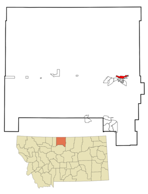
mapsize = 250px
map_caption = Location of Havre North, Montana
mapsize1 =
map_caption1 =subdivision_type = Country
subdivision_name =United States
subdivision_type1 = State
subdivision_name1 =Montana
subdivision_type2 = County
subdivision_name2 = Hill
government_footnotes =
government_type =
leader_title =
leader_name =
leader_title1 =
leader_name1 =
established_title =
established_date =unit_pref = Imperial
area_footnotes =area_magnitude =
area_total_km2 = 8.7
area_land_km2 = 8.7
area_water_km2 = 0.0
area_total_sq_mi = 3.4
area_land_sq_mi = 3.4
area_water_sq_mi = 0.0population_as_of = 2000
population_footnotes =
population_total = 973
population_density_km2 = 111.9
population_density_sq_mi = 289.7timezone = Mountain (MST)
utc_offset = -7
timezone_DST = MDT
utc_offset_DST = -6
elevation_footnotes =
elevation_m =
elevation_ft =
latd = 48 |latm = 33 |lats = 25 |latNS = N
longd = 109 |longm = 39 |longs = 57 |longEW = Wpostal_code_type =
postal_code =
area_code = 406
blank_name = FIPS code
blank_info = 30-35125
blank1_name =
blank1_info =
website =
footnotes =Havre North is a
census-designated place (CDP) in Hill County,Montana ,United States . The population was 973 at the 2000 census.Geography
Havre North is located at coor dms|48|33|25|N|109|39|57|W|city (48.556871, -109.665936)GR|1.
According to the
United States Census Bureau , the CDP has a total area of 3.4square mile s (8.7km² ), all of it land.Demographics
As of the
census GR|2 of 2000, there were 973 people, 422 households, and 259 families residing in the CDP. Thepopulation density was 289.7 people per square mile (111.8/km²). There were 474 housing units at an average density of 141.1/sq mi (54.5/km²). The racial makeup of the CDP was 88.18% White, 0.10% African American, 8.53% Native American, 0.10% Asian, 0.41% from other races, and 2.67% from two or more races. Hispanic or Latino of any race were 0.72% of the population.There were 422 households out of which 28.7% had children under the age of 18 living with them, 42.4% were married couples living together, 15.4% had a female householder with no husband present, and 38.6% were non-families. 32.0% of all households were made up of individuals and 10.9% had someone living alone who was 65 years of age or older. The average household size was 2.30 and the average family size was 2.89.
In the CDP the population was spread out with 25.5% under the age of 18, 9.0% from 18 to 24, 28.6% from 25 to 44, 25.1% from 45 to 64, and 11.8% who were 65 years of age or older. The median age was 37 years. For every 100 females there were 95.8 males. For every 100 females age 18 and over, there were 95.4 males.
The median income for a household in the CDP was $20,888, and the median income for a family was $25,625. Males had a median income of $21,250 versus $17,277 for females. The
per capita income for the CDP was $10,921. About 18.8% of families and 23.3% of the population were below thepoverty line , including 24.6% of those under age 18 and 2.2% of those age 65 or over.References
External links
Wikimedia Foundation. 2010.