- Muro de Alcoy
-
Muro de Alcoy/Muro d'Alcoi — Municipality — Location in Spain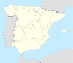
 Muro de Alcoy/Muro d'Alcoi
Coordinates: 38°46′47″N 0°26′10″W / 38.77972°N 0.43611°WCoordinates: 38°46′47″N 0°26′10″W / 38.77972°N 0.43611°W Country  Spain
SpainAutonomous community  Valencian Community
Province Alicante Comarca Comtat Judicial district Alcoy Government – Alcalde Rafael Climent González Area – Total 129.86 km2 (50.1 sq mi) Elevation 410 m (1,345 ft) Population (2009) – Total 8,893 – Density 68.5/km2 (177.4/sq mi) Demonym Mureros Time zone CET (UTC+1) – Summer (DST) CEST (UTC+2) Postal code 03830 Official language(s) Valencian Muro de Alcoy (Spanish: [ˈmuɾo ðe alˈkoi]) or Muro d'Alcoi (Valencian: [ˈmuɾo ðaɫˈkɔj]), also briefly called Muro (Spanish and Valencian: [ˈmuɾo]) is a town located in the comarca of Comtat, in the province of Alicante, Spain, lying at the foot of the Serra de Mariola. As of 2009, it has a total population of c. 8,900 inhabitants. The economy of Muro de Alcoy is based on textile industry, manufacture of plastic products and furniture and agriculture (olives and almonds).
The main festival in Muro is the Moros i cristians, celebrated during the second weekend of May. According to popular tradition the festival commemorate the battles, combats and fights between Moors (or Muslims) and Christians during the period known as Reconquista (from the 8th century through the 15th century). The festivals represent the capture of the city by the Moors and the subsequent Christian reconquest.
External links
- Pictures of Moros y Cristianos, Muro 2006
Municipalities of Comtat Agres · Alcocer de Planes · Alcoleja · Alfafara · Almudaina · L'Alqueria d'Asnar · Balones · Benasau · Beniarrés · Benilloba · Benillup · Benimarfull · Benimassot · Cocentaina · Fageca · Famorca · Gaianes · Gorga · Millena · Muro de Alcoy · L'Orxa/Lorcha · Planes · Quatretondeta · Tollos Categories:
- Municipalities in Alicante
- Populated places in Alicante
- Valencian Community geography stubs

Wikimedia Foundation. 2010.