- Baring, Missouri
Infobox Settlement
official_name = Baring, Missouri
settlement_type =City
nickname =
motto =
imagesize =
image_caption =
image_
imagesize =
image_caption =
image_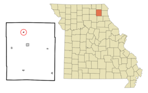
mapsize = 250px
map_caption = Location of Baring, Missouri
mapsize1 =
map_caption1 =subdivision_type = Country
subdivision_name =United States
subdivision_type1 = State
subdivision_name1 =Missouri
subdivision_type2 = County
subdivision_name2 = Knox
government_footnotes =
government_type =
leader_title =
leader_name =
leader_title1 =
leader_name1 =
established_title =
established_date =unit_pref = Imperial
area_footnotes =area_magnitude =
area_total_km2 = 0.3
area_land_km2 = 0.3
area_water_km2 = 0.0
area_total_sq_mi = 0.1
area_land_sq_mi = 0.1
area_water_sq_mi = 0.0population_as_of = 2000
population_footnotes =
population_total = 159
population_density_km2 = 484.4
population_density_sq_mi = 1254.6timezone = Central (CST)
utc_offset = -6
timezone_DST = CDT
utc_offset_DST = -5
elevation_footnotes =
elevation_m = 250
elevation_ft = 820
latd = 40 |latm = 14 |lats = 38 |latNS = N
longd = 92 |longm = 12 |longs = 24 |longEW = Wpostal_code_type =
ZIP code
postal_code = 63531
area_code = 660
blank_name = FIPS code
blank_info = 29-03322GR|2
blank1_name = GNIS feature ID
blank1_info = 0713640GR|3
website =
footnotes =Baring is a city in Knox County,
Missouri ,United States . The population was 159 at the 2000 census.Baring is located on the
Burlington Northern and Santa Fe railroad's mainline betweenChicago and Los Angeles, which carries heavy mixed freight and intermodal traffic, as well asAmtrak 's "Southwest Chief " passenger train.Geography
Baring is located at coor dms|40|14|38|N|92|12|24|W|city (40.243973, -92.206779)GR|1.
According to the
United States Census Bureau , the city has a total area of 0.1square mile s (0.3km² ), all of it land.Demographics
As of the
census GR|2 of 2000, there were 159 people, 65 households, and 41 families residing in the city. Thepopulation density was 1,254.6 people per square mile (472.2/km²). There were 80 housing units at an average density of 631.2/sq mi (237.6/km²). The racial makeup of the city was 100.00% White. Hispanic or Latino of any race were 0.63% of the population.There were 65 households out of which 29.2% had children under the age of 18 living with them, 52.3% were married couples living together, 12.3% had a female householder with no husband present, and 35.4% were non-families. 30.8% of all households were made up of individuals and 15.4% had someone living alone who was 65 years of age or older. The average household size was 2.45 and the average family size was 3.14.
In the city the population was spread out with 28.3% under the age of 18, 6.9% from 18 to 24, 20.8% from 25 to 44, 25.2% from 45 to 64, and 18.9% who were 65 years of age or older. The median age was 40 years. For every 100 females there were 82.8 males. For every 100 females age 18 and over, there were 78.1 males.
The median income for a household in the city was $27,500, and the median income for a family was $32,500. Males had a median income of $25,000 versus $23,750 for females. The
per capita income for the city was $11,980. About 8.3% of families and 14.1% of the population were below thepoverty line , including 22.7% of those under the age of eighteen and 10.3% of those sixty five or over.References
External links
Wikimedia Foundation. 2010.