- Walnut, Mississippi
Infobox Settlement
official_name = Walnut, Mississippi
settlement_type =Town
nickname =
motto =
imagesize =
image_caption =
image_
imagesize =
image_caption =
image_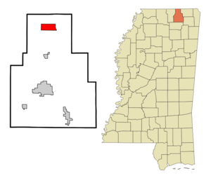
mapsize = 250x200px
map_caption = Location of Walnut, Mississippi
mapsize1 =
map_caption1 =subdivision_type = Country
subdivision_name =United States
subdivision_type1 = State
subdivision_name1 =Mississippi
subdivision_type2 = County
subdivision_name2 = Tippah
government_footnotes =
government_type =
leader_title =
leader_name =
leader_title1 =
leader_name1 =
established_title =
established_date =unit_pref = Imperial
area_footnotes =area_magnitude =
area_total_km2 = 14.1
area_land_km2 = 14.0
area_water_km2 = 0.1
area_total_sq_mi = 5.4
area_land_sq_mi = 5.4
area_water_sq_mi = 0.0population_as_of = 2000
population_footnotes =
population_total = 754
population_density_km2 = 53.7
population_density_sq_mi = 139.1timezone = Central (CST)
utc_offset = -6
timezone_DST = CDT
utc_offset_DST = -5
elevation_footnotes =
elevation_m = 140
elevation_ft = 459
latd = 34 |latm = 56 |lats = 57 |latNS = N
longd = 88 |longm = 54 |longs = 35 |longEW = Wpostal_code_type =
ZIP code
postal_code = 38683
area_code = 662
blank_name = FIPS code
blank_info = 28-77480
blank1_name = GNIS feature ID
blank1_info = 0695090
website =
footnotes =Walnut is a town in Tippah County,
Mississippi ,United States . The population was 754 at the 2000 census.Geography
Walnut is located at coor dms|34|56|57|N|88|54|35|W|city (34.949109, -88.909812)GR|1.
According to the
United States Census Bureau , the town has a total area of 5.4square mile s (14.1km² ), of which, 5.4 square miles (14.0 km²) of it is land and 0.04 square miles (0.1 km²) of it (0.37%) is water.Demographics
As of the
census GR|2 of 2000, there were 754 people, 319 households, and 202 families residing in the town. Thepopulation density was 139.1 people per square mile (53.7/km²). There were 341 housing units at an average density of 62.9/sq mi (24.3/km²). The racial makeup of the town was 84.48% White, 14.46% African American, 0.27% Native American, 0.13% from other races, and 0.66% from two or more races. Hispanic or Latino of any race were 0.66% of the population.There were 319 households out of which 30.4% had children under the age of 18 living with them, 45.1% were married couples living together, 14.4% had a female householder with no husband present, and 36.4% were non-families. 35.1% of all households were made up of individuals and 19.4% had someone living alone who was 65 years of age or older. The average household size was 2.36 and the average family size was 3.06.
In the town the population was spread out with 26.9% under the age of 18, 10.6% from 18 to 24, 25.7% from 25 to 44, 19.5% from 45 to 64, and 17.2% who were 65 years of age or older. The median age was 36 years. For every 100 females there were 81.7 males. For every 100 females age 18 and over, there were 78.9 males.
The median income for a household in the town was $17,102, and the median income for a family was $23,906. Males had a median income of $29,444 versus $17,292 for females. The
per capita income for the town was $10,212. About 25.1% of families and 26.4% of the population were below thepoverty line , including 25.4% of those under age 18 and 40.8% of those age 65 or over. It is also home of the world famous softball player, Derek Smith.Education
The Town of Walnut is served by the
North Tippah School District .References
External links
Wikimedia Foundation. 2010.