- Hatley, Mississippi
Infobox Settlement
official_name = Hatley, Mississippi
settlement_type =Town
nickname =
motto =
imagesize =
image_caption =
image_
imagesize =
image_caption =
image_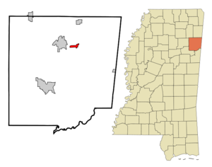
mapsize = 250px
map_caption = Location of Hatley, Mississippi
mapsize1 =
map_caption1 =subdivision_type = Country
subdivision_name =United States
subdivision_type1 = State
subdivision_name1 =Mississippi
subdivision_type2 = County
subdivision_name2 = Monroe
government_footnotes =
government_type =
leader_title =
leader_name =
leader_title1 =
leader_name1 =
established_title =
established_date =unit_pref = Imperial
area_footnotes =area_magnitude =
area_total_km2 = 3.5
area_land_km2 = 3.5
area_water_km2 = 0.0
area_total_sq_mi = 1.3
area_land_sq_mi = 1.3
area_water_sq_mi = 0.0population_as_of = 2000
population_footnotes =
population_total = 476
population_density_km2 = 136.8
population_density_sq_mi = 354.4timezone = Central (CST)
utc_offset = -6
timezone_DST = CDT
utc_offset_DST = -5
elevation_footnotes =
elevation_m = 107
elevation_ft = 351
latd = 33 |latm = 58 |lats = 47 |latNS = N
longd = 88 |longm = 25 |longs = 34 |longEW = Wpostal_code_type =
ZIP code
postal_code = 38821
area_code = 662
blank_name = FIPS code
blank_info = 28-30980
blank1_name = GNIS feature ID
blank1_info = 0671011
website =
footnotes =Hatley is a town in Monroe County,
Mississippi ,United States . The population was 476 at the 2000 census.Geography
Hatley is located at coor dms|33|58|36|N|88|25|14|W| east of Amory. According to the
United States Geological Survey , a variant name is "Tubbs Cross Roads".According to the
United States Census Bureau , the town has a total area of 1.3square mile s (3.5km² ), all of it land.Demographics
As of the
census GR|2 of 2000, there were 476 people, 188 households, and 144 families residing in the town. Thepopulation density was 354.4 people per square mile (137.2/km²). There were 202 housing units at an average density of 150.4/sq mi (58.2/km²). The racial makeup of the town was 98.53% White, 1.26% African American and 0.21% Native American.There were 188 households out of which 34.0% had children under the age of 18 living with them, 64.4% were married couples living together, 9.6% had a female householder with no husband present, and 23.4% were non-families. 22.3% of all households were made up of individuals and 9.6% had someone living alone who was 65 years of age or older. The average household size was 2.53 and the average family size was 2.98.
In the town the population was spread out with 24.4% under the age of 18, 7.6% from 18 to 24, 27.3% from 25 to 44, 25.4% from 45 to 64, and 15.3% who were 65 years of age or older. The median age was 40 years. For every 100 females there were 93.5 males. For every 100 females age 18 and over, there were 91.5 males.
The median income for a household in the town was $44,167, and the median income for a family was $51,667. Males had a median income of $32,813 versus $26,875 for females. The
per capita income for the town was $17,726. About 8.7% of families and 10.8% of the population were below thepoverty line , including 12.2% of those under age 18 and 14.3% of those age 65 or over.Education
The Town of Hatley is served by the
Monroe County School District .References
*cite web | url=Gnis3|671011 | title=Hatley | work=Geographic Names Information System | publisher=United States Geological Survey | accessdate=2006-04-17External links
Wikimedia Foundation. 2010.