- Purvis, Mississippi
Infobox Settlement
official_name = Purvis, Mississippi
settlement_type =City
nickname =
motto =
imagesize =
image_caption =
image_
imagesize =
image_caption =
image_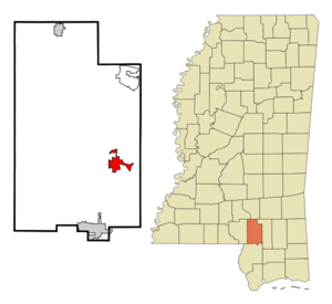
mapsize = 250x200px
map_caption = Location of Purvis, Mississippi
mapsize1 =
map_caption1 =subdivision_type = Country
subdivision_name =United States
subdivision_type1 = State
subdivision_name1 =Mississippi
subdivision_type2 = County
subdivision_name2 = Lamar
government_footnotes =
government_type =
leader_title =Mayor
leader_name = Roger H. Herrin [http://www.lamarcounty.com/cms/index.php?option=com_content&task=view&id=54&Itemid=14]
leader_title1 =Alderman
leader_name1 = Ward 1: Nancy Pylant
Ward 2: Vernon Hartfield
Ward 3: Allen Stuart
Ward 4: John W. Jordan
At-Large: Milton Bourn
leader_title2 =State Senator
leader_name2 = Tom King (R)
leader_title3 = State Delegate
leader_name3 = Joey Fillingane (R)
leader_title4 =U.S. Rep.
leader_name4 =Gene Taylor (D)
established_title =
established_date =unit_pref = Imperial
area_footnotes =area_magnitude =
area_total_km2 = 10.2
area_land_km2 = 10.2
area_water_km2 = 0.0
area_total_sq_mi = 3.9
area_land_sq_mi = 3.9
area_water_sq_mi = 0.0population_as_of = 2000
population_footnotes =
population_total = 2164
population_density_km2 = 212.8
population_density_sq_mi = 551.0timezone = Central (CST)
utc_offset = -6
timezone_DST = CDT
utc_offset_DST = -5
elevation_footnotes =
elevation_m = 118
elevation_ft = 387
latd = 31 |latm = 8 |lats = 33 |latNS = N
longd = 89 |longm = 24 |longs = 28 |longEW = Wpostal_code_type =
ZIP code
postal_code = 39475
area_code = 601
blank_name = FIPS code
blank_info = 28-60480
blank1_name = GNIS feature ID
blank1_info = 0676425
website =
footnotes =Purvis is a city in Lamar County,
Mississippi ,United States . It is part of the Hattiesburg, Mississippi Metropolitan Statistical Area. The population was 2,164 at the 2000 census. It is thecounty seat of Lamar CountyGR|6.Geography
Purvis is located at coor dms|31|8|33|N|89|24|28|W|city (31.142616, -89.407724)GR|1.
According to the
United States Census Bureau , the city has a total area of 3.9square mile s (10.2km² ), of which, 3.9 square miles (10.2 km²) of it is land and 0.25% is water. Because of a well known system of aquifers and sand mines, this area was selected for "project dribble" to be the site of nuclear tests by the US government during 1961 to 1968 to measure seismic activity.Demographics
As of the
census GR|2 of 2000, there were 2,164 people, 786 households, and 577 families residing in the city. Thepopulation density was 551.0 people per square mile (212.6/km²). There were 844 housing units at an average density of 214.9/sq mi (82.9/km²). The racial makeup of the city was 70.84% White, 27.68% African American, 0.18% Native American, 0.14% Asian, 0.23% from other races, and 0.92% from two or more races. Hispanic or Latino of any race were 1.06% of the population.There were 786 households out of which 34.9% had children under the age of 18 living with them, 48.2% were married couples living together, 20.2% had a female householder with no husband present, and 26.5% were non-families. 24.8% of all households were made up of individuals and 11.6% had someone living alone who was 65 years of age or older. The average household size was 2.67 and the average family size was 3.16.
In the city the population was spread out with 27.6% under the age of 18, 10.2% from 18 to 24, 27.2% from 25 to 44, 21.9% from 45 to 64, and 13.1% who were 65 years of age or older. The median age was 35 years. For every 100 females there were 90.8 males. For every 100 females age 18 and over, there were 82.8 males.
The median income for a household in the city was $30,938, and the median income for a family was $35,000. Males had a median income of $27,571 versus $17,500 for females. The
per capita income for the city was $13,727. About 11.3% of families and 14.6% of the population were below thepoverty line , including 20.0% of those under age 18 and 13.6% of those age 65 or over.Education
Noteworthy Facts
Tornadoes of 1908
April 24, 1908, tornadoes killed around 200 and injured around 770 people in Louisiana, Mississippi, Alabama, and Georgia. Three F4 tornadoes accounted for most of the deaths and damage. Most of the town of Purvis, Mississippi was leveled to the ground, only seven houses remained intact. It is the seventh most deadly tornadic outbreak in United States history.
1960's Vela Uniform/Project Dribble Nuclear Tests
Vela Uniform was an element ofProject Vela conducted jointly by theUnited States Department of Energy (DOE) and theAdvanced Research Projects Agency (ARPA). Its purpose was to developseismic methods for detectingunderground nuclear testing .The Project Dribble program involved two nuclear detonations called Salmon and Sterling that were conducted within Tatum Salt Dome southwest of the
Hattiesburg /Purvis area in the late 60's.The Sterling Event was the fourth nuclear detonation involved in a study, identified as Project Dribble, sponsored by the Department of Defense's Advanced Research Project Agency. Project Dribble involves the recording and identification of seismic signals from underground detonations. These studies are part of a seismic research program called Vela Uniform which is designed to improve the United States' capability to detect, identify, and locate underground nuclear detonations.
Project Dribble's purpose was to give U.S. scientists experience in detecting underground nuclear tests in the
Soviet Union . The first blast, a 5.3 kiloton bomb, took place in 1964 at the bottom of a 2,710-foot shaft 28 miles southwest of Hattiesburg and four miles northeast ofBaxterville . The second bomb, much smaller, was exploded two years later within the cavity created by the first blast. (To be sure, these were only two of well over a thousand documented nuclear tests by the United States, with the vast majority taking place in Nevada.) [cite web | url = http://stinet.dtic.mil/oai/oai?verb=getRecord&metadataPrefix=html&identifier=AD0612711 | title = PROJECT DRIBBLE-SALMON EVENT VOLUNTEER TEAM PROGRAM | publisher = GEOTECHNICAL CORP GARLAND TEX]Notable Residents (Past & Present)
*
Lacey Chabert , film and television actress.
*Billy Hudson Sr. , CEO of Hudson Salvage (retired) and State Senator.References
External links
* [http://www.clui.org/clui_4_1/ludb/sites/MS3126.html The CLUI Land Use Database: Salmon and Sterling Nuclear Test Sites]
* [http://www.intellicast.com/Almanac/SouthCentral/April/ Significant Past Weather Occurrences in the South Central States]
* [http://www.epicdisasters.com/deadlyustornadoes.php Epic Disasters]
* [http://www.lm.doe.gov/documents/sites/ms/salmonfactsheet.pdf Fact Sheet on Purvis, Salmon Nuclear Test Site]
*
Wikimedia Foundation. 2010.