- Irapuato, Guanajuato
Infobox City
official_name = Irapuato
native_name = Ciudad de Irapuato
nickname = Ciudad de las Fresas
motto = Ad Augusta Per Angusta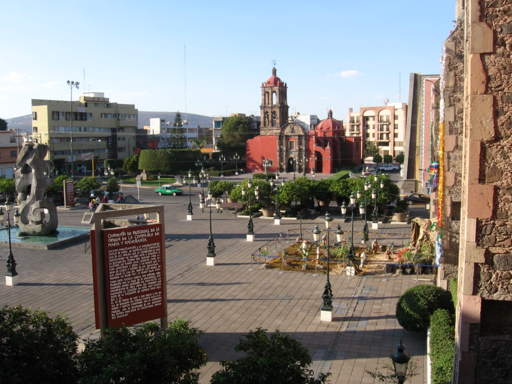
imagesize = 260px
image_caption =Historic Downtown of Irapuato
image_ |75px
|75px
image_shield =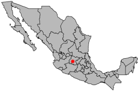
mapsize =
map_caption = Location of Irapuato in Mexico
subdivision_type = Country
subdivision_name =
subdivision_type1 =
subdivision_name1 =
subdivision_type2 =
subdivision_name2 =
government_type =
leader_title =Municipal President
leader_name = Mario Turrent Antón
leader_title1 =
leader_name1 =
leader_title2 =
leader_name2 =
leader_title3 =
leader_name3 =
established_title = Founded (officially)
established_date = 1547 (byVasco de Quiroga [Cite web | url=http://www.e-local.gob.mx/work/templates/enciclo/guanajuato/municipios/11017a.htm | title=Historia de Irapuato | work=Enciclopedia de los Municipios de México | accessdate=2007-03-22] )
established_title2 =
established_date2 =
established_title3 =
established_date3 =
area_magnitude =
unit_pref = Metric
area_footnotes =
area_total_km2 = 845.16
area_total_sq_mi =
area_land_km2 =
area_land_sq_mi =
area_water_km2 =
area_water_sq_mi =
area_water_percent =
area_urban_km2 =
area_urban_sq_mi =
area_metro_km2 =
area_metro_sq_mi =
population_as_of = 2005
population_note =
population_total = 342561 city; 463103 municipality
population_density_km2 = 547.95
population_density_sq_mi =
population_metro =
population_density_metro_km2 =
population_density_metro_sq_mi =
population_urban =
timezone = Central Standard Time
utc_offset = -6
timezone_DST = Central Daylight Time
utc_offset_DST = -5
latd = 20 | latm=40 | lats= | latNS=N
longd = 101 | longm=21 | longs= | longEW=W
elevation_m = 1724
elevation_ft = 5 676
postal_code_type =
postal_code = 36500 to 36899
website = [http://www.irapuato.gob.mx Official Website of the City of Irapuato]
footnotes = Average temperature 21°CIrapuato is a Mexican city (and municipality) located at the foot of the Arandas mountain (in Spanish: "el cerro de arandas"), in the south central region of the state of
Guanajuato . It lies between the Silao River and theGuanajuato River , a tributary of theLerma River , at 1,724 m (5,656 ft) above sea level. It is located at coord|20|40|N|101|21|W|. The city is the second-largest in the state (only behind León), with a population of 342,561 according to the 2005 census, while its municipality has a population of 463,103 [Cite web | url=http://www.inegi.gob.mx/est/contenidos/espanol/sistemas/conteo2005/localidad/iter/ | title=2005 Census | work=INEGI: Instituto Nacional de Estadística, Geografía e Informática | accessdate=2007-03-22] [Cite web | url=http://www.e-local.gob.mx/wb2/ELOCAL/EMM_guanajuato Guanajuato | title=Mexican Municipality Encyclopedia | work=Enciclopedia de los Municipios de México | accessdate=2007-03-22] . The municipality has an area of 845.16 km² (326.32 sq mi) and includes numerous smaller outlying communities. The city's main industry isagriculture and it is famous for itsstrawberries and the raising ofpig s andcattle . Thefruits andflowers of Irapuato's luxurious gardens are well known throughout Mexico [Cite web | url=http://www.questia.com/library/encyclopedia/irapuato.jsp | title=Irapuato | work=Questia Encyclopedia | accessdate=2007-03-21] .History
Prehispanic era
In the pre-hispanic era, the site was inhabited by the
Chichimecas (c. 1200 C.E.), a group of semi-nomadichunter-gatherer s. Later on, theTarascan s (also known as theP'urhépecha ) conquered the region and initiated the establishment of a permanent settlement. They constructed buildings in the tarascan architectural style, produced pottery, and practicedagriculture . They called the settlement Xiriquitzio (or Iriquitzio), which the Spanish conquerors pronounced "Jiricuato" (or Jiricuicho), which meant "the place with houses (or low dwellings)" [Cite web | url=http://www.http://www.irapuato.gob.mx/index.php?option=com_staticxt&Itemid=30&xt_item=1&staticfile=irapuato/historia/prehispanica.htm | title=Irapuato History | work=irapuato.gob.mx | accessdate=2007-03-20] . The initial growth period, however, was short lived. The downfall of the Purépecha empire led to the abandonment of the settlement, at which point it was once again inhabited by the Chichimecas.Conquest
In the 16th century, vasts amounts of
silver ore were discovered at the present day site of the capital city of Guanajuato. This discovery led to a massive migration of Spanishconquistadors settling in the area [Cite web | url=http://www.irapuato.gob.mx/index.php?option=com_staticxt&Itemid=30&xt_item=1&staticfile=irapuato/historia/conquista.htm | title=Historia de la Conquista | work=irapuato.gob.mx | accessdate=2007-03-20] .Attractions
*Fountain of Dancing Water (in Spanish: "Fuente de Aguas Danzarinas"): The fountain, which was inaugurated on
December 21 ,2004 , stands in the central plaza of Irapuato. Every night there is a light, music and water show. The fountain is lit up in a rainbow of colors, and the jets provide a choreographed show accompanied by music [Cite web | url=http://www.irapuato.gob.mx/index.php?option=com_staticxt&staticfile=irapuato/fuentes_danzarinas/index.htm&Itemid=30 | title=Fuentes Danzarinas | work=irapuato.gob.mx | accessdate=2007-03-20] .*Irapuato Zoo (in Spanish: "Parque Zoológico de Irapuato"): The Irapuato Zoo, which is located on the outskirts of the city, is home to 103
mammal s, 271bird s, and various species of fish [Cite web | url=http://www.zooira.org.mx/ | title=Parque Zoologico de Irapuato | work=zooira.org.mx | accessdate=2007-03-20] . The zoo was established in 1992 byarchitect Vicente Cázares Rodriguez, with the support of the then stategovernor , Carlos Medina Placencia [Cite web | url=http://www.zooira.org.mx/links/quienes.html | title=Quienes Somos | work=zooira.org.mx | accessdate=2007-03-20] .*Plaza Cibeles Mall (in Spanish: "Plaza Cibeles"): This is the newest and largest
mall in the city of Irapuato. The mall contains many stores such as the Liverpool chain, and aCinépolis movie theatre. The mall was named after the famousPlaza de Cibeles , a famous square inMadrid ,Spain , which features a beautifulsculpture andfountain that have been adopted as a symbol for the city of Madrid.*John Paul II Monument (in Spanish: "Monumento al papa Juan Pablo II"): Bronze statue of
Pope John Paul II , located in theMiguel Hidalgo square next to the Irapuato Cathedral. Thebronze sculpture has asteel skeleton and has a weight of 300 kg (661 lbs). It was unveiled onFebruary 15 ,2006 [Cite web | url=http://www.irapuato.gob.mx/index.php?option=com_staticxt&Itemid=30&xt_item=1&staticfile=irapuato/turismo/index.php?option=com_staticxt&staticfile=irapuato/turismo/lugares.htm&Itemid=30 | title=Lugares Turisticos | work=irapuato.gob.mx | accessdate=2007-03-22] .*Irapuato Cathedral (in Spanish: "Catedral de Irapuato"): The
cathedral was built in 16th century in thebaroque style. The outside facade is also baroque. The interior is in the neoclassical architectural style. The cathedral is laid out in the traditionalLatin Cross style. [Cite web | url=http://www.irapuato.gob.mx/index.php?option=com_staticxt&Itemid=30&xt_item=1&staticfile=irapuato/turismo/index.php?option=com_staticxt&staticfile=irapuato/turismo/lugares.htm&Itemid=30 | title=Catedral de Irapuato | work=irapuato.gob.mx | accessdate=2007-03-22] .*Miguel Hidalgo Square (in Spanish: "Plazuela Miguel Hidalgo"): A large public square in the historical center of Irapuato. The square contains the Fountain of Dancing Water as well as the Irapuato Cathedral. The square is named after
Miguel Hidalgo y Costilla , the father of the Mexican Independence movement.*Little Hospital Church (in Spanish: "Templo del Hospitalito"): This was the first church built in lrapuato. The interior was completed in 1713 and the
facade in 1733. It is baroque in style and dedicated to the Lady of Mercy (in Spanish: "Señora de la Misericordia"). The church is built in the traditionalLatin Cross style. The main altars contain images made from corn paste. The church was originally built as a chapel for the Indians' Hospital (in Spanish: "Hospital de Indios"), which was built two centuries earlier byVasco de Quiroga in 1550 [Cite web | url=hhttp://www.tourbymexico.com/guana/irapuato/irapuato.htm | title=Hospitalito Church | work=Tour By Mexico | accessdate=2007-03-24] .*Dolphin (or Florentine) Fountain (in Spanish: "Fuente de los delfines (o Florentina)"): In 1864, Archduke Maximilian of Hapsburg donated three bronze Florentine fountains to the state of Guanajuato. These fountains are located in lrapuato,huh Léon, and the city of Guanajuato. [Cite web | url=http://www.irapuato.gob.mx/index.php?option=com_staticxt&Itemid=30&xt_item=1&staticfile=irapuato/turismo/index.php?option=com_staticxt&staticfile=irapuato/turismo/lugares.htm&Itemid=30 | title=Fuente de los Delfines | work=irapuato.gob.mx | accessdate=2007-03-22] [Cite web | url=hhttp://www.tourbymexico.com/guana/irapuato/irapuato.htm | title=Dolphin Fountain | work=Tour By Mexico | accessdate=2007-03-24] .
*Sergio Leon Chávez Stadium (in Spanish: " [http://es.wikipedia.org/wiki/Estadio_Sergio_León_Chávez Estadio Sergio Leon Chávez] "): Former home of the [http://es.wikipedia.org/wiki/Freseros_de_Irapuato Irapuato Freseros] soccer team. It was one of the stadiums used in the 1986
FIFA World Cup [Cite web | url=http://www.irapuato.gob.mx/index.php?option=com_staticxt&Itemid=30&xt_item=1&staticfile=irapuato/turismo/index.php?option=com_staticxt&staticfile=irapuato/turismo/lugares.htm&Itemid=30 | title=Estadio Sergio Leon Chávez | work=irapuato.gob.mx | accessdate=2007-03-22] . It has a maximum capacity of 32,000 spectators.*Sun Clock (in Spanish: "Reloj del Sol"): The
clock is over a century old and it is located in the Juan Alvarez Square. The clock is elevated on apedestal and column [Cite web | url=http://www.irapuato.gob.mx/index.php?option=com_staticxt&Itemid=30&xt_item=1&staticfile=irapuato/turismo/index.php?option=com_staticxt&staticfile=irapuato/turismo/lugares.htm&Itemid=30 | title=Reloj del Sol | work=irapuato.gob.mx | accessdate=2007-03-22] .Education
The city of Irapuato is home to some private universities, and a single public university:
*The Higher Technological Institute of Irapuato (ITESI), is the only public institution decentralized from the state government.The city is home to a research center of the Center for Advanced Research and Studies (CINVESTAV)specialized in plant biotechnology and genetics and the newly created National Center of Plant Genomics.
Some of the private universities include:
*The Irapuato campus of the
Monterrey Institute of Technology and Higher Education (ITESM), (also popularly known as "el Tec de Monterrey" or simply as "el Tec").
*TheIrapuato Institute ("Instituto Irapuato")
*The Irapuato campus of theQuetzalcoatl University (UQI)
*There is also a branch of theUniversity of Léon ("Universidad de Léon").
*Liceo Cervantino University (Universidad Liceo Cervantino) (ULC)
=ister Cities
*
*References
External links
* [http://www.irapuato.gob.mx/ Presidencia Municipal de Irapuato] Official website
* [http://es.wikipedia.org/wiki/Irapuato Irapuato Article on Wikipedia Español]
Wikimedia Foundation. 2010.