Chucuito District

Chucuito District
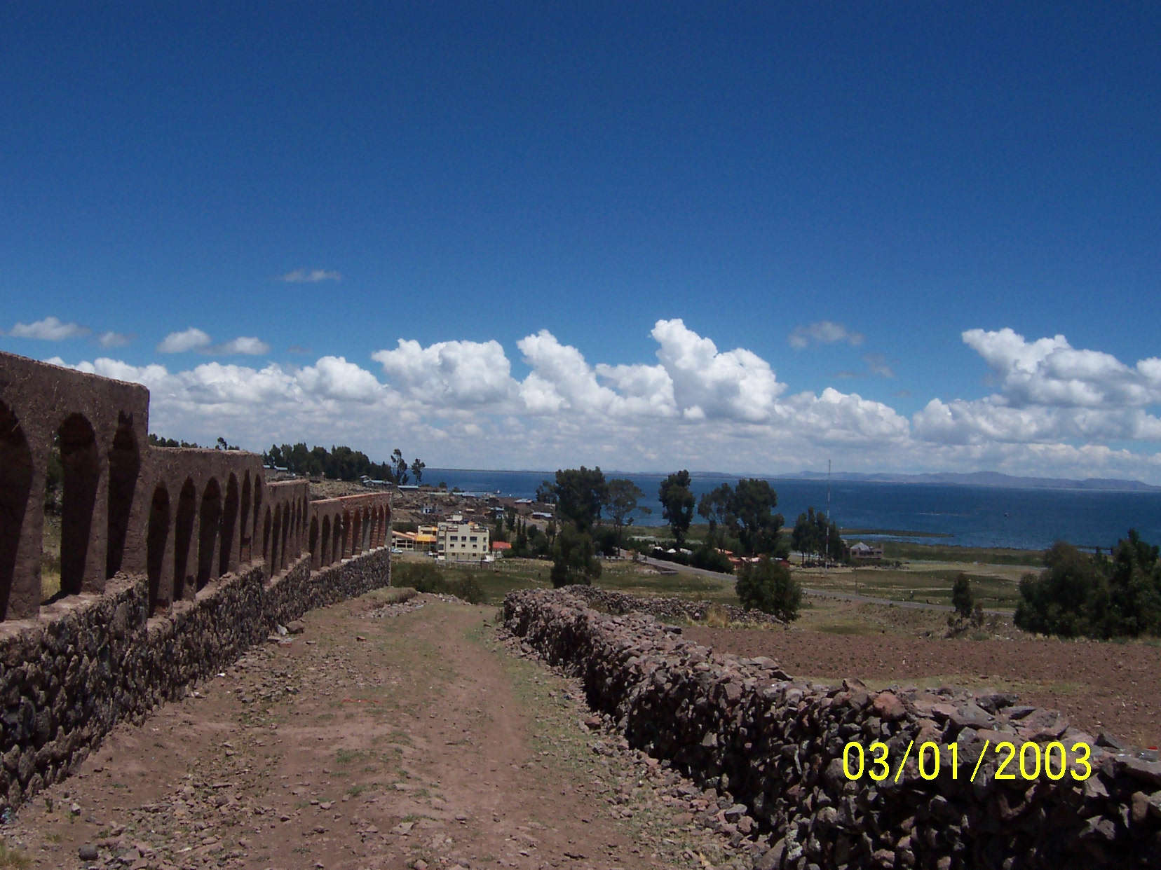
Chucuito
—  District  —
Lake Titicaca as seen from Chucuito

Coat of arms
Country  Peru
Region Puno
Province Puno
Founded
Capital Chucuito
Government
 - Mayor Pedro Alfonso Teves Cruz
Area
 - Total 121.18 km2 (46.8 sq mi)
Elevation 3,871 m (12,700 ft)
Population (2005 census)
 - Total 9,366
 - Density 77.3/km2 (200.2/sq mi)
Time zone PET (UTC-5)
UBIGEO 210106
Website munichucuito.gob.pe

Chucuito District is one of the districts of the Puno Province in the Puno Region in Peru.[1]

References

  1. ^ (Spanish) Municipalidad Distrital Chucuito, Municipalidad Distrital de Chucuito, Retrieved November 9, 2007.

External links


Wikimedia Foundation. 2010.

Игры ⚽ Поможем написать реферат

Look at other dictionaries:

  • Chucuito (disambiguation) — Chucuito can refer to a city, a district and a province in Peru. For the use of the term in a specific setting, see: Chucuito for the town in Peru. Chucuito District for the district in the Puno Province. Chucuito Province for the province in the …   Wikipedia

  • Chucuito Province — Chucuito   Province   San Juan de Latrán church in Juli …   Wikipedia

  • Desaguadero District — Distrito de Desaguadero Huchusuma distritu   District   Country   …   Wikipedia

  • Ollaraya District — Distrito de Ollaraya Ullaraya distritu   District   Country   …   Wikipedia

  • Huacullani District — Infobox District Peru district = Huacullani image size = image caption = cofarms = coa width = region = Puno province = Chucuito capital = Huacullani elevation = 3910 hamlets = ubigeo = 210403 pop = commas|10610 density = commas|15 area =… …   Wikipedia

  • Kelluyo District — Infobox District Peru district = Kelluyo image size = image caption = cofarms = coa width = region = Puno province = Chucuito capital = Kelluyo elevation = 3830 hamlets = ubigeo = 210404 pop = commas|13801 density = commas|28.4 area =… …   Wikipedia

  • Pisacoma District — Infobox District Peru district = Pisacoma image size = image caption = cofarms = coa width = region = Puno province = Chucuito capital = Pisacoma elevation = 3915 hamlets = ubigeo = 210405 pop = commas|11086 density = commas|11.6 area =… …   Wikipedia

  • Pomata District — Infobox District Peru district = Pomata image size = image caption = cofarms = coa width = region = Puno province = Chucuito capital = Pomata elevation = 3863 hamlets = ubigeo = 210406 pop = commas|17012 density = commas|44.5 area = commas|382.58 …   Wikipedia

  • Zepita District — Infobox District Peru district = Zepita image size = image caption = cofarms = coa width = region = Puno province = Chucuito capital = Zepita elevation = 3814 hamlets = ubigeo = 210407 pop = commas|19228 density = commas|35.2 area = commas|546.57 …   Wikipedia

  • Juli District — Infobox District Peru district = Juli image size = image caption = cofarms = coa width = region = Puno province = Chucuito capital = Juli elevation = 3869 hamlets = ubigeo = 210401 pop = commas|25923 density = commas|36 area = commas|720.38… …   Wikipedia

Share the article and excerpts

Direct link
Do a right-click on the link above
and select “Copy Link”