Darling Point Road

Darling Point Road
Darling Point Road
SydneyNew South Wales
Darlingpointrdpavement.jpg
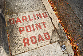
Footpath on Darling Point Road
Postcode: 2027
Location: 4 km (2 mi) from CBD
LGA: Woollahra Council
State District: Vaucluse
Federal Division: Wentworth

Darling Point Road is one of the main roads within the suburb Darling Point in the Eastern Suburbs of Sydney, New South Wales, Australia.

Beginning on the northern cusp of Edgecliff at the intersection of New South Head Road, Darling Point Road terminates on the most northern part of the suburb, next to McKell Park. Darling Point Road passes St Marks Anglican Church, situated on the highest point of the ridge, here it intersects Mona Road and Greenoaks Avenue at a small roundabout. As Darling Point has magnificent views of Sydney Harbour in all but the southern direction it is a wealthy area, many fine homes and apartments line Darling Point Road, and the entire suburb. It is possibly one of the most leafy roads in the Eastern Suburbs of Sydney.


Wikimedia Foundation. 2010.

Игры ⚽ Поможем сделать НИР

Look at other dictionaries:

  • Darling Point, New South Wales — Darling Point Sydney, New South Wales Darling Point Population …   Wikipedia

  • Darling Harbour — ist ein Stadtteil von Sydney, New South Wales, Australien. Es handelt sich um ein großes Erholungsgebiet mit zahlreichen Hotels, Restaurants, Shoppingcentern, Theatern, Museen und Unterhaltungszentren, welches zu großen Teilen als Fußgängerzone… …   Deutsch Wikipedia

  • Darling — is a term of endearment of Anglo Saxon origin. It may also refer to: Contents 1 People 2 Places 3 Films 4 Music 5 …   Wikipedia

  • Darling Street — Rozelle Public School, designed by John Horbury Hunt Darling Street, running along the ridge of the Balmain Peninsular in inner west Sydney, Australia, from the East Balmain Ferry Wharf to Victoria Road, is the main thoroughfare and high street… …   Wikipedia

  • Point Piper, New South Wales — Infobox Australian Place | type = suburb name = Point Piper city = Sydney state = nsw caption = Seven Shillings Beach lga = Municipality of Woollahra postcode = 2027 pop = 1,386 (2001) [Census 2001 AUS|id=SSC12926|name=Point Piper (State… …   Wikipedia

  • Ralph Darling — General Sir Ralph Darling, GCH (1772cite web |url=http://www.adb.online.anu.edu.au/biogs/A010270b.htm |title=Darling, Sir Ralph (1772 1858) |accessdate=2007 08 14 |work=Australian Dictionary of Biography, Volume 1 |publisher=MUP |year=1966 |pages …   Wikipedia

  • Darling Harbour, New South Wales — Darling Harbour looking towards the east Darling Harbour is a locality of the city centre of Sydney, Australia. It is a large recreational and pedestrian precinct that is situated on western outskirts of the Sydney central business district. The… …   Wikipedia

  • Darling Scarp — Southwest Western Australia from space. The dark green is dense vegetation on and above the scarp, which has been retained for forest reserve and water catchment purposes. The sharp vegetation boundary on the coastal side coincides with the edge… …   Wikipedia

  • McMahons Point ferry wharf — McMahons Point Darling Harbo …   Wikipedia

  • New South Head Road — New South Head Road, Double Bay New South Head Road, is a major road in the Eastern Suburbs of Sydney, Australia. The road runs north east from Rushcutters Bay through Edgecliff, Double Bay, Point Piper, Rose Bay and Vaucluse where it finally me …   Wikipedia

Share the article and excerpts

Direct link
Do a right-click on the link above
and select “Copy Link”