- Dunlap's Creek Bridge
-
Dunlap's Creek Bridge 
Carries National Road Crosses Dunlap's Creek Locale Brownsville, Pennsylvania Designer Richard Delafield Design arch bridge Material cast iron Longest span 24.4 metres (80 ft)[1] Number of spans 1 Construction begin 1836 Construction end 1839 Coordinates Dunlap's Creek Bridge

Coordinates: 40°1′17″N 79°53′19″W / 40.02139°N 79.88861°WCoordinates: 40°1′17″N 79°53′19″W / 40.02139°N 79.88861°W Governing body: State NRHP Reference#: 78002398[3] Added to NRHP: July 31, 1978 Dunlap's Creek Bridge was the first cast iron, metal arch bridge in the United States. It was designed by Richard Delafield and built by the United States Army Corps of Engineers.[4] Constructed from 1836 to 1839 on the National Road in Brownsville, Pennsylvania, it remains in use today. It is listed on the National Register of Historic Places and is a National Historic Civil Engineering Landmark (1978).
Contents
History
There have been four structures on this site. The first two collapsed in 1808 and 1820. The third, a wood frame structure, needed replacement by 1832.[5]
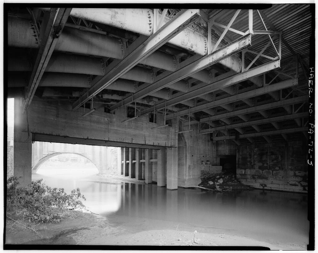
This bridge is constructed using five parallel tubular ribs, each made of 9 elliptical segments to form the 80 feet (24 m) arch.[4]
Image
-
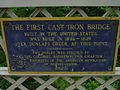
Plaque commemorating Dunlap's Creek Bridge
See also
- List of Registered Historic Places in Fayette County, Pennsylvania
- List of historic civil engineering landmarks
References
- Vivian, Cassandra (2003). The National Road in Pennsylvania. Arcadia Publishing. pp. 85–86. ISBN 0-7385-1166-8.
- ^ Dunlap's Creek Bridge at Structurae
- ^ The First Cast Iron Bridge: Historical Marker Database
- ^ "National Register Information System". National Register of Historic Places. National Park Service. 2008-04-15. http://nrhp.focus.nps.gov/natreg/docs/All_Data.html.
- ^ a b Jackson, Donald C. (1988). Great American Bridges and Dams. Wiley. pp. 142. ISBN 0-471-14385-5.
- ^ "Dunlap's Creek Bridge, Spanning Dunlap's Creek, Brownsville, Fayette County, PA". http://lcweb2.loc.gov/cgi-bin/query/h?pp/hh:@field(NUMBER+@band(pa1412)). Retrieved 2008-07-16.
External links
Categories:- Bridges in Fayette County, Pennsylvania
- Bridges on the National Register of Historic Places in Pennsylvania
- Historic Civil Engineering Landmarks
- Road bridges in Pennsylvania
-


Wikimedia Foundation. 2010.