- Masafi
-
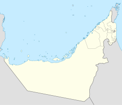
Masafi Coordinates: 25°18′48″N 56°9′46″E / 25.31333°N 56.16278°ECoordinates: 25°18′48″N 56°9′46″E / 25.31333°N 56.16278°E Country United Arab Emirates Emirate Ras Al Khaimah, Fujairah Elevation 567 m (1,863 ft) Masafi is a village located on the edge of the Hajar Mountains in the United Arab Emirates. It developed along the old unpaved road which ran from Fujairah to Dubai via Sharjah. It was a trading post and refuelling stop for 4x4 vehicles and camel trains that plied the route before the modern highways were built in the 1970s. The village is divided into two parts. The larger belongs to the emirate of Ras Al Khaimah while the smaller belongs to the emirate of Fujairah. Symbolising the historic division between the two emirates is an unfinished building straddling the boundary. This building was a scene of fighting when its ownership was disputed. Eventually, the conflict was ended by the acquisition of the offending construction by the Federal Government.
Etymology
The name "Masafi" is Arabic for "pure water" or "ماء صافي". From that name a company was formed, Masafi Mineral Water Co. LLC.
Environment
Masafi is famous for its weather as the highest living area in the UAE also famous of its mango trees and various citruses. The village is known for its natural springs. Masafi is also the name of the Persian Gulf's leading water producer, which is situated in the town itself.
Sports
Categories:- Populated places in Fujairah
- Populated places in Ras al-Khaimah
- United Arab Emirates geography stubs
Wikimedia Foundation. 2010.

