- Ōnuma Quasi-National Park
-
Ōnuma Quasi-National Park 大沼国定公園 
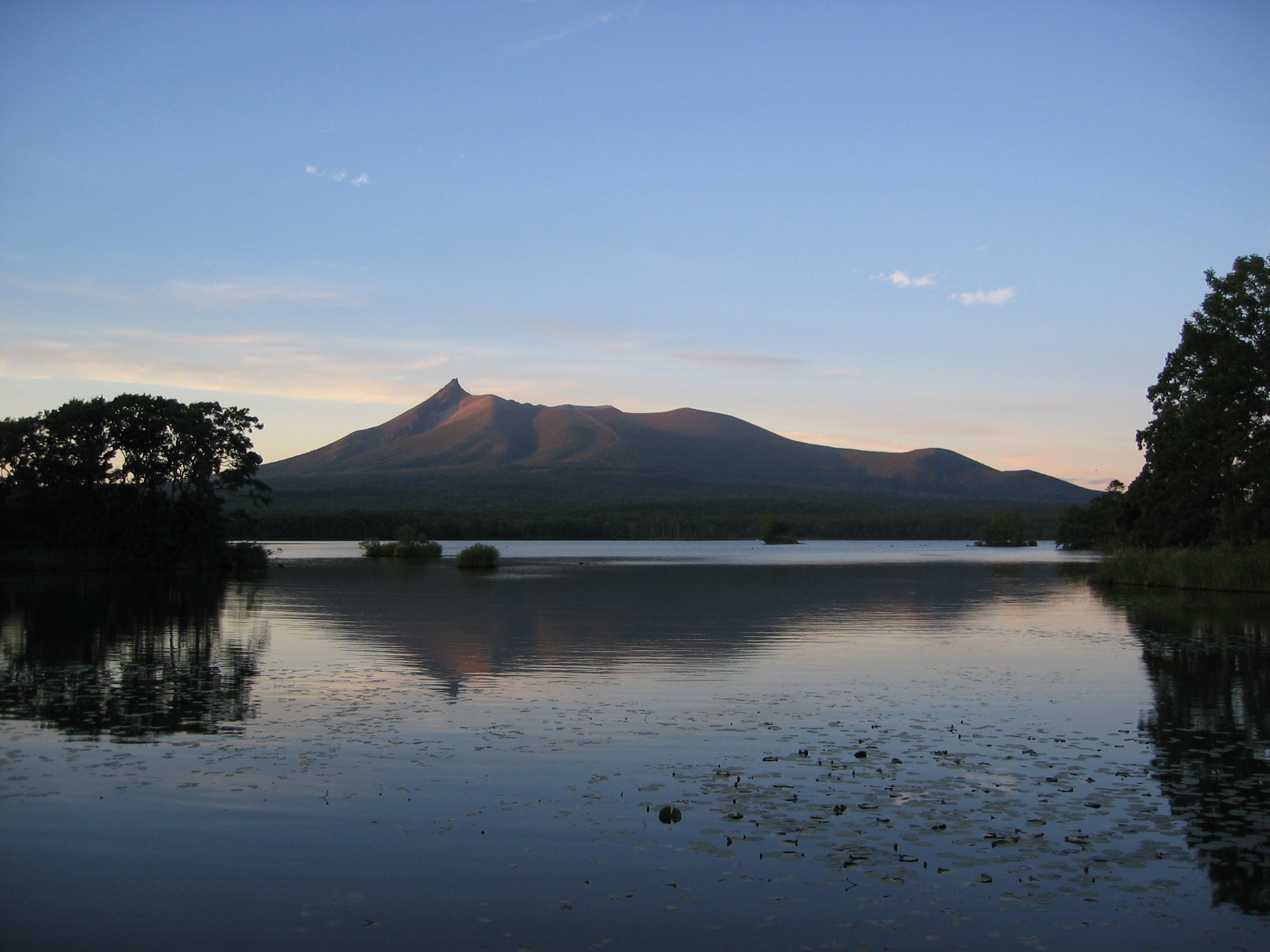
Hokkaidō Komagatake, in the center of the park, at dusk.

Location Hokkaidō, Japan Nearest city Nanae Coordinates 42°00′44″N 140°40′16″E / 42.0121°N 140.671°ECoordinates: 42°00′44″N 140°40′16″E / 42.0121°N 140.671°E[1] Area 90.83 km2 (35.07 sq mi) Established July 1, 1958 Ōnuma Quasi-National Park (大沼国定公園 Ōnuma Kokutei Kōen) is a 90.83 km2 (35.07 sq mi)[1] quasi-national park on the Oshima Peninsula in southwest Hokkaidō, Japan. The park encompasses the volcanic Hokkaidō Komagatake (北海道駒ケ岳 Hokkaidō Komagatake) as well as the Ōnuma (大沼) and Konuma (小沼) ponds, which abut against the west slope of the mountain. The park, which was designated as quasi-national in 1958, is the smallest major park in Hokkaidō.
Ōnuma and Konuma were created when mudflows due to eruptions of Hokkaidō Komagatake dammed up depressions at the base of the mountain. The ponds, which are dotted with watershields, are surrounded by birch and maple forests.
Contents
Related cities, towns and villages
References
- ^ a b Onuma Quasi National Park protectedplanet.net
See also
External links
- J-IBIS (Japanese)
Categories:- IUCN Category II
- Hokkaidō geography stubs
- Japan protected area stubs
- National parks of Japan
- Visitor attractions in Hokkaidō
- Protected Areas of Hokkaidō
- Protected areas established in 1958


Wikimedia Foundation. 2010.