- Tustin, Michigan
Infobox Settlement
official_name = Tustin, Michigan
settlement_type = Village
nickname =
motto =
imagesize =
image_caption =
image_
imagesize =
image_caption =
image_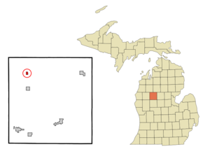
mapsize = 250px
map_caption = Location of Tustin, Michigan
mapsize1 =
map_caption1 =subdivision_type = Country
subdivision_name =United States
subdivision_type1 = State
subdivision_name1 =Michigan
subdivision_type2 = County
subdivision_name2 = Osceolagovernment_footnotes =
government_type =
leader_title =
leader_name =
leader_title1 =
leader_name1 =
established_title =
established_date =area_footnotes =
area_magnitude =
area_total_km2 = 1.0
area_land_km2 = 1.0
area_water_km2 = 0.0
area_total_sq_mi = 0.4
area_land_sq_mi = 0.4
area_water_sq_mi = 0.0population_as_of = 2000
population_footnotes =
population_total = 237
population_density_km2 = 236.8
population_density_sq_mi = 613.4timezone = Eastern (EST)
utc_offset = -5
timezone_DST = EDT
utc_offset_DST = -4
elevation_footnotes =
elevation_m = 374
elevation_ft = 1227
latd = 44 |latm = 6 |lats = 8 |latNS = N
longd = 85 |longm = 27 |longs = 28 |longEW = Wpostal_code_type =
ZIP code
postal_code = 49688
area_code = 231
blank_name = FIPS code
blank_info = 26-80960GR|2
blank1_name = GNIS feature ID
blank1_info = 1615213GR|3
website =
footnotes =Tustin is a village in Osceola County of the
U.S. state ofMichigan . As of the 2000 census, the village population was 237. The village is within Burdell Township.Geography
According to the
United States Census Bureau , the village has a total area of 0.4square mile s (1.0km² ), all land.Demographics
As of the
census GR|2 of 2000, there were 237 people, 88 households, and 63 families residing in the village. Thepopulation density was 613.4 per square mile (234.6/km²). There were 92 housing units at an average density of 238.1/sq mi (91.1/km²). The racial makeup of the village was 98.73% White and 1.27% Asian.There were 88 households out of which 35.2% had children under the age of 18 living with them, 47.7% were married couples living together, 19.3% had a female householder with no husband present, and 27.3% were non-families. 21.6% of all households were made up of individuals and 13.6% had someone living alone who was 65 years of age or older. The average household size was 2.69 and the average family size was 3.13.
In the village the population was spread out with 29.1% under the age of 18, 10.5% from 18 to 24, 23.2% from 25 to 44, 22.4% from 45 to 64, and 14.8% who were 65 years of age or older. The median age was 36 years. For every 100 females there were 88.1 males. For every 100 females age 18 and over, there were 78.7 males.
The median income for a household in the village was $29,063, and the median income for a family was $36,250. Males had a median income of $25,417 versus $15,000 for females. The
per capita income for the village was $11,390. About 12.0% of families and 18.6% of the population were below thepoverty line , including 14.9% of those under the age of eighteen and 15.6% of those sixty five or over.References
Wikimedia Foundation. 2010.