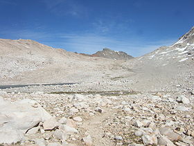
- Muir Pass
-
Muir Pass 
Elevation 11,955 ft (3,644 m) Traversed by John Muir Trail Location Location Fresno County, California,  United States
Range Sierra Nevada Coordinates 37°06′42″N 118°40′14″W / 37.11167°N 118.67056°WCoordinates: 37°06′42″N 118°40′14″W / 37.11167°N 118.67056°W [1] Muir Pass is a mountain pass in the Sierra Nevada of California, United States, in Kings Canyon National Park. It is named for John Muir.[1]
The pass is near the midway point of the John Muir Trail, which traverses the pass. It crosses the Goddard Divide between Mount Solomons and Mount Warlow,[1] at an elevation of 11,955 feet (3,644 m). The Muir Hut, built by the Sierra Club, is at the summit of the pass.
Notes
Categories:- Mountain passes of California
- Kings Canyon National Park
- Landforms of Fresno County, California
- Fresno County, California geography stubs
Wikimedia Foundation. 2010.
