- Benzonia, Michigan
Infobox Settlement
official_name = Benzonia, Michigan
settlement_type = Village
nickname =
motto =
imagesize =
image_caption =
image_
imagesize =
image_caption =
image_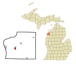
mapsize = 250px
map_caption = Location of Benzonia, Michigan
mapsize1 =
map_caption1 =subdivision_type = Country
subdivision_name =United States
subdivision_type1 = State
subdivision_name1 =Michigan
subdivision_type2 = County
subdivision_name2 = Benziegovernment_footnotes =
government_type =
leader_title =
leader_name =
leader_title1 =
leader_name1 =
established_title =
established_date =area_footnotes =
area_magnitude =
area_total_km2 = 2.8
area_land_km2 = 2.8
area_water_km2 = 0.0
area_total_sq_mi = 1.1
area_land_sq_mi = 1.1
area_water_sq_mi = 0.0population_as_of = 2000
population_footnotes =
population_total = 519
population_density_km2 = 188.5
population_density_sq_mi = 488.2timezone = Eastern (EST)
utc_offset = -5
timezone_DST = EDT
utc_offset_DST = -4
elevation_footnotes =
elevation_m = 249
elevation_ft = 817
latd = 44 |latm = 37 |lats = 6 |latNS = N
longd = 86 |longm = 5 |longs = 59 |longEW = Wpostal_code_type =
ZIP code
postal_code = 49616
area_code = 231
blank_name = FIPS code
blank_info = 26-07580GR|2
blank1_name = GNIS feature ID
blank1_info = 0621150 [gnis|0621150]
website =
footnotes =Benzonia is a village in Benzie County in the
U.S. state ofMichigan . The population was 519 at the 2000 census. The village is located within Benzonia Township at the southeast end of Crystal Lake onU.S. Highway 31 at the junction with M-115 west.Geography
According to the
United States Census Bureau , the village has a total area of 1.1square mile s (2.7km² ), all land.History
Benzonia began in 1858 as an educational Christian colony on the model of
Oberlin, Ohio . Its founding was under the leadership ofCharles E. Bailey . In 1863Grand Traverse College was chartered and began here. It was renamed Benzonia College in 1891. In 1900 it became an academy which continued to function until 1918 when it was closed. [ [http://www.michmarkers.com/startup.asp?startpage=S0245.htm Michigan Historical Markers ] ]Demographics
As of the
census GR|2 of 2000, there were 519 people, 211 households, and 128 families residing in the village. Thepopulation density was 488.2 per square mile (189.0/km²). There were 254 housing units at an average density of 238.9/sq mi (92.5/km²). The racial makeup of the village was 93.45% White, 0.39% African American, 3.08% Native American, 0.39% Asian, 0.19% Pacific Islander, 0.96% from other races, and 1.54% from two or more races. Hispanic or Latino of any race were 2.89% of the population.There were 211 households out of which 25.6% had children under the age of 18 living with them, 44.5% were married couples living together, 12.3% had a female householder with no husband present, and 39.3% were non-families. 33.2% of all households were made up of individuals and 19.9% had someone living alone who was 65 years of age or older. The average household size was 2.25 and the average family size was 2.88.
In the village the population was spread out with 21.0% under the age of 18, 10.4% from 18 to 24, 25.6% from 25 to 44, 22.4% from 45 to 64, and 20.6% who were 65 years of age or older. The median age was 40 years. For every 100 females there were 100.4 males. For every 100 females age 18 and over, there were 106.0 males.
The median income for a household in the village was $28,650, and the median income for a family was $35,104. Males had a median income of $25,469 versus $20,313 for females. The
per capita income for the village was $15,515. About 5.0% of families and 10.1% of the population were below thepoverty line , including 4.6% of those under age 18 and 15.6% of those age 65 or over.Famous resident
Benzonia was the boyhood home of Civil War historian
Bruce Catton . Later in his life he spent his summers in the Frankfort area. A Michigan state historical marker commemorates his residence there.References
Wikimedia Foundation. 2010.