- Psorothamnus spinosus
-
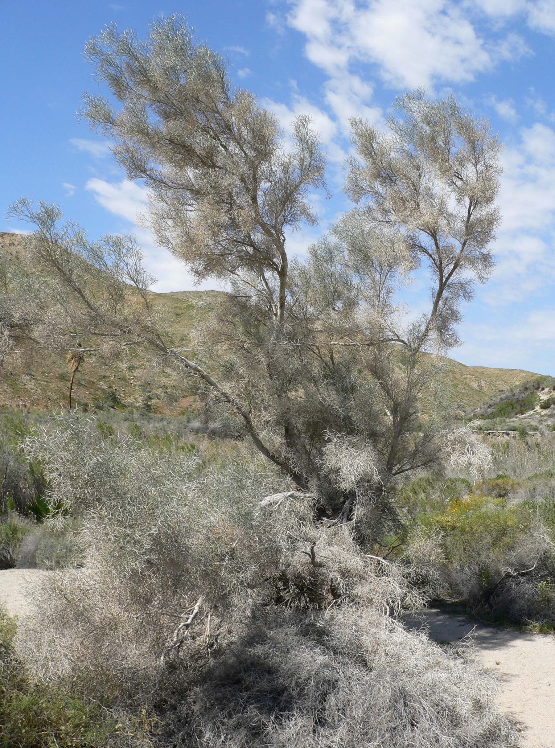
Psorothamnus spinosus 
Mature form: 3–5 m Scientific classification Kingdom: Plantae (unranked): Angiosperms (unranked): Eudicots (unranked): Rosids Order: Fabales Family: Fabaceae Genus: Psorothamnus Species: P. spinosus Binomial name Psorothamnus spinosus
(A.Gray) BarnebySynonyms Dalea spinosa
Psorothamnus spinosus, known as the Smokethorn, Smoketree, Smoke tree, Indigobush, Smokethorn dalea, and Corona de Cristo, is a perennial legume tree common to the desert washes of the southern part of California, Arizona, and most of Baja California, including islands[1] in the northern Sea of Cortez-(Gulf of California). The Smokethorn is also common to Joshua Tree National Park, where it is called the Smoketree.
The twigs of the Smokethorn are slender and densely covered with fine whitish hairs. The flowers are lateral clusters of purple in June, with small seeded pea pods as its fruit.
Distribution
The range of Psorothamnus spinosus is centered north-south along the Lower Colorado River Valley ranging west into mostly all of the Colorado Desert-(subsection of Sonoran Desert), and east of the Colorado River in southwestern Arizona's Sonoran Desert.[2]
To the west in Baja California it borders the western Sea of Cortez; it occurs on the islands there including Isla Ángel de la Guarda, but not Tiburon Island.[3] To the east in Sonora, the species ranges into the northwest of the great Gran Desierto de Altar, on the northern shore of the Sea of Cortez.
In Arizona, the RangeMap also shows that the ranges center on the river courses of southwest Arizona, specifically, the Bill Williams River in the north, then the Gila River[4] in the south. The range also extends into extreme southern Nevada, mostly adjacent the Colorado River.[5]
References
- Little. Atlas of United States Trees, Volume 3, Minor Western Hardwoods, Little, Elbert L, 1976, US Government Printing Office. Library of Congress No. 79-653298. Map 64, "Dalea spinosa".
External links
Categories:- Psorothamnus
- North American desert flora
- Flora of the California desert regions
- Flora of the Sonoran Deserts
- Yuma Desert
- Gran Desierto de Altar
- Trees of the Southwestern United States
- Trees of Northwestern Mexico
- Trees of Arizona
- Trees of California
- Trees of Baja California
- Trees of Sonora
- Flora of Gulf of California islands
- Gila River
- Lower Colorado River Valley
- Trees of Nevada
- Trees of Mexico
Wikimedia Foundation. 2010.