- Clay, Kentucky
-
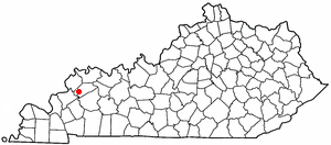
Clay, Kentucky — City — Location of Clay, Kentucky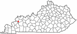
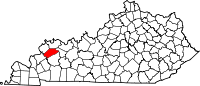
Coordinates: 37°28′41″N 87°49′15″W / 37.47806°N 87.82083°WCoordinates: 37°28′41″N 87°49′15″W / 37.47806°N 87.82083°W Country United States State Kentucky County Webster Area – Total 0.9 sq mi (2.3 km2) – Land 0.9 sq mi (2.3 km2) – Water 0.0 sq mi (0.0 km2) Elevation 381 ft (116 m) Population (2000) – Total 1,179 – Density 1,300.9/sq mi (502.3/km2) Time zone Central (CST) (UTC-6) – Summer (DST) CDT (UTC-5) ZIP code 42404 Area code(s) 270 FIPS code 21-15202 GNIS feature ID 0489565 Clay is a city in Webster County, Kentucky, United States. The population was 1,179 at the 2000 census. Settled in 1837, the city is named for statesman Henry Clay.[1]
Contents
Geography
Clay is located at 37°28′41″N 87°49′15″W / 37.477969°N 87.820922°W.[2]
According to the United States Census Bureau, the city has a total area of 0.9 square miles (2.3 km2), all of it land.
Mayor
Rick Householder: Wife Ramonia Householder
City Council Members
Bena Travis
Paul Cowan
Jackie Edens
Gary Vaughn
Peggy Durbin
Patty Dennis
City Clerk
Julianna Rhye
Utility Manager
Mike Grigg
Demographics
As of the census[3] of 2000, there were 1,179 people, 485 households, and 333 families residing in the city. The population density was 1,300.9 people per square mile (500.2/km²). There were 541 housing units at an average density of 596.9 per square mile (229.5/km²). The racial makeup of the city was 99.15% White, 0.25% African American, 0.17% Asian, 0.17% Pacific Islander, and 0.25% from two or more races. Hispanic or Latino of any race were 0.34% of the population.
There were 485 households out of which 31.1% had children under the age of 18 living with them, 55.9% were married couples living together, 9.1% had a female householder with no husband present, and 31.3% were non-families. 29.3% of all households were made up of individuals and 15.7% had someone living alone who was 65 years of age or older. The average household size was 2.43 and the average family size was 2.99.
In the city the population was spread out with 24.8% under the age of 18, 7.8% from 18 to 24, 30.8% from 25 to 44, 21.4% from 45 to 64, and 15.3% who were 65 years of age or older. The median age was 37 years. For every 100 females there were 97.2 males. For every 100 females age 18 and over, there were 92.0 males.
The median income for a household in the city was $31,625, and the median income for a family was $42,500. Males had a median income of $30,729 versus $16,538 for females. The per capita income for the city was $15,545. About 10.7% of families and 13.3% of the population were below the poverty line, including 23.1% of those under age 18 and 10.1% of those age 65 or over.
The city was featured in The Statler Brothers' song "How are Things in Clay, Kentucky?" (1980).
Education
Clay Elementary School serves students Pre-School-8. In the late 1990s a new gym and cafeteria were built for the school.
References
- ^ "Dictionary of Places: Clay". Encyclopedia of Kentucky. New York, New York: Somerset Publishers. 1987. ISBN 0403099811.
- ^ "US Gazetteer files: 2010, 2000, and 1990". United States Census Bureau. 2011-02-12. http://www.census.gov/geo/www/gazetteer/gazette.html. Retrieved 2011-04-23.
- ^ "American FactFinder". United States Census Bureau. http://factfinder.census.gov. Retrieved 2008-01-31.
Municipalities and communities of Webster County, Kentucky Cities Dixon | Clay | Providence | Sebree | Slaughters | Wheatcroft
 Categories:
- Populated places established in 1837
- Cities in Kentucky
- Populated places in Webster County, Kentucky
- Evansville metropolitan area

Wikimedia Foundation. 2010.