- Nahrstedt
-
Nahrstedt Stadtteil of Stendal 
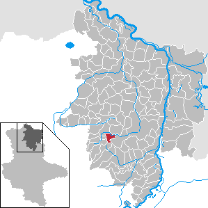
 NahrstedtLocation of Nahrstedt within Stendal district
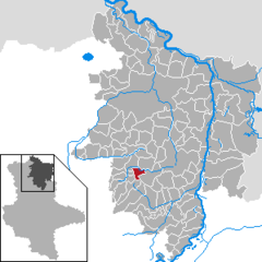
Coordinates 52°34′47″N 11°43′0″E / 52.57972°N 11.716667°ECoordinates: 52°34′47″N 11°43′0″E / 52.57972°N 11.716667°E Administration Country Germany State Saxony-Anhalt District Stendal Town Stendal Basic statistics Area 8.63 km2 (3.33 sq mi) Elevation 35 m (115 ft) Population 295 (31 December 2006) - Density 34 /km2 (89 /sq mi) Other information Time zone CET/CEST (UTC+1/+2) Licence plate SDL Postal code 39599 Area code 039329 Website www.uchtetal.de Nahrstedt is a village and a former municipality in the district of Stendal, in Saxony-Anhalt, Germany. Since 1 January 2010, it is part of the town Stendal.
Categories:- Villages in Saxony-Anhalt
- Stendal district geography stubs

Wikimedia Foundation. 2010.