- Mallaig, Alberta
-
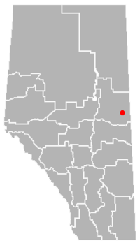 Location of Mallaig
Mallaig is a settlement in Alberta, Canada within the County of St. Paul No. 19.[1] It is located approximately 200 kilometres (120 mi) northeast of Edmonton. Its primary industry is agriculture.
The hamlet was one of the many communities that spawned due to the construction of the railroad in Western Canada during the early 1900s. In 1928, the hamlet was officially founded. The name was inspired by one of the Scottish workers. The many swamps and low lying areas in the area reminded him of his home town (Mallaig, Scotland).
As the 20th century progressed, the railway has been removed, and has been replaced by the Iron Horse Trail, which is a long, recreational trail intended for all-terrain vehicles. The hamlet today is quite small, containing minimal services, a landfill, and a school (Kindergarten to Grade 12) with an enrollment of approximately 300 students[citation needed] from the hamlet and surrounding area.
Contents
See also
- List of communities in Alberta
- List of hamlets in Alberta
References
- ^ Alberta Municipal Affairs (2010-04-01). "Specialized and Rural Municipalities and Their Communities". http://municipalaffairs.gov.ab.ca/documents/msb/2010-ruralmun.pdf. Retrieved 2010-07-04.
External links
- Information on the hamlet with pictures (located halfway down the page)
- Another edition of link above (information is located near the bottom of the page)
- Local school website
- Information on Mallaig and surrounding communities
- Information on "Haying in the 30's", an annual festival
- Alberta's Francophone Heritage - Mallaig
Further reading
- Mallaig – Therien History Book Committee. Precious Memories – Mémoires Précieuses: Mallaig – Therien 1906-1992. Mallaig: Mallaig History Book Committee, 1993.
 Subdivisions of Alberta
Subdivisions Regions · Census divisions · Municipal districts (counties) · Specialized municipalities · School districts · Regional health authoritiesCommunities Cities · Towns · Villages · Summer villages · Hamlets · Indian reserves · Métis settlements · Ghost towns · Designated placesCities and Urban
Service AreasAirdrie · Brooks · Calgary · Camrose · Cold Lake · Edmonton (capital) · Fort McMurray · Fort Saskatchewan · Grande Prairie · Lacombe · Leduc · Lethbridge · Lloydminster · Medicine Hat · Red Deer · Sherwood Park · Spruce Grove · St. Albert · Wetaskiwin Category ·
  Portal ·
  WikiProject
Coordinates: 54°12′37″N 111°21′39″W / 54.21028°N 111.36083°W
Categories:- Hamlets in Alberta
- Designated places in Alberta
- St. Paul County, Alberta
- Northern Alberta geography stubs

Wikimedia Foundation. 2010.