- Sylvan Grove, Kansas
Infobox Settlement
official_name = Sylvan Grove, Kansas
settlement_type =City
nickname =
motto =
imagesize =
image_caption =
image_
imagesize =
image_caption =
image_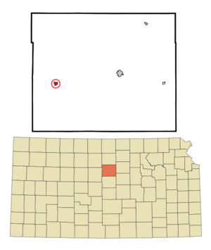
mapsize = 250x200px
map_caption = Location of Sylvan Grove, Kansas
mapsize1 =
map_caption1 =subdivision_type = Country
subdivision_name =United States
subdivision_type1 = State
subdivision_name1 =Kansas
subdivision_type2 = County
subdivision_name2 = Lincoln
government_footnotes =
government_type =
leader_title =
leader_name =
leader_title1 =
leader_name1 =
established_title =
established_date =unit_pref = Imperial
area_footnotes =area_magnitude =
area_total_km2 = 1.0
area_land_km2 = 1.0
area_water_km2 = 0.0
area_total_sq_mi = 0.4
area_land_sq_mi = 0.4
area_water_sq_mi = 0.0population_as_of = 2000
population_footnotes =
population_total = 324
population_density_km2 = 338.4
population_density_sq_mi = 876.5timezone = Central (CST)
utc_offset = -6
timezone_DST = CDT
utc_offset_DST = -5
elevation_footnotes =
elevation_m = 440
elevation_ft = 1444
latd = 39 |latm = 0 |lats = 46 |latNS = N
longd = 98 |longm = 23 |longs = 33 |longEW = Wpostal_code_type =
ZIP code
postal_code = 67481
area_code = 785
blank_name = FIPS code
blank_info = 20-69775GR|2
blank1_name = GNIS feature ID
blank1_info = 0472542GR|3
website =
footnotes =Sylvan Grove is a city in Lincoln County,
Kansas ,United States . The population was 324 at the 2000 census.Geography
Sylvan Grove is located at coor dms|39|0|46|N|98|23|33|W|city (39.012860, -98.392491)GR|1.
According to the
United States Census Bureau , the city has a total area of 0.4square mile s (1.0km² ), all of it land.Demographics
As of the
census GR|2 of 2000, there were 324 people, 157 households, and 88 families residing in the city. Thepopulation density was 876.5 people per square mile (338.1/km²). There were 195 housing units at an average density of 527.6/sq mi (203.5/km²). The racial makeup of the city was 96.91% White, 1.85% Native American, 0.93% from other races, and 0.31% from two or more races. Hispanic or Latino of any race were 1.54% of the population.There were 157 households out of which 21.7% had children under the age of 18 living with them, 48.4% were married couples living together, 3.8% had a female householder with no husband present, and 43.9% were non-families. 40.8% of all households were made up of individuals and 24.8% had someone living alone who was 65 years of age or older. The average household size was 2.06 and the average family size was 2.82.
In the city the population was spread out with 21.0% under the age of 18, 4.9% from 18 to 24, 23.1% from 25 to 44, 23.5% from 45 to 64, and 27.5% who were 65 years of age or older. The median age was 46 years. For every 100 females there were 98.8 males. For every 100 females age 18 and over, there were 98.4 males.
The median income for a household in the city was $27,188, and the median income for a family was $36,375. Males had a median income of $20,962 versus $16,250 for females. The
per capita income for the city was $14,684. About 13.5% of families and 17.6% of the population were below thepoverty line , including 27.4% of those under age 18 and 6.3% of those age 65 or over.Library
The Sylvan Grove Public Library was organized in the fall of 1925 by the Tuesday Club. The first library was housed in a central room above the Sylvan State Bank. In 1938, the city took over the library and it was moved to a southeast corner room of the bank. In 1949, a fund-raiser was held to purchase several hundred books. On
December 1 ,1956 , the library was moved to its present location in City Hall.References
External links
* [http://www.sylvangroveks.com Sylvan Grove Home Page]
* [http://www.usd299.k12.ks.us USD #299 School Home Page]
Wikimedia Foundation. 2010.