- Möllenbeck, Ludwigslust
-
Möllenbeck 
 MöllenbeckLocation of Möllenbeck within Ludwigslust-Parchim district
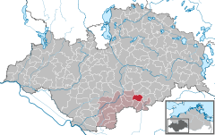
Coordinates 53°16′N 11°43′E / 53.26667°N 11.71667°ECoordinates: 53°16′N 11°43′E / 53.26667°N 11.71667°E Administration Country Germany State Mecklenburg-Vorpommern District Ludwigslust-Parchim Municipal assoc. Grabow Local subdivisions 4 Mayor Wolfgang Gawron Basic statistics Area 19.20 km2 (7.41 sq mi) Elevation 35 m (115 ft) Population 217 (31 December 2010)[1] - Density 11 /km2 (29 /sq mi) Other information Time zone CET/CEST (UTC+1/+2) Licence plate LWL Postal code 19300 Area codes 038721, 038752 Website www.amt-grabow.de Möllenbeck is a municipality in the Ludwigslust-Parchim district, in Mecklenburg-Vorpommern, Germany.
Geography and transport links
Möllenbeck lies in southwestern Mecklenburg-Vorpommern between the rivers Tarnitz and Löcknitz. The Löcknitz-Mühlbach flows through the municipality. The nearest town is Grabow, where there is a motorway junction and from where the Bundesstraße 5 federal road may be accessed. The motorway junction to the A 24 (Parchim) is twelve kilometres to the east.
The villages of Menzendorf, Carlshof and Horst belong to the parish of Möllenbeck.
References
- ^ "Bevölkerungsentwicklung der Kreise und Gemeinden" (in German). Statistisches Amt Mecklenburg-Vorpommern. 31 December 2010. http://service.mvnet.de/statmv/daten_stam_berichte/e-bibointerth01/bevoelkerung--haushalte--familien--flaeche/a-i__/a123__/2010/daten/a123-2010-22.pdf.
Categories:- Municipalities in Mecklenburg-Vorpommern
- Ludwigslust-Parchim geography stubs


Wikimedia Foundation. 2010.