- Robins, Iowa
Infobox Settlement
official_name = Robins, Iowa
settlement_type =City
nickname =
motto =
imagesize =
image_caption =
image_
imagesize =
image_caption =
image_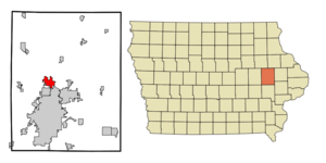
mapsize = 250px
map_caption = Location of Robins, Iowa
mapsize1 =
map_caption1 =subdivision_type = Country
subdivision_name =
subdivision_type1 = State
subdivision_name1 =
subdivision_type2 = County
subdivision_name2 = Linn
government_footnotes =
government_type =
leader_title =
leader_name =
leader_title1 =
leader_name1 =
established_title =
established_date =unit_pref = Imperial
area_footnotes =area_magnitude =
area_total_km2 = 9.9
area_land_km2 = 9.9
area_water_km2 = 0.0
area_total_sq_mi = 3.8
area_land_sq_mi = 3.8
area_water_sq_mi = 0.0population_as_of = 2000
population_footnotes =
population_total = 1806
population_density_km2 = 182.3
population_density_sq_mi = 472.3timezone = Central (CST)
utc_offset = -6
timezone_DST = CDT
utc_offset_DST = -5
elevation_footnotes =
elevation_m = 259
elevation_ft = 850
latd = 42 |latm = 4 |lats = 22 |latNS = N
longd = 91 |longm = 40 |longs = 7 |longEW = Wpostal_code_type =
ZIP code
postal_code = 52328
area_code = 319
blank_name = FIPS code
blank_info = 19-67800
blank1_name = GNIS feature ID
blank1_info = 0460699
website =
footnotes =Robins is a city in Linn County,
Iowa ,United States . The population was 1,806 at the 2000 census; a special census in 2005 counted 2,435 residents. [http://www.census.gov/field/www/specialcensus/files/iowa_2005.htm] Robins is a suburb of Cedar Rapids and is part of the Cedar Rapids Metropolitan Statistical Area.Geography
Robins is located at coor dms|42|4|22|N|91|40|7|W|city (42.072916, -91.668538)GR|1.
According to the
United States Census Bureau , the city has a total area of 3.8square mile s (9.9km² ), all of it land.Demographics
As of the
census GR|2 of 2000, there were 1,806 people, 592 households, and 520 families residing in the city. Thepopulation density was 472.3 people per square mile (182.5/km²). There were 603 housing units at an average density of 157.7/sq mi (60.9/km²). The racial makeup of the city was 98.17% White, 0.17% Native American, 0.50% Asian, 0.11% from other races, and 1.05% from two or more races. Hispanic or Latino of any race were 1.38% of the population.There were 592 households out of which 46.5% had children under the age of 18 living with them, 83.6% were married couples living together, 2.2% had a female householder with no husband present, and 12.0% were non-families. 9.3% of all households were made up of individuals and 1.9% had someone living alone who was 65 years of age or older. The average household size was 3.05 and the average family size was 3.27.
In the city the population was spread out with 33.0% under the age of 18, 4.5% from 18 to 24, 30.5% from 25 to 44, 26.5% from 45 to 64, and 5.6% who were 65 years of age or older. The median age was 37 years. For every 100 females there were 109.8 males. For every 100 females age 18 and over, there were 108.6 males.
The median income for a household in the city was $74,211, and the median income for a family was $76,666. Males had a median income of $51,520 versus $33,500 for females. The
per capita income for the city was $25,078. About 0.4% of families and 1.2% of the population were below thepoverty line , including 1.2% of those under age 18 and none of those age 65 or over.References
External links
Wikimedia Foundation. 2010.