- Grand Mound, Iowa
Infobox Settlement
official_name = Grand Mound, Iowa
settlement_type =City
nickname =
motto =
imagesize =
image_caption =
image_
imagesize =
image_caption =
image_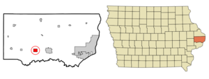
mapsize = 250x200px
map_caption = Location of Grand Mound, Iowa
mapsize1 =
map_caption1 =subdivision_type = Country
subdivision_name =
subdivision_type1 = State
subdivision_name1 =
subdivision_type2 = County
subdivision_name2 = Clinton
government_footnotes =
government_type =
leader_title =
leader_name =
leader_title1 =
leader_name1 =
established_title =
established_date =unit_pref = Imperial
area_footnotes =area_magnitude =
area_total_km2 = 4.8
area_land_km2 = 4.8
area_water_km2 = 0.0
area_total_sq_mi = 1.8
area_land_sq_mi = 1.8
area_water_sq_mi = 0.0population_as_of = 2000
population_footnotes =
population_total = 676
population_density_km2 = 142.0
population_density_sq_mi = 367.9timezone = Central (CST)
utc_offset = -6
timezone_DST = CDT
utc_offset_DST = -5
elevation_footnotes =
elevation_m = 221
elevation_ft = 725
latd = 41 |latm = 49 |lats = 27 |latNS = N
longd = 90 |longm = 38 |longs = 49 |longEW = Wpostal_code_type =
ZIP code
postal_code = 52751
area_code = 563
blank_name = FIPS code
blank_info = 19-32025
blank1_name = GNIS feature ID
blank1_info = 0457024
website =
footnotes =Grand Mound is a city in Clinton County,
Iowa ,United States . The population was 676 at the 2000 census.Geography
Grand Mound is located at coor dms|41|49|27|N|90|38|49|W|city (41.824275, -90.646815)GR|1.
According to the
United States Census Bureau , the city has a total area of 1.8square mile s (4.8km² ), all of it land.Demographics
As of the
census GR|2 of 2000, there were 675 people, 254 households, and 196 families residing in the city. Thepopulation density was 367.9 people per square mile (141.9/km²). There were 260 housing units at an average density of 141.5/sq mi (54.6/km²). The racial makeup of the city was 98.37% White, 0.15% Asian, and 1.48% from two or more races. Hispanic or Latino of any race were 1.33% of the population.There were 254 households out of which 38.6% had children under the age of 18 living with them, 65.7% were married couples living together, 6.7% had a female householder with no husband present, and 22.8% were non-families. 20.9% of all households were made up of individuals and 10.2% had someone living alone who was 65 years of age or older. The average household size was 2.66 and the average family size was 3.08.
In the city the population was spread out with 28.1% under the age of 18, 7.5% from 18 to 24, 29.9% from 25 to 44, 22.9% from 45 to 64, and 11.5% who were 65 years of age or older. The median age was 35 years. For every 100 females there were 100.6 males. For every 100 females age 18 and over, there were 96.0 males.
The median income for a household in the city was $42,411, and the median income for a family was $46,429. Males had a median income of $33,611 versus $20,250 for females. The
per capita income for the city was $17,228. About 4.2% of families and 7.1% of the population were below thepoverty line , including 9.6% of those under age 18 and 8.9% of those age 65 or over.References
External links
Wikimedia Foundation. 2010.