- Urner Alps
Geobox | Range
name=Urner Alps
other_name= _fr. Alpes uranaises
other_name1= _de. Urner Alpen
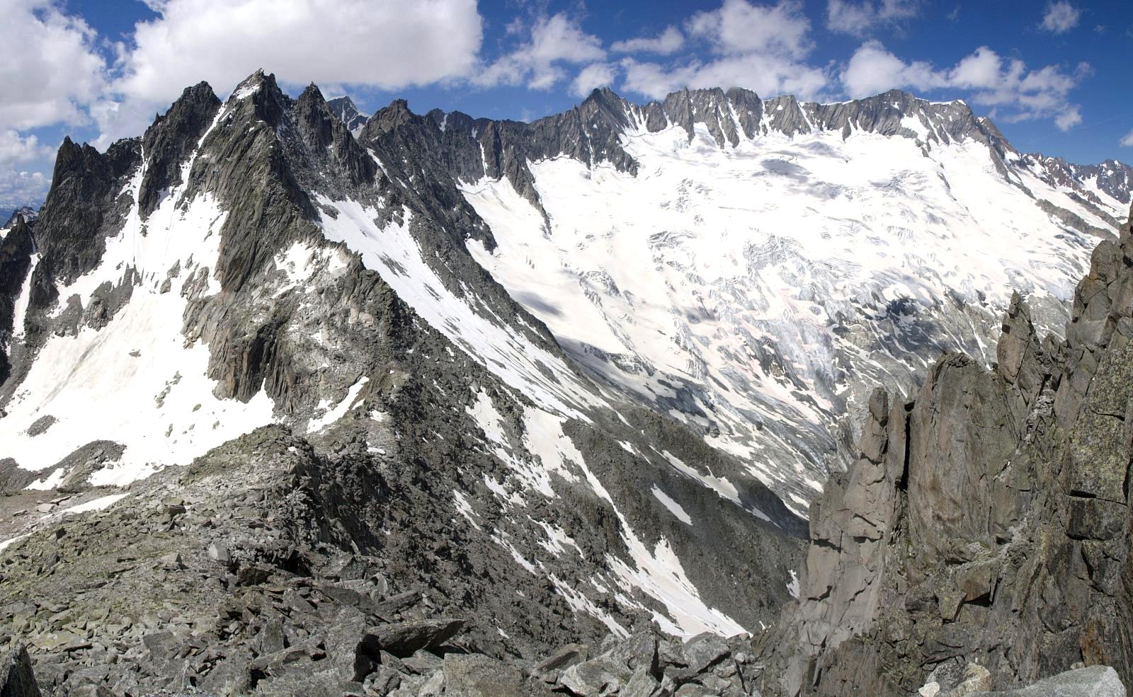
image_caption=The Dammastock from the Göscheneralp valley
country=Switzerland
region_type=Cantons
region=Bern| region1=Obwalden | region2=Lucerne
region3=Valais | region4=Uri
region5=Nidwalden
parent=Alps
border=Bernese Alps| border1=Lepontine Alps| border2=Glarus Alps
length_imperial=| length_orientation=
width_imperial= | width_orientation=
geology= | period= | orogeny=
highest=Dammastock
highest_elevation=3630
highest_lat_d=46|highest_lat_m=38|highest_lat_s=28|highest_lat_NS=N
highest_long_d=8|highest_long_m=25|highest_long_s=6|highest_long_EW=E
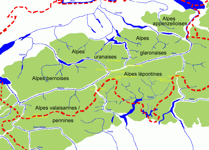
map_caption=Central Alps (the Urner Alps are marked as "Alpes uranaises")The Urner Alps (also known as the Uri Alps) are a
mountain range in centralSwitzerland in the western part of theAlps . They extend into the cantons ofObwalden ,Valais , Lucerne, Bern, Uri andNidwalden and are bordered by theBernese Alps to the west, theLepontine Alps to the south and theGlarus Alps to the east.Principal summits
The principal summits of the Urner Alps are:
ee also
*
Swiss Alps External links
* [http://www.summitpost.org/area/range/155149/uri-alps-group.html Urner Alps on SummitPost]
Wikimedia Foundation. 2010.