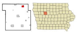
- Manson, Iowa
-
Manson, Iowa — City — Location of Manson, Iowa Coordinates: 42°31′50″N 94°32′5″W / 42.53056°N 94.53472°WCoordinates: 42°31′50″N 94°32′5″W / 42.53056°N 94.53472°W Country  United States
State  Iowa
IowaCounty Calhoun Area – Total 3.2 sq mi (8.3 km2) – Land 3.2 sq mi (8.3 km2) – Water 0.0 sq mi (0.0 km2) Elevation 1,240 ft (378 m) Population (2000) – Total 1,893 – Density 592.8/sq mi (228.9/km2) Time zone Central (CST) (UTC-6) – Summer (DST) CDT (UTC-5) ZIP code 50563 Area code(s) 712 FIPS code 19-48990 GNIS feature ID 0463553 Manson is a city in Calhoun County, Iowa, United States. The population was 1,893 at the 2000 census.
Contents
Geography
Manson is located at 42°31′50″N 94°32′5″W / 42.53056°N 94.53472°W (42.530690, -94.534673)[1].
According to the United States Census Bureau, the city has a total area of 3.2 square miles (8.3 km2), all of it land.
Demographics
As of the census[2] of 2000, there were 1,893 people, 814 households, and 529 families residing in the city. The population density was 592.8 people per square mile (229.1/km²). There were 863 housing units at an average density of 270.2 per square mile (104.5/km²). The racial makeup of the city was 98.68% White, 0.16% African American, 0.21% Native American, 0.32% Asian, 0.32% from other races, and 0.32% from two or more races. Hispanic or Latino of any race were 0.37% of the population.
There were 814 households out of which 27.4% had children under the age of 18 living with them, 53.8% were married couples living together, 8.7% had a female householder with no husband present, and 34.9% were non-families. 32.7% of all households were made up of individuals and 21.0% had someone living alone who was 65 years of age or older. The average household size was about 2.27 and the average family size was approximately 2.87.
In the city the population was spread out with 23.7% under the age of 18, 6.9% from 18 to 24, 22.5% from 25 to 44, 21.4% from 45 to 64, and 25.4% who were 65 years of age or older. The median age was 44 years. For every 100 females there were 86.0 males. For every 100 females age 18 and over, there were 79.8 males.
The median income for a household in the city was $31,331, and the median income for a family was $41,500. Males had a median income of $31,006 versus $20,491 for females. The per capita income for the city was $16,687. About 6.7% of families and 8.9% of the population were below the poverty line, including 11.9% of those under age 18 and 7.7% of those age 65 or over.
Manson impact crater
Manson is located near the site of the Manson crater, formed by a meteorite collision that happened 74 million years ago. The crater's existence was first discovered during an oil-drilling wildcatting expedition in the 1930s. It was eventually realized to be the biggest impact by an object from outer space to happen in North America and was theorized to have led to the extinction of the dinosaurs, or contributed to it as a fragment of the Chicxulub meteor, until tests by the U.S. Geological Survey in 1991 and 1992 proved that it was too old by 9 million years.
Not much remains due to glacial till which has filled in the crater and has made it undetectable at ground level. However due to this infilling it is one of the best preserved impact sites on Earth.
The impact crater measures approximately 24 miles (39 km) in diameter and the city of Manson is located near the center of the impact site.
Tornado of June 28, 1979
A destructive F4 tornado killed three people and destroyed a large part of Manson on June 28, 1979 at about 7:45 PM. The tornado slowly chewed its way from northwest to southeast through Manson. The tornado was on the southwest side of a large southeast-moving thunderstorm complex, thus it was surrounded on three sides by clear skies (in fact, the sun was shining) and was highly visible. Severe damage was done to the central business district with 25 of the 35 business either destroyed or severely damaged. The middle school was also destroyed as were about 110 homes. Another 139 homes were damaged. The General Telephone Company exchange building for Manson was completely destroyed - the first time this had ever happened in Iowa. It was reported that the storm was like a lawn mower going through the city, and afterwards one could see from one end of the city to the other when looking up the damage track.[3]
There was about 30 minutes warning and the tornado sirens were sounded well before the arrival of the tornado. The fact that it was still daylight also contributed to the relatively low death count from this destructive storm.
References
- ^ "US Gazetteer files: 2010, 2000, and 1990". United States Census Bureau. 2011-02-12. http://www.census.gov/geo/www/gazetteer/gazette.html. Retrieved 2011-04-23.
- ^ "American FactFinder". United States Census Bureau. http://factfinder.census.gov. Retrieved 2008-01-31.
- ^ Stanford, John L; Tornado - Accounts of Tornadoes in Iowa - 2nd Edition pp.100-106
External links
Municipalities and communities of Calhoun County, Iowa Cities Townships Unincorporated
communityKnoke
Footnotes ‡This populated place also has portions in an adjacent county or counties
Categories:- Populated places in Calhoun County, Iowa
- Cities in Iowa
Wikimedia Foundation. 2010.

