- State Line City, Indiana
Infobox Settlement
official_name = State Line City
settlement_type = Town
motto =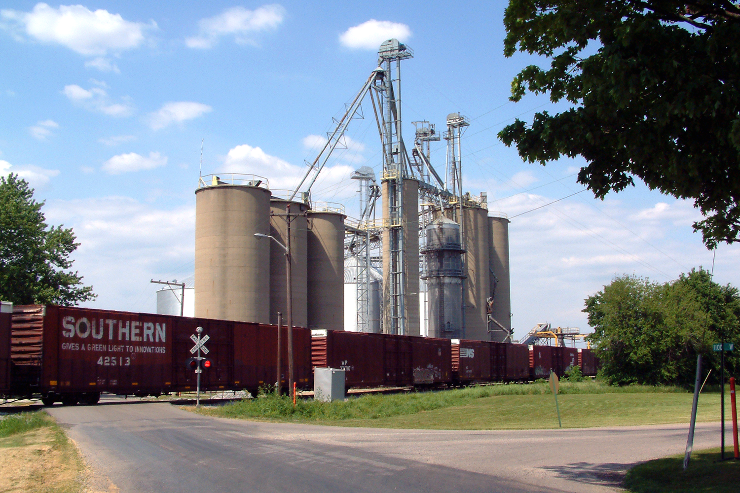
imagesize =
image_caption = A freight train passing State Line's grain elevators.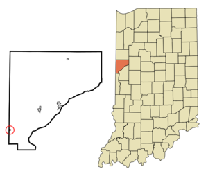
mapsize = 250x200px
map_caption =
mapsize1 =
map_caption1 =
image_dot_
dot_mapsize =
dot_map_caption =
dot_x =
dot_y =
pushpin_
pushpin_label_position =
pushpin_map_caption =
pushpin_mapsize =
subdivision_type = Country
subdivision_name =United States
subdivision_type1 = State
subdivision_name1 =Indiana
subdivision_type2 = County
subdivision_name2 = Warren
subdivision_type3 = Township
subdivision_name3 = Kent
government_type =
leader_title =
leader_name =
established_title = Founded
established_date =1857
area_magnitude =
area_total_km2 = 0.3
area_land_km2 = 0.3
population_as_of =2006
population_footnotes =
population_note =
population_total = 141
population_density_km2 = 418.8
timezone = EST
utc_offset = -5
timezone_DST = EDT
utc_offset_DST = -4
latd = 40 |latm = 11 |lats = 48 |latNS = N
longd = 87 |longm = 31 |longs = 38 |longEW = W
area_water_km2 = 0.0
area_total_sq_mi = 0.1
area_land_sq_mi = 0.1
area_water_sq_mi = 0.0
elevation_footnotes = cite web|url=Gnis3|449734|title=USGS detail on State Line|accessdate=2007-09-24]
elevation_m =
elevation_ft = 725
postal_code_type = ZIP code
postal_code = 47993
area_code = 765
website =
blank_name = FIPS code
blank_info = 18-72764GR|2
blank1_name =
blank1_info =
footnotes =State Line City is a town in Kent Township, Warren County,
Indiana ,United States , located along the state's border withIllinois . As of the 2006 census, the town population was 141. The small section of town that protrudes west across the border is formally known asIlliana, Illinois .History
In the mid-1850s, two large railway lines converged on the Indiana-Illinois state line -- the narrow-gauge
Wabash Valley Railroad , whose route from the east crossed Warren County and reached the border in October 1856, and the standard-gaugeGreat Western Railroad , which shortly thereafter reached the state line from the west. State Line City was platted on June 29, 1857 by Robert Casement at the convergence of these two railroads. The city flourished, and within 10 years had reached a population of approximately 550, but because of the drinking and carousing of the numerous railroaders it gained an unsavory reputation.cite book
last = Switzer
first = Betty Jo
title = A History of Warren County, Indiana (175th Anniversary Edition)
publisher = Warren County Historical Society
date = 2002
chapter = Kent Township]On February 11, 1861,
Abraham Lincoln stopped in State Line on his way fromSpringfield, Illinois toWashington, D.C. for his inauguration. He dined at the Frazier Eating House, then gave a short speech to a crowd in the public square before resuming his journey. A historical marker on the site commemorates the event.The town's post office was established in July 1857, with Robert Casement as the first postmaster, and continues to operate today from a newer building on Woodard Street. Grain elevators were erected in the fall of 1857, but fires in September 1900, December 1932 and June 1984 each completely destroyed the structures, which were subsequently rebuilt. State Line's grain elevators are currently operated by
Archer Daniels Midland ofDecatur, Illinois , and see considerable activity during harvest time. The town's other large business is a fertilizer and agricultural sales facility northeast of town, built in 1975 and currently operated by Westland Co-Op.Other establishments in State Line include the Kent Township Fire Department, formed in 1978, which took over local fire protection responsibilities from the West Lebanon Fire Department; in 2000, however, the department merged back with West Lebanon, which now maintains the State Line fire station. The KTFD sponsored for a number of years an annual town festival called the State Line Fun Days, but this is now longer held.
As of 2007, State Line houses one active church: the State Line Christian Church, built in 1868. Rev. Gerald Burt has been the pastor there since 1972. The Church of the Nazarene (built around 1860 as a Presbyterian church and purchased for use as a Nazarene church in 1929) and the Methodist Church (built in 1863-4) were both disbanded due to low attendance in the 1990s and have since been turned into homes. Rev. Jim Kessler was the last pastor at the Nazarene church.
Geography
State Line City is located at coor dms|40|11|48|N|87|31|38|W|city (40.196628, -87.527104)GR|1 in open farm land along the border with Illinois, five miles northeast of the city of Danville. According to the
United States Census Bureau , the town has a total area of 0.1square mile s (0.3km² ), all of it land.The
Norfolk Southern Railway runs southwest through town. For many years the famousWabash Cannonball ran on the line (then owned by the Wabash Railway), passing through town twice a day on its route from St. Louis to Detroit and back. The Wabash Railway merged in the mid 1960s with the Norfolk and Western Railway, which in turn merged with Southern Railway in the 1980s to become Norfolk Southern, officially bringing an end to the Wabash name.Demographics
As of the
census GR|2 of 2000, there were 141 people, 54 households, and 36 families residing in the town. Thepopulation density was 1,046.9 people per square mile (418.8/km²). There were 56 housing units at an average density of 415.8/sq mi (166.3/km²). The racial makeup of the town was 98.58% White, 0.71% African American, 0.71% from other races. Hispanic or Latino of any race were 1.42% of the population.There were 54 households out of which 33.3% had children under the age of 18 living with them, 64.8% were married couples living together, 1.9% had a female householder with no husband present, and 31.5% were non-families. 27.8% of all households were made up of individuals and 9.3% had someone living alone who was 65 years of age or older. The average household size was 2.61 and the average family size was 3.27.
In the town the population was spread out with 28.4% under the age of 18, 5.7% from 18 to 24, 32.6% from 25 to 44, 24.1% from 45 to 64, and 9.2% who were 65 years of age or older. The median age was 36 years. For every 100 females there were 120.3 males. For every 100 females age 18 and over, there were 110.4 males.
The median income for a household in the town was $34,250, and the median income for a family was $41,607. Males had a median income of $30,625 versus $14,000 for females. The
per capita income for the town was $15,685. There were none of the families and 3.7% of the population living below thepoverty line , including no under eighteens and none of those over 64.References
External links

Wikimedia Foundation. 2010.