- Waynetown, Indiana
Infobox Settlement
official_name = Waynetown, Indiana
settlement_type =Town
nickname =
motto =
imagesize = 250px
image_caption =
image_
image_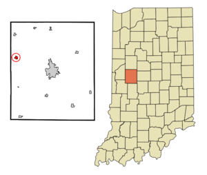
mapsize = 250x200px
map_caption = Location of Waynetown in the state ofIndiana
mapsize1 =
map_caption1 =subdivision_type = Country
subdivision_name =United States
subdivision_type1 = State
subdivision_name1 =Indiana
subdivision_type2 = County
subdivision_name2 = Montgomery
subdivision_type3 = Township
subdivision_name3 = Wayne
government_footnotes =
government_type =
leader_title =
leader_name =
leader_title1 =
leader_name1 =
established_title =
established_date =area_footnotes =
unit_pref = Imperial
area_magnitude =
area_total_km2 = 1.1
area_land_km2 = 1.1
area_water_km2 = 0.0
area_total_sq_mi = 0.4
area_land_sq_mi = 0.4
area_water_sq_mi = 0.0population_as_of = 2000
population_footnotes =
population_total = 909
population_density_km2 = 805.3
population_density_sq_mi = 2085.8timezone = Eastern (EST)
utc_offset = -5
timezone_DST = EDT
utc_offset_DST = -4
elevation_footnotes =
elevation_m = 239
elevation_ft = 784
latd = 40 |latm = 5 |lats = 15 |latNS = N
longd = 87 |longm = 3 |longs = 56 |longEW = Wpostal_code_type =
ZIP code
postal_code = 47990
area_code = 765
blank_name = FIPS code
blank_info = 18-82052GR|2
blank1_name = GNIS feature ID
blank1_info = 0445584GR|3
website =
footnotes =Waynetown is a town in Wayne Township, Montgomery County,
Indiana ,United States . The population was 909 at the 2000 census.History
Waynetown was platted, as "middletown", by Samuel Mann in 1830. [History of Montgomery County, Indiana : with personal sketches of representative citizens. pg 505]
Geography
Waynetown is located at coor dms|40|5|15|N|87|3|56|W|city (40.087559, -87.065562)GR|1.
According to the
United States Census Bureau , the town has a total area of 0.4square mile s (1.1km² ), all of it land.Demographics
As of the
census GR|2 of 2000, there were 909 people, 372 households, and 265 families residing in the town. Thepopulation density was 2,085.8 people per square mile (797.7/km²). There were 411 housing units at an average density of 943.1/sq mi (360.7/km²). The racial makeup of the town was 99.34% White, 0.11% African American, and 0.55% from two or more races. Hispanic or Latino of any race were 0.44% of the population.There were 372 households out of which 32.3% had children under the age of 18 living with them, 56.2% were married couples living together, 9.9% had a female householder with no husband present, and 28.5% were non-families. 25.8% of all households were made up of individuals and 16.7% had someone living alone who was 65 years of age or older. The average household size was 2.44 and the average family size was 2.91.
In the town the population was spread out with 27.3% under the age of 18, 6.6% from 18 to 24, 29.2% from 25 to 44, 21.3% from 45 to 64, and 15.6% who were 65 years of age or older. The median age was 35 years. For every 100 females there were 94.6 males. For every 100 females age 18 and over, there were 91.6 males.
The median income for a household in the town was $37,188, and the median income for a family was $44,191. Males had a median income of $35,313 versus $21,287 for females. The
per capita income for the town was $16,328. About 5.9% of families and 8.6% of the population were below thepoverty line , including 6.9% of those under age 18 and 13.1% of those age 65 or over.References
External links
Wikimedia Foundation. 2010.