- Ellettsville, Indiana
Infobox Settlement
official_name = Town of Ellettsville, Indiana
settlement_type =Town
nickname =
mapsize = 250x200px
imagesize =
image_caption =
imagesize =
image_caption =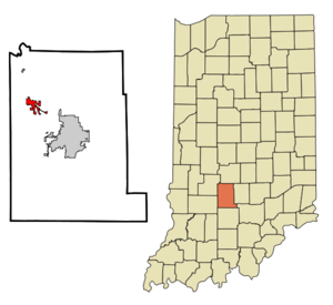
map_caption = Location in the state ofIndiana
mapsize1 =
map_caption1 =
subdivision_type = Country
subdivision_name =United States
area_note =
subdivision_type1 = State
subdivision_name1 =Indiana
subdivision_type2 = County
subdivision_name2 = Monroe
subdivision_type3 = Township
subdivision_name3 = Richland
government_type =
leader_title =
leader_name =
established_date =
area_magnitude = 1 E6
area_total_km2 = 5.6
area_land_km2 = 5.6
area_water_km2 = 0.0
population_as_of = 2000
population_note =
population_total = 5078
population_density_km2 = 911.9
timezone = EST
utc_offset = -5
timezone_DST = EST
utc_offset_DST = -5
area_total_sq_mi = 2.2
area_land_sq_mi = 2.2
area_water_sq_mi = 0.0
elevation_m = 212
elevation_ft = 696
latd = 39 |latm = 13 |lats = 47 |latNS = N
longd = 86 |longm = 37 |longs = 17 |longEW = W
postal_code_type =ZIP code
postal_code = 47429
area_code = 812
blank_name = FIPS code
blank_info = 18-20800GR|2
blank1_name = GNIS feature ID
blank1_info = 0434095GR|3
footnotes =
website = www.ellettsville.in.usEllettsville is a town in Richland Township, Monroe County,
Indiana ,United States . The population was 5,078 at the 2000 census. The town is widely known as the home of the famous "Monroe County Fall Festival ," an annual event which draws crowds from all over the state of Indiana.Ellettsville is often considered a suburb of nearby Bloomington. Some residents of both cities deny this and prefer to regard each community as completely separate.
Geography
Ellettsville is located at coor dms|39|13|47|N|86|37|17|W|city (39.229645, -86.621404)GR|1.
According to the
United States Census Bureau , the town has a total area of 2.2square mile s (5.6km² ), all of it land.Demographics
As of the
census GR|2 of 2000, there were 5,078 people, 1,944 households, and 1,345 families residing in the town. Thepopulation density was 2,356.8 people per square mile (911.9/km²). There were 2,085 housing units at an average density of 967.7/sq mi (374.4/km²). The racial makeup of the town was 95.83% White, 1.22% African American, 0.18% Native American, 0.73% Asian, 0.81% from other races, and 1.24% from two or more races. Hispanic or Latino of any race were 1.18% of the population.There were 1,944 households out of which 40.8% had children under the age of 18 living with them, 51.2% were married couples living together, 13.2% had a female householder with no husband present, and 30.8% were non-families. 25.4% of all households were made up of individuals and 9.1% had someone living alone who was 65 years of age or older. The average household size was 2.57 people, and the average family size was 3.09 people.
The population of the town was spread out with 30.1% under the age of 18, 8.4% from 18 to 24, 32.7% from 25 to 44, 19.4% from 45 to 64, and 9.4% who were 65 years of age or older. The median age was 33 years. For every 100 females there were 90.7 males. For every 100 females age 18 and over, there were 83.0 males.
The median income for a household in the town was $37,276, and the median income for a family was $42,950. Males had a median income of $32,153 versus $26,313 for females. The
per capita income for the town is $16,120. About 6.7% of families and 9.2% of the population were below thepoverty line , including 9.8% of those under age 18 and 12.6% of those age 65 or over.Education
Edgewood High School serves students in grades 9-12.Edgewood Junior High School serves grades 6-8.Edgewood Intermediate School serves grades 3-5.Edgewood Primary School serves grades K-2.Richland-Bean Blossom Community School Corporation represents the two townships (Richland and Bean Blossom) in northwestern Monroe County.
References
External links
Wikimedia Foundation. 2010.